Wolcott Topo Map New York
To zoom in, hover over the map of Wolcott
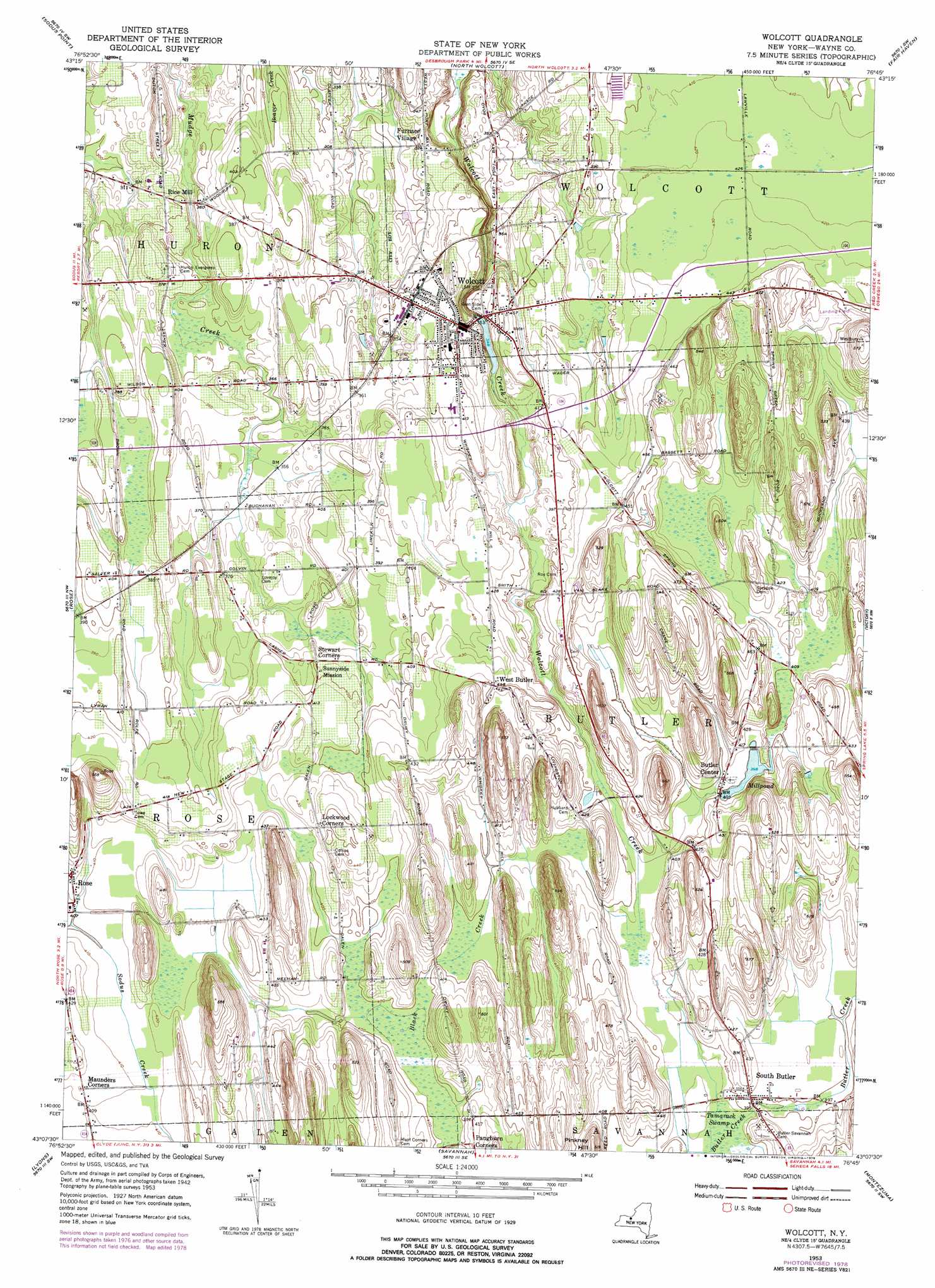
USGS Topo Quad 43076b7 - 1:24,000 scale
| Topo Map Name: | Wolcott |
| USGS Topo Quad ID: | 43076b7 |
| Print Size: | ca. 21 1/4" wide x 27" high |
| Southeast Coordinates: | 43.125° N latitude / 76.75° W longitude |
| Map Center Coordinates: | 43.1875° N latitude / 76.8125° W longitude |
| U.S. State: | NY |
| Filename: | o43076b7.jpg |
| Download Map JPG Image: | Wolcott topo map 1:24,000 scale |
| Map Type: | Topographic |
| Topo Series: | 7.5´ |
| Map Scale: | 1:24,000 |
| Source of Map Images: | United States Geological Survey (USGS) |
| Alternate Map Versions: |
Wolcott NY 1953, updated 1955 Download PDF Buy paper map Wolcott NY 1953, updated 1974 Download PDF Buy paper map Wolcott NY 1953, updated 1979 Download PDF Buy paper map Wolcott NY 2010 Download PDF Buy paper map Wolcott NY 2013 Download PDF Buy paper map Wolcott NY 2016 Download PDF Buy paper map |
1:24,000 Topo Quads surrounding Wolcott
West Ninemile Point |
Oswego West |
|||
Salmon Creek |
Sodus Point |
North Wolcott |
Fair Haven |
Hannibal |
Sodus |
Rose |
Wolcott |
Victory |
Cato |
Newark |
Lyons |
Savannah |
Montezuma |
Weedsport |
Phelps |
Geneva North |
Seneca Falls |
Cayuga |
Auburn |
> Back to 43076a1 at 1:100,000 scale
> Back to 43076a1 at 1:250,000 scale
> Back to U.S. Topo Maps home
Wolcott topo map: Gazetteer
Wolcott: Airports
Hill Top Airpark elevation 146m 479′Wolcott: Populated Places
Butler Center elevation 122m 400′Furnace Village elevation 98m 321′
Hickory Square elevation 112m 367′
Rice Mill elevation 98m 321′
South Butler elevation 122m 400′
West Butler elevation 135m 442′
Wolcott elevation 113m 370′
Wolcott: Reservoirs
Millpond elevation 121m 396′Wolcott: Summits
Pinkney Hill elevation 157m 515′Wolcott digital topo map on disk
Buy this Wolcott topo map showing relief, roads, GPS coordinates and other geographical features, as a high-resolution digital map file on DVD:
New York, Vermont, Connecticut & Western Massachusetts
Buy digital topo maps: New York, Vermont, Connecticut & Western Massachusetts