Clifton Topo Map New York
To zoom in, hover over the map of Clifton
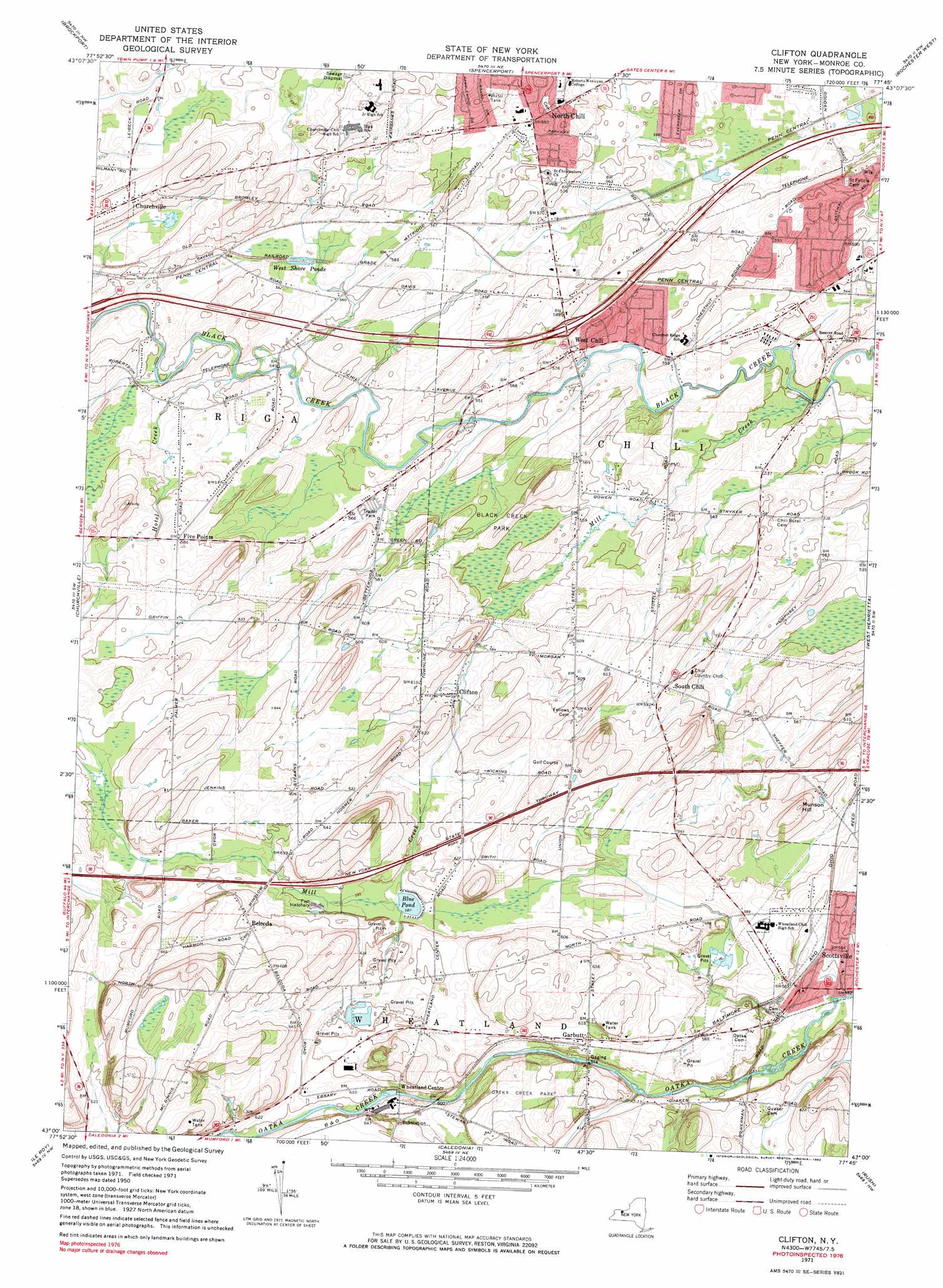
USGS Topo Quad 43077a7 - 1:24,000 scale
| Topo Map Name: | Clifton |
| USGS Topo Quad ID: | 43077a7 |
| Print Size: | ca. 21 1/4" wide x 27" high |
| Southeast Coordinates: | 43° N latitude / 77.75° W longitude |
| Map Center Coordinates: | 43.0625° N latitude / 77.8125° W longitude |
| U.S. State: | NY |
| Filename: | o43077a7.jpg |
| Download Map JPG Image: | Clifton topo map 1:24,000 scale |
| Map Type: | Topographic |
| Topo Series: | 7.5´ |
| Map Scale: | 1:24,000 |
| Source of Map Images: | United States Geological Survey (USGS) |
| Alternate Map Versions: |
Clifton NY 1934 Download PDF Buy paper map Clifton NY 1934 Download PDF Buy paper map Clifton NY 1950, updated 1952 Download PDF Buy paper map Clifton NY 1950, updated 1960 Download PDF Buy paper map Clifton NY 1950, updated 1970 Download PDF Buy paper map Clifton NY 1971, updated 1974 Download PDF Buy paper map Clifton NY 1971, updated 1983 Download PDF Buy paper map Clifton NY 1971, updated 1983 Download PDF Buy paper map Clifton NY 2010 Download PDF Buy paper map Clifton NY 2013 Download PDF Buy paper map Clifton NY 2016 Download PDF Buy paper map |
1:24,000 Topo Quads surrounding Clifton
Kendall |
Hamlin |
Hilton |
Braddock Heights |
|
Holley |
Brockport |
Spencerport |
Rochester West |
Rochester East |
Byron |
Churchville |
Clifton |
West Henrietta |
Pittsford |
Stafford |
Le Roy |
Caledonia |
Rush |
Honeoye Falls |
Wyoming |
Leicester |
Geneseo |
Livonia |
Honeoye |
> Back to 43077a1 at 1:100,000 scale
> Back to 43076a1 at 1:250,000 scale
> Back to U.S. Topo Maps home
Clifton topo map: Gazetteer
Clifton: Lakes
Blue Pond elevation 179m 587′West Shore Ponds elevation 168m 551′
Clifton: Parks
Black Creek Park elevation 169m 554′Oatka Creek Park elevation 194m 636′
Clifton: Populated Places
Belcoda elevation 197m 646′Clifton elevation 176m 577′
Five Points elevation 178m 583′
Garbutt elevation 182m 597′
North Chili elevation 178m 583′
South Chili elevation 177m 580′
West Chili elevation 167m 547′
Wheatland Center elevation 184m 603′
Clifton: Streams
Hotel Creek elevation 165m 541′Mill Creek elevation 162m 531′
Clifton: Summits
Munson Hill elevation 198m 649′Clifton digital topo map on disk
Buy this Clifton topo map showing relief, roads, GPS coordinates and other geographical features, as a high-resolution digital map file on DVD:
New York, Vermont, Connecticut & Western Massachusetts
Buy digital topo maps: New York, Vermont, Connecticut & Western Massachusetts