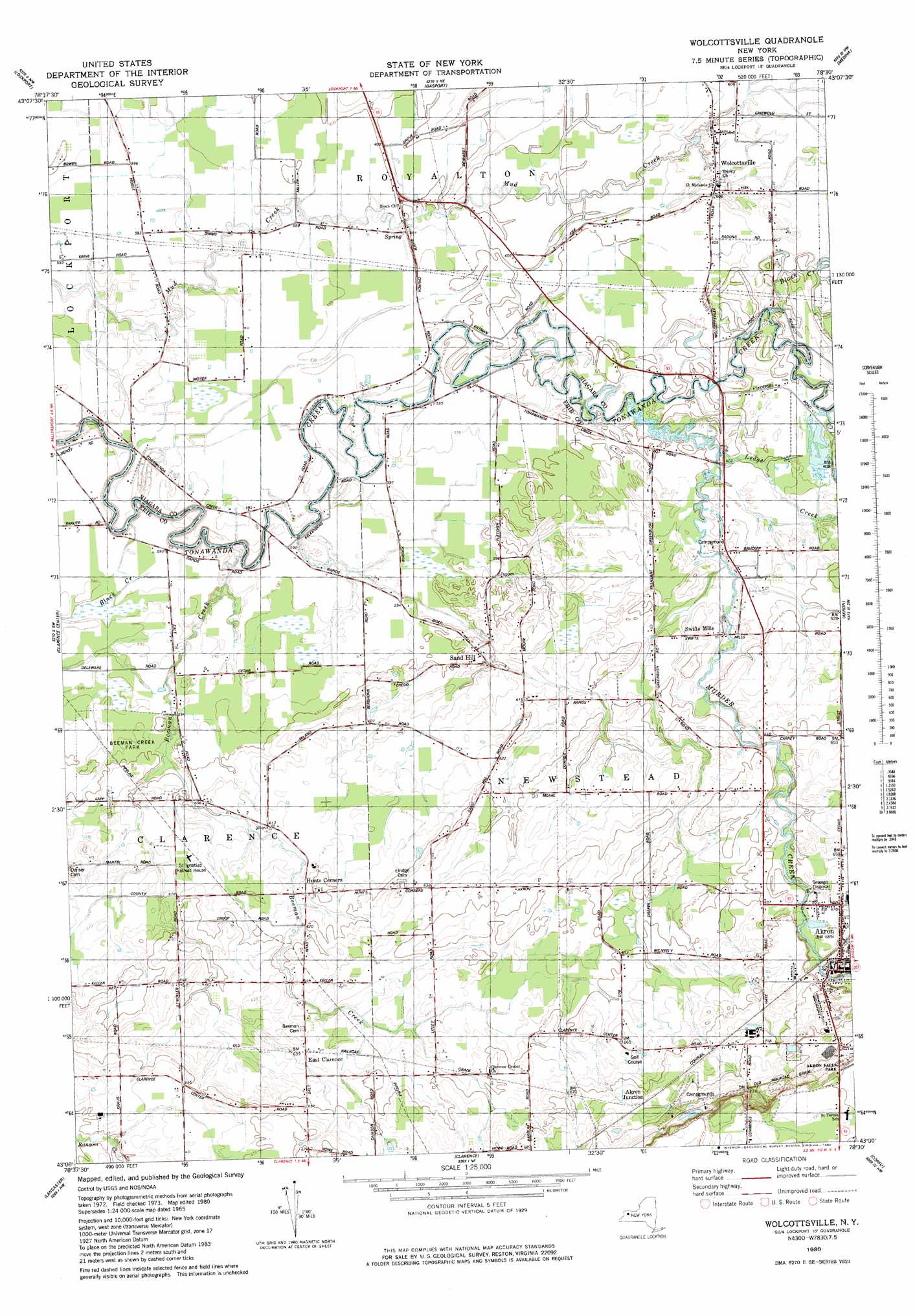
Wolcottsville Topo Map New York
To zoom in, hover over the map of Wolcottsville
USGS Topo Quad 43078a5 - 1:25,000 scale
| Topo Map Name: | Wolcottsville |
| USGS Topo Quad ID: | 43078a5 |
| Print Size: | ca. 21 1/4" wide x 27" high |
| Southeast Coordinates: | 43° N latitude / 78.5° W longitude |
| Map Center Coordinates: | 43.0625° N latitude / 78.5625° W longitude |
| U.S. State: | NY |
| Filename: | l43078a5.jpg |
| Download Map JPG Image: | Wolcottsville topo map 1:25,000 scale |
| Map Type: | Topographic |
| Topo Series: | 7.5´ |
| Map Scale: | 1:25,000 |
| Source of Map Images: | United States Geological Survey (USGS) |
| Alternate Map Versions: |
Wolcottsville NY 1980, updated 1980 Download PDF Buy paper map Wolcottsville NY 1980, updated 1980 Download PDF Buy paper map |
1:24,000 Topo Quads surrounding Wolcottsville
Wilson |
Newfane |
Barker |
Lyndonville |
Ashwood |
Cambria |
Lockport |
Gasport |
Medina |
Knowlesville |
Tonawanda East |
Clarence Center |
Wolcottsville |
Akron |
Oakfield |
Buffalo Ne |
Clarence |
Alexander |
||
Buffalo Se |
Orchard Park |
East Aurora |
Cowlesville |
Attica |
> Back to 43078a1 at 1:100,000 scale
> Back to 43078a1 at 1:250,000 scale
> Back to U.S. Topo Maps home
Wolcottsville topo map: Gazetteer
Wolcottsville: Airports
Merkle Airport elevation 176m 577′Wolcottsville: Populated Places
Akron Junction elevation 210m 688′East Clarence elevation 193m 633′
Hunts Corners elevation 189m 620′
Sand Hill elevation 186m 610′
Swifts Mills elevation 187m 613′
Wolcottsville elevation 184m 603′
Wolcottsville: Streams
Beeman Creek elevation 174m 570′Black Creek elevation 181m 593′
Ledge Creek elevation 179m 587′
Murder Creek elevation 181m 593′
Wolcottsville digital topo map on disk
Buy this Wolcottsville topo map showing relief, roads, GPS coordinates and other geographical features, as a high-resolution digital map file on DVD:
 map DVD")