Holley Topo Map New York
To zoom in, hover over the map of Holley
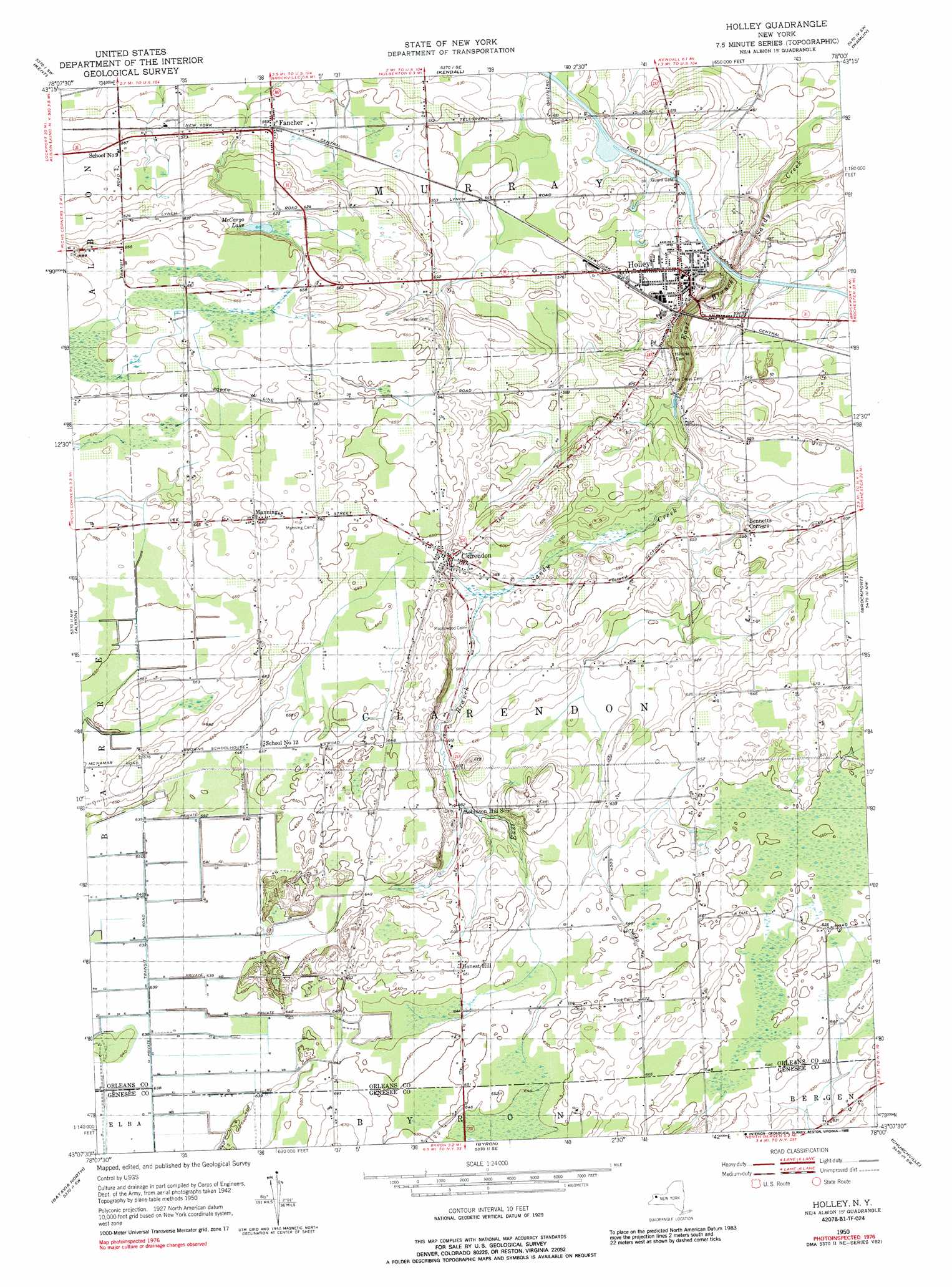
USGS Topo Quad 43078b1 - 1:24,000 scale
| Topo Map Name: | Holley |
| USGS Topo Quad ID: | 43078b1 |
| Print Size: | ca. 21 1/4" wide x 27" high |
| Southeast Coordinates: | 43.125° N latitude / 78° W longitude |
| Map Center Coordinates: | 43.1875° N latitude / 78.0625° W longitude |
| U.S. State: | NY |
| Filename: | o43078b1.jpg |
| Download Map JPG Image: | Holley topo map 1:24,000 scale |
| Map Type: | Topographic |
| Topo Series: | 7.5´ |
| Map Scale: | 1:24,000 |
| Source of Map Images: | United States Geological Survey (USGS) |
| Alternate Map Versions: |
Holley NY 1950, updated 1952 Download PDF Buy paper map Holley NY 1950, updated 1971 Download PDF Buy paper map Holley NY 1950, updated 1988 Download PDF Buy paper map Holley NY 2010 Download PDF Buy paper map Holley NY 2013 Download PDF Buy paper map Holley NY 2016 Download PDF Buy paper map |
1:24,000 Topo Quads surrounding Holley
Ashwood |
Kent |
Kendall |
Hamlin |
Hilton |
Knowlesville |
Albion |
Holley |
Brockport |
Spencerport |
Oakfield |
Batavia North |
Byron |
Churchville |
Clifton |
Alexander |
Batavia South |
Stafford |
Le Roy |
Caledonia |
> Back to 43078a1 at 1:100,000 scale
> Back to 43078a1 at 1:250,000 scale
> Back to U.S. Topo Maps home
Holley topo map: Gazetteer
Holley: Airports
Maxon Field elevation 186m 610′Holley: Lakes
McCargo Lake elevation 187m 613′Holley: Mines
Clarendon Quarry elevation 176m 577′Holley: Populated Places
Bennetts Corners elevation 180m 590′Clarendon elevation 185m 606′
County Line Mobile Home Park elevation 151m 495′
Fancher elevation 173m 567′
Holley elevation 165m 541′
Honest Hill elevation 201m 659′
Manning elevation 208m 682′
Thomas Estates West elevation 185m 606′
Holley digital topo map on disk
Buy this Holley topo map showing relief, roads, GPS coordinates and other geographical features, as a high-resolution digital map file on DVD:
 map DVD")