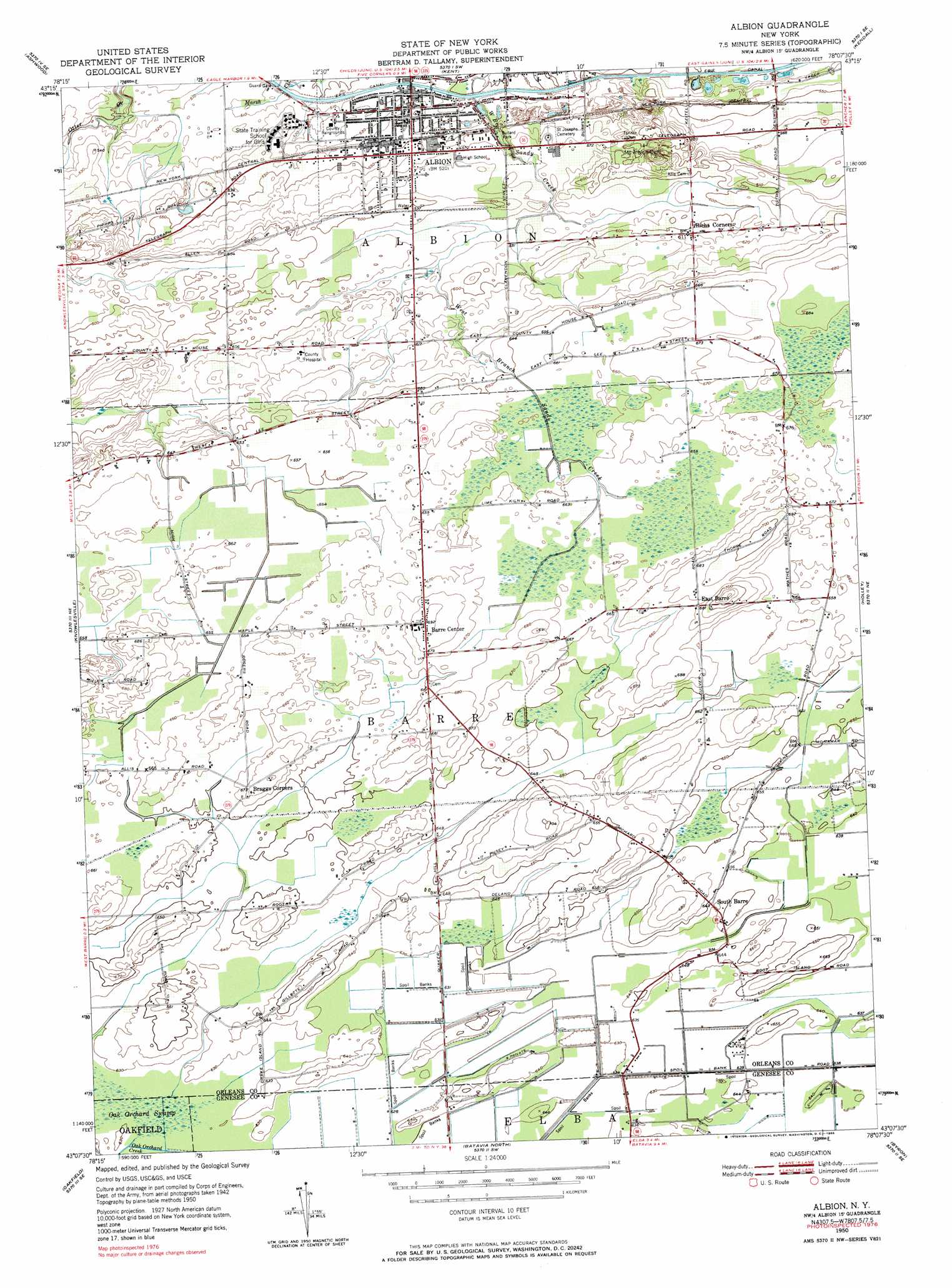
Albion Topo Map New York
To zoom in, hover over the map of Albion
USGS Topo Quad 43078b2 - 1:24,000 scale
| Topo Map Name: | Albion |
| USGS Topo Quad ID: | 43078b2 |
| Print Size: | ca. 21 1/4" wide x 27" high |
| Southeast Coordinates: | 43.125° N latitude / 78.125° W longitude |
| Map Center Coordinates: | 43.1875° N latitude / 78.1875° W longitude |
| U.S. State: | NY |
| Filename: | o43078b2.jpg |
| Download Map JPG Image: | Albion topo map 1:24,000 scale |
| Map Type: | Topographic |
| Topo Series: | 7.5´ |
| Map Scale: | 1:24,000 |
| Source of Map Images: | United States Geological Survey (USGS) |
| Alternate Map Versions: |
Albion NY 1950, updated 1965 Download PDF Buy paper map Albion NY 1950, updated 1972 Download PDF Buy paper map Albion NY 1950, updated 1985 Download PDF Buy paper map Albion NY 1952 Download PDF Buy paper map Albion NY 2010 Download PDF Buy paper map Albion NY 2013 Download PDF Buy paper map Albion NY 2016 Download PDF Buy paper map |
1:24,000 Topo Quads surrounding Albion
Lyndonville |
Ashwood |
Kent |
Kendall |
Hamlin |
Medina |
Knowlesville |
Albion |
Holley |
Brockport |
Akron |
Oakfield |
Batavia North |
Byron |
Churchville |
Alexander |
Batavia South |
Stafford |
Le Roy |
> Back to 43078a1 at 1:100,000 scale
> Back to 43078a1 at 1:250,000 scale
> Back to U.S. Topo Maps home
Albion topo map: Gazetteer
Albion: Parks
Bullard Park elevation 165m 541′Albion: Populated Places
Albion elevation 164m 538′Barre Center elevation 211m 692′
East Barre elevation 208m 682′
Richs Corners elevation 185m 606′
South Barre elevation 195m 639′
Westside Mobile Home Park elevation 156m 511′
Albion digital topo map on disk
Buy this Albion topo map showing relief, roads, GPS coordinates and other geographical features, as a high-resolution digital map file on DVD:
 map DVD")