Knowlesville Topo Map New York
To zoom in, hover over the map of Knowlesville
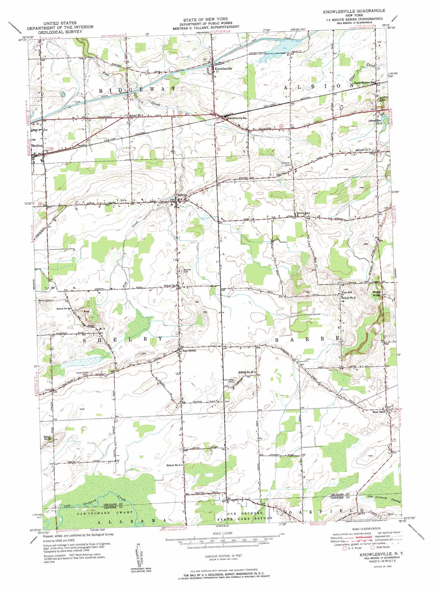
USGS Topo Quad 43078b3 - 1:24,000 scale
| Topo Map Name: | Knowlesville |
| USGS Topo Quad ID: | 43078b3 |
| Print Size: | ca. 21 1/4" wide x 27" high |
| Southeast Coordinates: | 43.125° N latitude / 78.25° W longitude |
| Map Center Coordinates: | 43.1875° N latitude / 78.3125° W longitude |
| U.S. State: | NY |
| Filename: | o43078b3.jpg |
| Download Map JPG Image: | Knowlesville topo map 1:24,000 scale |
| Map Type: | Topographic |
| Topo Series: | 7.5´ |
| Map Scale: | 1:24,000 |
| Source of Map Images: | United States Geological Survey (USGS) |
| Alternate Map Versions: |
Knowlesville NY 1950 Download PDF Buy paper map Knowlesville NY 1950 Download PDF Buy paper map Knowlesville NY 1950 Download PDF Buy paper map Knowlesville NY 2010 Download PDF Buy paper map Knowlesville NY 2013 Download PDF Buy paper map Knowlesville NY 2016 Download PDF Buy paper map |
1:24,000 Topo Quads surrounding Knowlesville
Barker |
Lyndonville |
Ashwood |
Kent |
Kendall |
Gasport |
Medina |
Knowlesville |
Albion |
Holley |
Wolcottsville |
Akron |
Oakfield |
Batavia North |
Byron |
Clarence |
Alexander |
Batavia South |
Stafford |
> Back to 43078a1 at 1:100,000 scale
> Back to 43078a1 at 1:250,000 scale
> Back to U.S. Topo Maps home
Knowlesville topo map: Gazetteer
Knowlesville: Airports
Knowlesville Airport elevation 169m 554′Maple Ridge Airport elevation 195m 639′
Pine Hill Airport elevation 201m 659′
Zelazny Airport elevation 194m 636′
Knowlesville: Populated Places
Burma Woods elevation 211m 692′Eagle Harbor Station elevation 161m 528′
East Shelby elevation 202m 662′
Knowlesville elevation 156m 511′
Knowlesville Station elevation 168m 551′
Millville elevation 183m 600′
West Barre elevation 205m 672′
Knowlesville: Reservoirs
Albion Reservoir Number Two elevation 172m 564′Medina Reservoir elevation 202m 662′
Knowlesville: Summits
Pine Hill elevation 217m 711′Knowlesville digital topo map on disk
Buy this Knowlesville topo map showing relief, roads, GPS coordinates and other geographical features, as a high-resolution digital map file on DVD:
 map DVD")