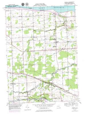
Kendall Topo Map New York
To zoom in, hover over the map of Kendall
USGS Topo Quad 43078c1 - 1:24,000 scale
| Topo Map Name: | Kendall |
| USGS Topo Quad ID: | 43078c1 |
| Print Size: | ca. 21 1/4" wide x 27" high |
| Southeast Coordinates: | 43.25° N latitude / 78° W longitude |
| Map Center Coordinates: | 43.3125° N latitude / 78.0625° W longitude |
| U.S. State: | NY |
| Filename: | o43078c1.jpg |
| Download Map JPG Image: | Kendall topo map 1:24,000 scale |
| Map Type: | Topographic |
| Topo Series: | 7.5´ |
| Map Scale: | 1:24,000 |
| Source of Map Images: | United States Geological Survey (USGS) |
| Alternate Map Versions: |
Kendall NY 1951 Download PDF Buy paper map Kendall NY 1951 Download PDF Buy paper map Kendall NY 1978, updated 1979 Download PDF Buy paper map Kendall NY 2010 Download PDF Buy paper map Kendall NY 2013 Download PDF Buy paper map Kendall NY 2016 Download PDF Buy paper map |
1:24,000 Topo Quads surrounding Kendall
Ashwood |
Kent |
Kendall |
Hamlin |
Hilton |
Knowlesville |
Albion |
Holley |
Brockport |
Spencerport |
Oakfield |
Batavia North |
Byron |
Churchville |
Clifton |
> Back to 43078a1 at 1:100,000 scale
> Back to 43078a1 at 1:250,000 scale
> Back to U.S. Topo Maps home
Kendall topo map: Gazetteer
Kendall: Airports
Maynards Airport elevation 103m 337′Kendall: Populated Places
Brockville elevation 138m 452′Hinsburg elevation 156m 511′
Hulberton elevation 158m 518′
Kendall elevation 103m 337′
Lomond Shore elevation 78m 255′
Murray elevation 125m 410′
West Kendall elevation 98m 321′
Kendall: Streams
Bald Eagle Creek elevation 75m 246′East Branch Sandy Creek elevation 120m 393′
West Branch Sandy Creek elevation 120m 393′
Kendall digital topo map on disk
Buy this Kendall topo map showing relief, roads, GPS coordinates and other geographical features, as a high-resolution digital map file on DVD:


