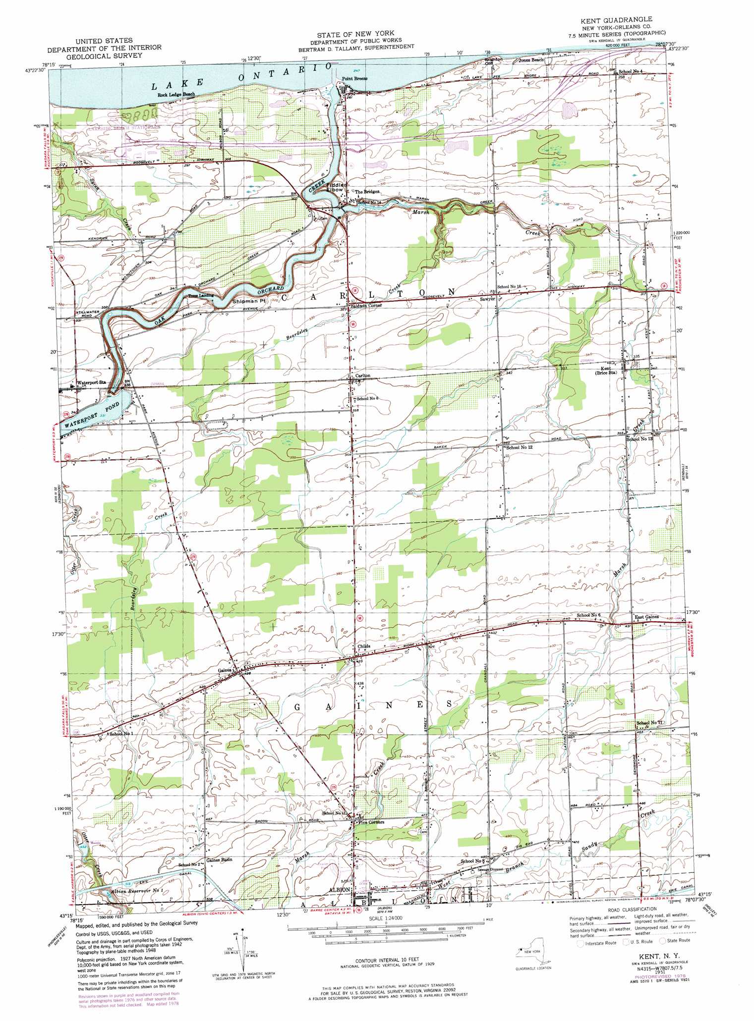
Kent Topo Map New York
To zoom in, hover over the map of Kent
USGS Topo Quad 43078c2 - 1:24,000 scale
| Topo Map Name: | Kent |
| USGS Topo Quad ID: | 43078c2 |
| Print Size: | ca. 21 1/4" wide x 27" high |
| Southeast Coordinates: | 43.25° N latitude / 78.125° W longitude |
| Map Center Coordinates: | 43.3125° N latitude / 78.1875° W longitude |
| U.S. State: | NY |
| Filename: | o43078c2.jpg |
| Download Map JPG Image: | Kent topo map 1:24,000 scale |
| Map Type: | Topographic |
| Topo Series: | 7.5´ |
| Map Scale: | 1:24,000 |
| Source of Map Images: | United States Geological Survey (USGS) |
| Alternate Map Versions: |
Kent NY 1951 Download PDF Buy paper map Kent NY 2010 Download PDF Buy paper map Kent NY 2013 Download PDF Buy paper map Kent NY 2016 Download PDF Buy paper map |
1:24,000 Topo Quads surrounding Kent
Lyndonville |
Ashwood |
Kent |
Kendall |
Hamlin |
Medina |
Knowlesville |
Albion |
Holley |
Brockport |
Akron |
Oakfield |
Batavia North |
Byron |
Churchville |
> Back to 43078a1 at 1:100,000 scale
> Back to 43078a1 at 1:250,000 scale
> Back to U.S. Topo Maps home
Kent topo map: Gazetteer
Kent: Airports
Dawn Patrol Aviation Airport elevation 144m 472′Gaines Valley Aviation Airport elevation 116m 380′
Kent: Capes
Fiddlers Elbow elevation 75m 246′Shipman Point elevation 90m 295′
Kent: Cliffs
Brighton Cliff elevation 80m 262′Kent: Parks
Lakeside Beach State Park elevation 85m 278′Kent: Populated Places
Baldwin Corner elevation 100m 328′Carlton elevation 105m 344′
Childs elevation 128m 419′
East Gaines elevation 128m 419′
Five Corners elevation 150m 492′
Gaines elevation 129m 423′
Gaines Basin elevation 151m 495′
Heritage Estates elevation 156m 511′
Jones Beach elevation 77m 252′
Kent elevation 104m 341′
Oak Orchard Estates elevation 152m 498′
Point Breeze elevation 79m 259′
Rock Ledge Beach elevation 82m 269′
Sawyer elevation 101m 331′
Toms Landing elevation 79m 259′
Waterport Station elevation 105m 344′
Kent: Reservoirs
Albion Reservoir Number One elevation 142m 465′Waterport Pond elevation 101m 331′
Kent: Streams
Beardsley Creek elevation 81m 265′Marsh Creek elevation 75m 246′
Oak Orchard Creek elevation 75m 246′
Kent digital topo map on disk
Buy this Kent topo map showing relief, roads, GPS coordinates and other geographical features, as a high-resolution digital map file on DVD:
 map DVD")