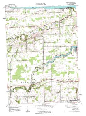
Ashwood Topo Map New York
To zoom in, hover over the map of Ashwood
USGS Topo Quad 43078c3 - 1:24,000 scale
| Topo Map Name: | Ashwood |
| USGS Topo Quad ID: | 43078c3 |
| Print Size: | ca. 21 1/4" wide x 27" high |
| Southeast Coordinates: | 43.25° N latitude / 78.25° W longitude |
| Map Center Coordinates: | 43.3125° N latitude / 78.3125° W longitude |
| U.S. State: | NY |
| Filename: | o43078c3.jpg |
| Download Map JPG Image: | Ashwood topo map 1:24,000 scale |
| Map Type: | Topographic |
| Topo Series: | 7.5´ |
| Map Scale: | 1:24,000 |
| Source of Map Images: | United States Geological Survey (USGS) |
| Alternate Map Versions: |
Ashwood NY 1950, updated 1959 Download PDF Buy paper map Ashwood NY 1950, updated 1959 Download PDF Buy paper map Ashwood NY 1952 Download PDF Buy paper map Ashwood NY 2010 Download PDF Buy paper map Ashwood NY 2013 Download PDF Buy paper map Ashwood NY 2016 Download PDF Buy paper map |
1:24,000 Topo Quads surrounding Ashwood
Barker |
Lyndonville |
Ashwood |
Kent |
Kendall |
Gasport |
Medina |
Knowlesville |
Albion |
Holley |
Wolcottsville |
Akron |
Oakfield |
Batavia North |
Byron |
> Back to 43078a1 at 1:100,000 scale
> Back to 43078a1 at 1:250,000 scale
> Back to U.S. Topo Maps home
Ashwood topo map: Gazetteer
Ashwood: Populated Places
Ashwood elevation 101m 331′Eagle Harbor elevation 155m 508′
Kenyonville elevation 107m 351′
Kuckville elevation 77m 252′
Lakeside elevation 80m 262′
Lakeside Park elevation 84m 275′
Oak Orchard elevation 120m 393′
Platten elevation 107m 351′
Sunset Beach elevation 80m 262′
Waterport elevation 107m 351′
West Gaines elevation 129m 423′
Ashwood: Streams
Fish Creek elevation 114m 374′Johnson Creek elevation 75m 246′
Marsh Creek elevation 75m 246′
Otter Creek elevation 103m 337′
Syren Creek elevation 75m 246′
Ashwood: Swamps
The Marsh elevation 76m 249′Ashwood digital topo map on disk
Buy this Ashwood topo map showing relief, roads, GPS coordinates and other geographical features, as a high-resolution digital map file on DVD:


