Lyndonville Topo Map New York
To zoom in, hover over the map of Lyndonville
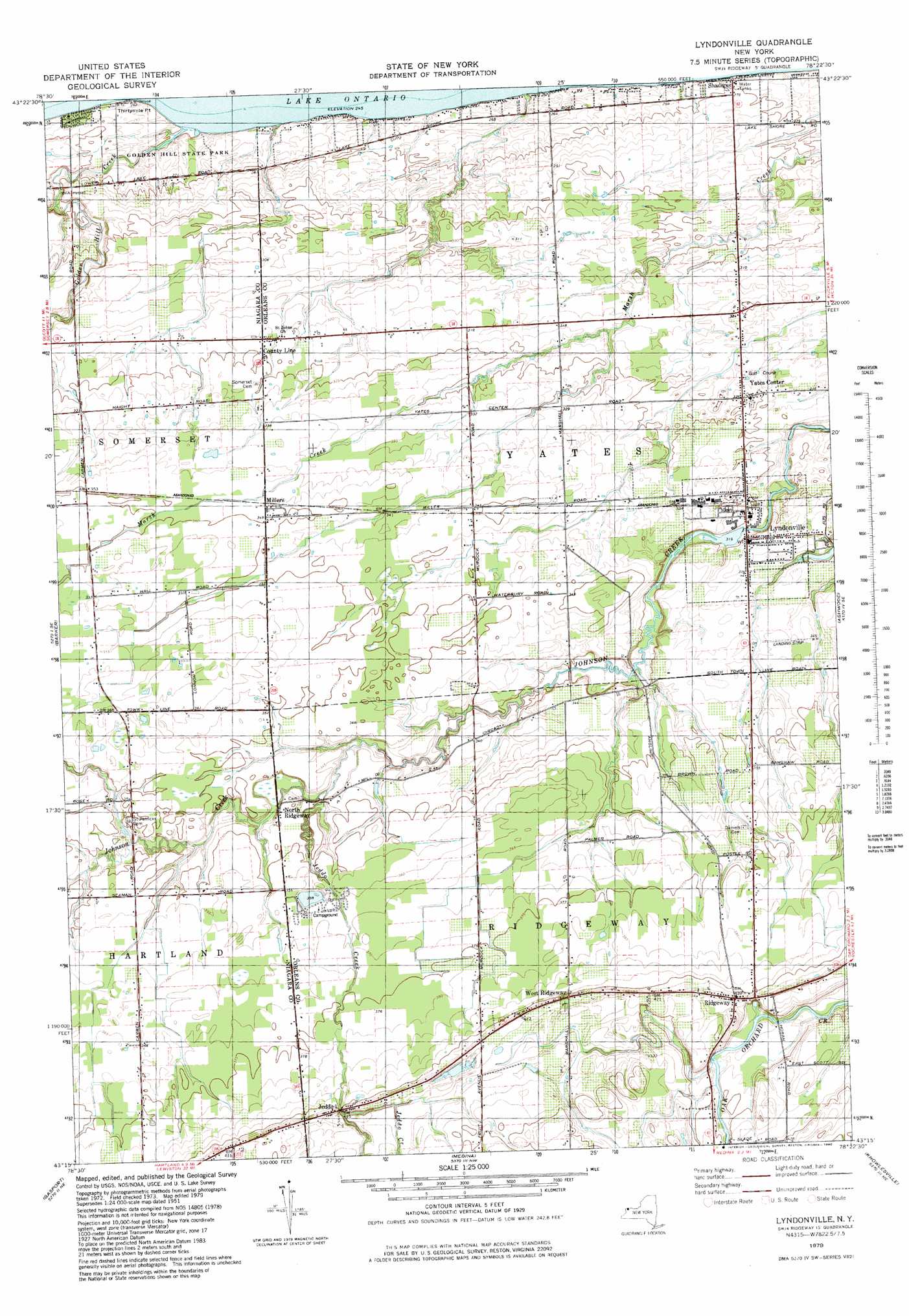
USGS Topo Quad 43078c4 - 1:25,000 scale
| Topo Map Name: | Lyndonville |
| USGS Topo Quad ID: | 43078c4 |
| Print Size: | ca. 21 1/4" wide x 27" high |
| Southeast Coordinates: | 43.25° N latitude / 78.375° W longitude |
| Map Center Coordinates: | 43.3125° N latitude / 78.4375° W longitude |
| U.S. State: | NY |
| Filename: | l43078c4.jpg |
| Download Map JPG Image: | Lyndonville topo map 1:25,000 scale |
| Map Type: | Topographic |
| Topo Series: | 7.5´ |
| Map Scale: | 1:25,000 |
| Source of Map Images: | United States Geological Survey (USGS) |
| Alternate Map Versions: |
Lyndonville NY 1979, updated 1980 Download PDF Buy paper map |
1:24,000 Topo Quads surrounding Lyndonville
Newfane |
Barker |
Lyndonville |
Ashwood |
Kent |
Lockport |
Gasport |
Medina |
Knowlesville |
Albion |
Clarence Center |
Wolcottsville |
Akron |
Oakfield |
Batavia North |
> Back to 43078a1 at 1:100,000 scale
> Back to 43078a1 at 1:250,000 scale
> Back to U.S. Topo Maps home
Lyndonville topo map: Gazetteer
Lyndonville: Capes
Thirtymile Point elevation 80m 262′Lyndonville: Parks
Golden Hill State Park elevation 80m 262′Lyndonville: Populated Places
County Line elevation 98m 321′Jeddo elevation 126m 413′
Lyndonville elevation 98m 321′
Millers elevation 106m 347′
North Ridgeway elevation 104m 341′
Ridgeway elevation 127m 416′
West Ridgeway elevation 126m 413′
Yates Center elevation 99m 324′
Lyndonville: Streams
Golden Hill Creek elevation 75m 246′Jeddo Creek elevation 100m 328′
Lyndonville digital topo map on disk
Buy this Lyndonville topo map showing relief, roads, GPS coordinates and other geographical features, as a high-resolution digital map file on DVD:
 map DVD")