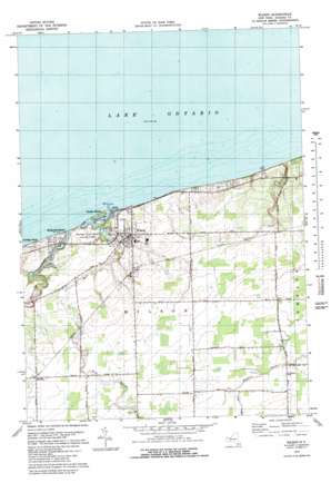
Wilson Topo Map New York
To zoom in, hover over the map of Wilson
USGS Topo Quad 43078c7 - 1:25,000 scale
| Topo Map Name: | Wilson |
| USGS Topo Quad ID: | 43078c7 |
| Print Size: | ca. 21 1/4" wide x 27" high |
| Southeast Coordinates: | 43.25° N latitude / 78.75° W longitude |
| Map Center Coordinates: | 43.3125° N latitude / 78.8125° W longitude |
| U.S. State: | NY |
| Filename: | l43078c7.jpg |
| Download Map JPG Image: | Wilson topo map 1:25,000 scale |
| Map Type: | Topographic |
| Topo Series: | 7.5´ |
| Map Scale: | 1:25,000 |
| Source of Map Images: | United States Geological Survey (USGS) |
| Alternate Map Versions: |
1:24,000 Topo Quads surrounding Wilson
Fort Niagara |
Six Mile Creek |
Wilson |
Newfane |
Barker |
Lewiston |
Ransomville |
Cambria |
Lockport |
Gasport |
Niagara Falls |
Tonawanda West |
Tonawanda East |
Clarence Center |
Wolcottsville |
> Back to 43078a1 at 1:100,000 scale
> Back to 43078a1 at 1:250,000 scale
> Back to U.S. Topo Maps home
Wilson topo map: Gazetteer
Wilson: Airports
Hollands International Field elevation 108m 354′Wilson: Bays
Tuscarora Bay elevation 76m 249′Wilson: Islands
Tugwells Island elevation 75m 246′Wilson: Populated Places
Coolidge Beach elevation 83m 272′Elberta elevation 99m 324′
North Wilson elevation 97m 318′
Pleasant Corners elevation 105m 344′
Roosevelt Beach elevation 83m 272′
Sunset Beach elevation 77m 252′
Wilson elevation 85m 278′
Wilson: Streams
East Branch Twelvemile Creek elevation 75m 246′Twelvemile Creek elevation 75m 246′
Wilson digital topo map on disk
Buy this Wilson topo map showing relief, roads, GPS coordinates and other geographical features, as a high-resolution digital map file on DVD:


