Lakeport Topo Map Michigan
To zoom in, hover over the map of Lakeport
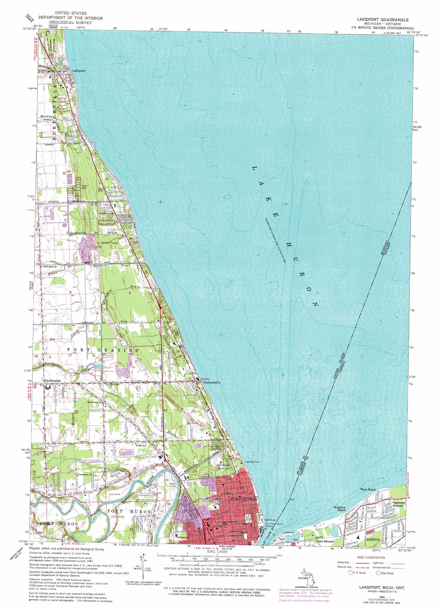
USGS Topo Quad 43082a4 - 1:24,000 scale
| Topo Map Name: | Lakeport |
| USGS Topo Quad ID: | 43082a4 |
| Print Size: | ca. 21 1/4" wide x 27" high |
| Southeast Coordinates: | 43° N latitude / 82.375° W longitude |
| Map Center Coordinates: | 43.0625° N latitude / 82.4375° W longitude |
| U.S. State: | MI |
| Filename: | o43082a4.jpg |
| Download Map JPG Image: | Lakeport topo map 1:24,000 scale |
| Map Type: | Topographic |
| Topo Series: | 7.5´ |
| Map Scale: | 1:24,000 |
| Source of Map Images: | United States Geological Survey (USGS) |
| Alternate Map Versions: |
Lakeport MI 1961, updated 1963 Download PDF Buy paper map Lakeport MI 1961, updated 1977 Download PDF Buy paper map Lakeport MI 2011 Download PDF Buy paper map Lakeport MI 2014 Download PDF Buy paper map Lakeport MI 2016 Download PDF Buy paper map |
1:24,000 Topo Quads surrounding Lakeport
Applegate |
Croswell |
|||
Roseburg |
Jeddo |
|||
Avoca |
Ruby |
Lakeport |
||
Goodells |
Smiths Creek |
Port Huron |
||
Adair |
Rattle Run |
Saint Clair |
> Back to 43082a1 at 1:100,000 scale
> Back to 43082a1 at 1:250,000 scale
> Back to U.S. Topo Maps home
Lakeport topo map: Gazetteer
Lakeport: Airports
Baker Airport elevation 178m 583′Lakeport: Canals
Black River Canal elevation 183m 600′Carrigan Drain elevation 180m 590′
Galbraith Drain elevation 184m 603′
Howe Drain elevation 181m 593′
Meadow Lawn Drain elevation 183m 600′
Thompson Drain elevation 180m 590′
Warner Drain elevation 186m 610′
Lakeport: Parks
E C Williams House Historical Marker elevation 183m 600′Fort Gratiot Light Historical Marker elevation 178m 583′
Fort Saint Joseph Historical Marker elevation 181m 593′
Gratiot Park elevation 181m 593′
Lakeport State Park elevation 183m 600′
Methodist Episcopal Church Historical Marker elevation -1m -4′
Palmer Park elevation 181m 593′
Lakeport: Populated Places
Gardendale elevation 187m 613′Keewahdin elevation 180m 590′
Lakeport elevation 181m 593′
Lakeport: Post Offices
Fort Gratiot Post Office (historical) elevation 177m 580′Gardendale Post Office (historical) elevation 187m 613′
Huronia Beach Post Office (historical) elevation 180m 590′
Lakeport Post Office elevation 181m 593′
Lakeport: Streams
Doe Creek elevation 177m 580′Milwaukee Creek elevation 176m 577′
Lakeport digital topo map on disk
Buy this Lakeport topo map showing relief, roads, GPS coordinates and other geographical features, as a high-resolution digital map file on DVD:
 map DVD")