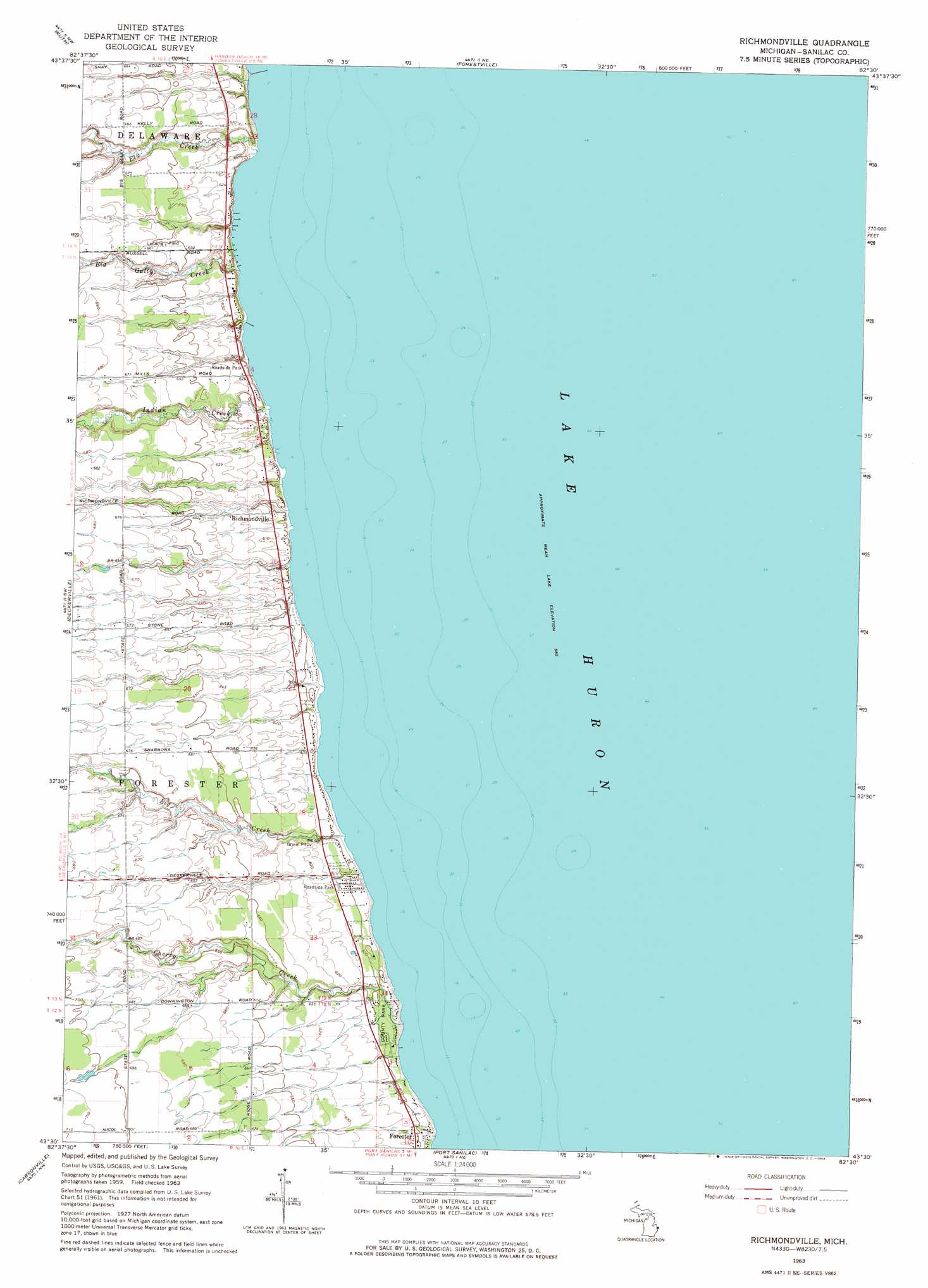
Richmondville Topo Map Michigan
To zoom in, hover over the map of Richmondville
USGS Topo Quad 43082e5 - 1:24,000 scale
| Topo Map Name: | Richmondville |
| USGS Topo Quad ID: | 43082e5 |
| Print Size: | ca. 21 1/4" wide x 27" high |
| Southeast Coordinates: | 43.5° N latitude / 82.5° W longitude |
| Map Center Coordinates: | 43.5625° N latitude / 82.5625° W longitude |
| U.S. State: | MI |
| Filename: | o43082e5.jpg |
| Download Map JPG Image: | Richmondville topo map 1:24,000 scale |
| Map Type: | Topographic |
| Topo Series: | 7.5´ |
| Map Scale: | 1:24,000 |
| Source of Map Images: | United States Geological Survey (USGS) |
| Alternate Map Versions: |
Richmondville MI 1963, updated 1964 Download PDF Buy paper map Richmondville MI 2011 Download PDF Buy paper map Richmondville MI 2014 Download PDF Buy paper map Richmondville MI 2017 Download PDF Buy paper map |
1:24,000 Topo Quads surrounding Richmondville
Bad Axe Se |
Harbor Beach |
|||
Minden City |
Ruth |
Forestville |
||
Palms |
Deckerville |
Richmondville |
||
Sandusky |
Carsonville |
Port Sanilac |
||
Peck |
Applegate |
Croswell |
> Back to 43082e1 at 1:100,000 scale
> Back to 43082a1 at 1:250,000 scale
> Back to U.S. Topo Maps home
Richmondville topo map: Gazetteer
Richmondville: Parks
Forester County Park elevation 181m 593′Sanilac County Park elevation 179m 587′
Richmondville: Populated Places
Richmondville elevation 185m 606′Richmondville: Post Offices
Murray Post Office (historical) elevation 207m 679′Richmondville Post Office (historical) elevation 186m 610′
Richmondville: Streams
Big Creek elevation 177m 580′Big Gully Creek elevation 176m 577′
Cherry Creek elevation 176m 577′
Elk Creek elevation 176m 577′
Griggs River elevation 176m 577′
Indian Creek elevation 176m 577′
Richmondville digital topo map on disk
Buy this Richmondville topo map showing relief, roads, GPS coordinates and other geographical features, as a high-resolution digital map file on DVD:
 map DVD")