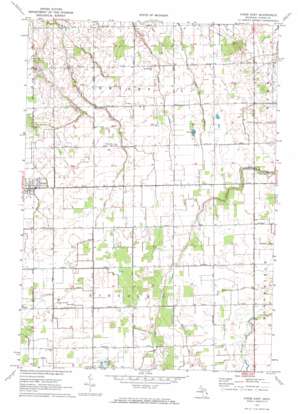
Kinde East Topo Map Michigan
To zoom in, hover over the map of Kinde East
USGS Topo Quad 43082h8 - 1:24,000 scale
| Topo Map Name: | Kinde East |
| USGS Topo Quad ID: | 43082h8 |
| Print Size: | ca. 21 1/4" wide x 27" high |
| Southeast Coordinates: | 43.875° N latitude / 82.875° W longitude |
| Map Center Coordinates: | 43.9375° N latitude / 82.9375° W longitude |
| U.S. State: | MI |
| Filename: | o43082h8.jpg |
| Download Map JPG Image: | Kinde East topo map 1:24,000 scale |
| Map Type: | Topographic |
| Topo Series: | 7.5´ |
| Map Scale: | 1:24,000 |
| Source of Map Images: | United States Geological Survey (USGS) |
| Alternate Map Versions: |
Kinde East MI 1970, updated 1973 Download PDF Buy paper map Kinde East MI 2011 Download PDF Buy paper map Kinde East MI 2014 Download PDF Buy paper map Kinde East MI 2016 Download PDF Buy paper map |
1:24,000 Topo Quads surrounding Kinde East
Port Austin West |
Port Austin East |
Huron City |
||
Rush Lake |
Kinde West |
Kinde East |
Redman |
Port Hope |
Elkton |
Bad Axe West |
Bad Axe East |
Bad Axe Se |
Harbor Beach |
Gagetown |
New Greenleaf |
Ubly |
Minden City |
Ruth |
> Back to 43082e1 at 1:100,000 scale
> Back to 43082a1 at 1:250,000 scale
> Back to U.S. Topo Maps home
Kinde East topo map: Gazetteer
Kinde East: Canals
Carr Drain elevation 217m 711′Cramp Drain elevation 210m 688′
Filion Drain elevation 223m 731′
Lincoln Drain elevation 216m 708′
Marsa Drain elevation 219m 718′
Pitcher Drain elevation 219m 718′
Rice Drain elevation 217m 711′
Weber Drain elevation 219m 718′
Kinde East: Parks
Saint Mary of Czestochowa Roman Catholic Church Historical Marker elevation 215m 705′Kinde East: Populated Places
Glencoe elevation 214m 702′Kinde elevation 213m 698′
Kinde East: Post Offices
Glencoe Post Office (historical) elevation 214m 702′Varney Post Office (historical) elevation 196m 643′
Kinde East digital topo map on disk
Buy this Kinde East topo map showing relief, roads, GPS coordinates and other geographical features, as a high-resolution digital map file on DVD:


