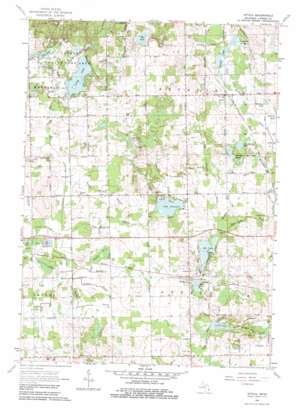
Attica Topo Map Michigan
To zoom in, hover over the map of Attica
USGS Topo Quad 43083a2 - 1:24,000 scale
| Topo Map Name: | Attica |
| USGS Topo Quad ID: | 43083a2 |
| Print Size: | ca. 21 1/4" wide x 27" high |
| Southeast Coordinates: | 43° N latitude / 83.125° W longitude |
| Map Center Coordinates: | 43.0625° N latitude / 83.1875° W longitude |
| U.S. State: | MI |
| Filename: | o43083a2.jpg |
| Download Map JPG Image: | Attica topo map 1:24,000 scale |
| Map Type: | Topographic |
| Topo Series: | 7.5´ |
| Map Scale: | 1:24,000 |
| Source of Map Images: | United States Geological Survey (USGS) |
| Alternate Map Versions: |
Attica MI 1963, updated 1964 Download PDF Buy paper map Attica MI 1963, updated 1983 Download PDF Buy paper map Attica MI 2011 Download PDF Buy paper map Attica MI 2014 Download PDF Buy paper map Attica MI 2016 Download PDF Buy paper map |
1:24,000 Topo Quads surrounding Attica
> Back to 43083a1 at 1:100,000 scale
> Back to 43082a1 at 1:250,000 scale
> Back to U.S. Topo Maps home
Attica topo map: Gazetteer
Attica: Canals
Abbott Drain elevation 254m 833′Ballard Drain elevation 259m 849′
Barber Drain elevation 263m 862′
Bishop Drain elevation 262m 859′
Brant Lake Drain elevation 259m 849′
Bryant Drain elevation 253m 830′
Earl Branch Drain elevation 262m 859′
Elgin Drain elevation 268m 879′
Fish Lake Drain elevation 260m 853′
Geer Williams Drain elevation 261m 856′
Long Lake Drain elevation 259m 849′
Mud Lake Drain elevation 262m 859′
Palmer Branch Drain elevation 259m 849′
Pleasant Lake Drain elevation 268m 879′
Sickles Drain elevation 259m 849′
Swamp Corners Drain elevation 268m 879′
Winn Drain elevation 264m 866′
Attica: Crossings
Interchange 159 elevation 263m 862′Interchange 163 elevation 262m 859′
Attica: Lakes
Cooks Lake elevation 256m 839′Cranberry Lake elevation 264m 866′
Elk Lake elevation 261m 856′
Elk Lake elevation 283m 928′
Fish Lake elevation 264m 866′
Grass Lake elevation 266m 872′
Lake Pleasant elevation 263m 862′
Long Lake elevation 255m 836′
Long Lake elevation 258m 846′
Mitchell Lakes elevation 263m 862′
Mud Lake elevation 265m 869′
Rose Lake elevation 263m 862′
Simmons Lake elevation 260m 853′
Stanton Lakes elevation 261m 856′
Attica: Populated Places
Attica elevation 273m 895′Lum elevation 266m 872′
Sandhill Mobile Home Estates elevation 285m 935′
Attica: Post Offices
Arkdale Post Office (historical) elevation 262m 859′Attica Post Office elevation 274m 898′
Lum Post Office (historical) elevation 265m 869′
Attica digital topo map on disk
Buy this Attica topo map showing relief, roads, GPS coordinates and other geographical features, as a high-resolution digital map file on DVD:


