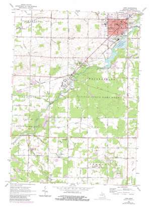
Caro Topo Map Michigan
To zoom in, hover over the map of Caro
USGS Topo Quad 43083d4 - 1:24,000 scale
| Topo Map Name: | Caro |
| USGS Topo Quad ID: | 43083d4 |
| Print Size: | ca. 21 1/4" wide x 27" high |
| Southeast Coordinates: | 43.375° N latitude / 83.375° W longitude |
| Map Center Coordinates: | 43.4375° N latitude / 83.4375° W longitude |
| U.S. State: | MI |
| Filename: | o43083d4.jpg |
| Download Map JPG Image: | Caro topo map 1:24,000 scale |
| Map Type: | Topographic |
| Topo Series: | 7.5´ |
| Map Scale: | 1:24,000 |
| Source of Map Images: | United States Geological Survey (USGS) |
| Alternate Map Versions: |
Caro MI 1963, updated 1964 Download PDF Buy paper map Caro MI 1963, updated 1980 Download PDF Buy paper map Caro MI 1963, updated 1980 Download PDF Buy paper map Caro MI 2011 Download PDF Buy paper map Caro MI 2014 Download PDF Buy paper map Caro MI 2017 Download PDF Buy paper map |
1:24,000 Topo Quads surrounding Caro
> Back to 43083a1 at 1:100,000 scale
> Back to 43082a1 at 1:250,000 scale
> Back to U.S. Topo Maps home
Caro topo map: Gazetteer
Caro: Airports
Caro Municipal Airport elevation 210m 688′Caro: Canals
Bader Drain elevation 212m 695′Chambers Drain elevation 204m 669′
Chapple Drain elevation 204m 669′
Coleman Drain elevation 207m 679′
Craig Drain elevation 231m 757′
Cutts Drain elevation 213m 698′
Hutchinson Drain elevation 235m 770′
Lynn Drain elevation 223m 731′
Northwest Drain elevation 224m 734′
O'Brien Drain elevation 216m 708′
Schoener Drain elevation 223m 731′
Scott Drain elevation 219m 718′
Terry Allen Drain elevation 211m 692′
Caro: Parks
Caro Masonic Temple Historical Marker elevation 219m 718′First Presbyterian Church of Caro Historical Marker elevation 221m 725′
Indianfields Park elevation 205m 672′
Peninsular Sugar Refining Company Historical Marker elevation 213m 698′
Trinity Episcopal Church Historical Marker elevation 218m 715′
Tuscola County Advertiser Historical Marker elevation 219m 718′
Tuscola County Courthouse Historical Marker elevation 219m 718′
Tuscola County Fair Historical Marker elevation 213m 698′
Tuscola State Game Area elevation 213m 698′
William H Carson House Historical Marker elevation 224m 734′
Caro: Populated Places
Caro elevation 221m 725′Caro Mobile Estates elevation 217m 711′
Riverview Mobile Home Park elevation 210m 688′
Vaughn Village Mobile Home Park elevation 213m 698′
Wahjamega elevation 207m 679′
Caro: Post Offices
Caro Post Office elevation 221m 725′Northgrove Post Office (historical) elevation 235m 770′
Wahjamega Post Office (historical) elevation 207m 679′
Caro: Streams
Evergreen Creek elevation 193m 633′Sucker Creek elevation 201m 659′
Caro digital topo map on disk
Buy this Caro topo map showing relief, roads, GPS coordinates and other geographical features, as a high-resolution digital map file on DVD:


