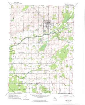
Cass City Topo Map Michigan
To zoom in, hover over the map of Cass City
USGS Topo Quad 43083e2 - 1:24,000 scale
| Topo Map Name: | Cass City |
| USGS Topo Quad ID: | 43083e2 |
| Print Size: | ca. 21 1/4" wide x 27" high |
| Southeast Coordinates: | 43.5° N latitude / 83.125° W longitude |
| Map Center Coordinates: | 43.5625° N latitude / 83.1875° W longitude |
| U.S. State: | MI |
| Filename: | o43083e2.jpg |
| Download Map JPG Image: | Cass City topo map 1:24,000 scale |
| Map Type: | Topographic |
| Topo Series: | 7.5´ |
| Map Scale: | 1:24,000 |
| Source of Map Images: | United States Geological Survey (USGS) |
| Alternate Map Versions: |
Cass City MI 1963, updated 1964 Download PDF Buy paper map Cass City MI 2011 Download PDF Buy paper map Cass City MI 2014 Download PDF Buy paper map Cass City MI 2017 Download PDF Buy paper map |
1:24,000 Topo Quads surrounding Cass City
> Back to 43083e1 at 1:100,000 scale
> Back to 43082a1 at 1:250,000 scale
> Back to U.S. Topo Maps home
Cass City topo map: Gazetteer
Cass City: Airports
Flying T Ranch Airport elevation 219m 718′Cass City: Canals
Center Drain elevation 220m 721′Deer Lick Drain elevation 219m 718′
Dickinson Drain elevation 219m 718′
Galspie Drain elevation 228m 748′
Gekeler Drain elevation 228m 748′
Gowing Drain elevation 222m 728′
Hack Drain elevation 220m 721′
Holts Drain elevation 228m 748′
Kelly Branch elevation 218m 715′
McCallum Drain elevation 231m 757′
Parks Drain elevation 226m 741′
Reid Drain elevation 228m 748′
Spencer Drain elevation 219m 718′
Talmadge Drain elevation 219m 718′
Tracy Drain elevation 216m 708′
Tuckey Drain elevation 221m 725′
Vorhes Drain elevation 229m 751′
Walton Drain elevation 222m 728′
Webster Drain elevation 219m 718′
Whitney Drain elevation 222m 728′
Cass City: Parks
Elkland Township Hall Historical Marker elevation 226m 741′State Reward Road Number One Historical Marker elevation 226m 741′
Cass City: Populated Places
Cass City elevation 227m 744′Deford elevation 226m 741′
Huntsville Park elevation 226m 741′
Cass City: Post Offices
Cass City Post Office elevation 228m 748′Deford Post Office elevation 225m 738′
Novesta Post Office (historical) elevation 232m 761′
Cass City: Streams
Cedar Run elevation 209m 685′Mud Creek elevation 222m 728′
North Branch Cass River elevation 215m 705′
South Branch Cass River elevation 215m 705′
Cass City digital topo map on disk
Buy this Cass City topo map showing relief, roads, GPS coordinates and other geographical features, as a high-resolution digital map file on DVD:


