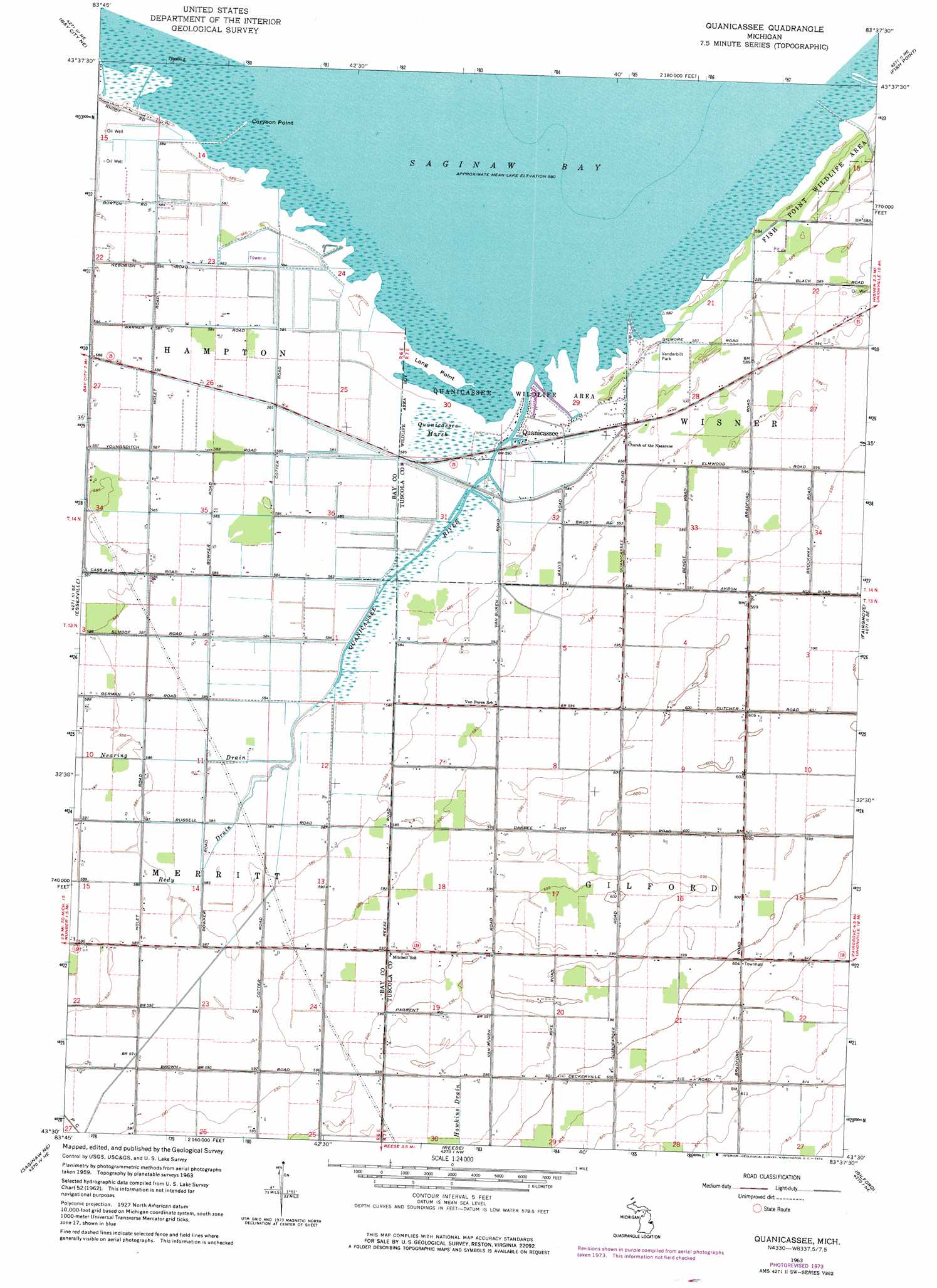
Quanicassee Topo Map Michigan
To zoom in, hover over the map of Quanicassee
USGS Topo Quad 43083e6 - 1:24,000 scale
| Topo Map Name: | Quanicassee |
| USGS Topo Quad ID: | 43083e6 |
| Print Size: | ca. 21 1/4" wide x 27" high |
| Southeast Coordinates: | 43.5° N latitude / 83.625° W longitude |
| Map Center Coordinates: | 43.5625° N latitude / 83.6875° W longitude |
| U.S. State: | MI |
| Filename: | o43083e6.jpg |
| Download Map JPG Image: | Quanicassee topo map 1:24,000 scale |
| Map Type: | Topographic |
| Topo Series: | 7.5´ |
| Map Scale: | 1:24,000 |
| Source of Map Images: | United States Geological Survey (USGS) |
| Alternate Map Versions: |
Quanicassee MI 1963, updated 1964 Download PDF Buy paper map Quanicassee MI 1963, updated 1973 Download PDF Buy paper map Quanicassee MI 2011 Download PDF Buy paper map Quanicassee MI 2014 Download PDF Buy paper map Quanicassee MI 2016 Download PDF Buy paper map |
1:24,000 Topo Quads surrounding Quanicassee
Pinconning |
Bay Port West |
|||
Kawkawlin |
Bay City Ne |
Fish Point |
Sebewaing |
|
Bay City |
Essexville |
Quanicassee |
Fairgrove |
Colling |
Saginaw |
Saginaw Ne |
Reese |
Gilford |
Caro |
Bridgeport |
Birch Run North |
Frankenmuth |
Vassar |
Juniata |
> Back to 43083e1 at 1:100,000 scale
> Back to 43082a1 at 1:250,000 scale
> Back to U.S. Topo Maps home
Quanicassee topo map: Gazetteer
Quanicassee: Canals
Hugo Drain elevation 178m 583′Quanicassee: Capes
Coryeon Point elevation 177m 580′Long Point elevation 177m 580′
Quanicassee: Parks
Vanderbilt Park elevation 178m 583′Quanicassee: Populated Places
Quanicassee elevation 177m 580′Quanicassee: Post Offices
Quanicassee City Post Office (historical) elevation 177m 580′Quanicassee: Streams
Quanicassee River elevation 177m 580′Quanicassee: Swamps
Quanicassee Marsh elevation 178m 583′Quanicassee digital topo map on disk
Buy this Quanicassee topo map showing relief, roads, GPS coordinates and other geographical features, as a high-resolution digital map file on DVD:
 map DVD")