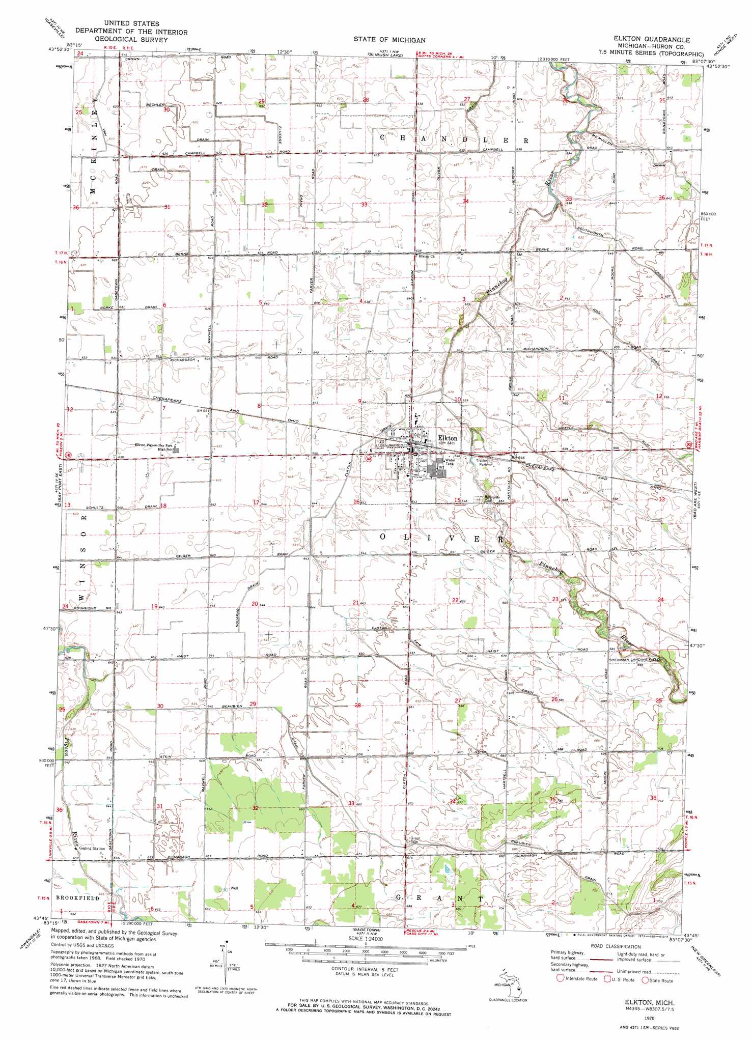
Elkton Topo Map Michigan
To zoom in, hover over the map of Elkton
USGS Topo Quad 43083g2 - 1:24,000 scale
| Topo Map Name: | Elkton |
| USGS Topo Quad ID: | 43083g2 |
| Print Size: | ca. 21 1/4" wide x 27" high |
| Southeast Coordinates: | 43.75° N latitude / 83.125° W longitude |
| Map Center Coordinates: | 43.8125° N latitude / 83.1875° W longitude |
| U.S. State: | MI |
| Filename: | o43083g2.jpg |
| Download Map JPG Image: | Elkton topo map 1:24,000 scale |
| Map Type: | Topographic |
| Topo Series: | 7.5´ |
| Map Scale: | 1:24,000 |
| Source of Map Images: | United States Geological Survey (USGS) |
| Alternate Map Versions: |
Elkton MI 1970, updated 1973 Download PDF Buy paper map Elkton MI 2011 Download PDF Buy paper map Elkton MI 2014 Download PDF Buy paper map Elkton MI 2017 Download PDF Buy paper map |
1:24,000 Topo Quads surrounding Elkton
Charity Island |
Port Austin West |
Port Austin East |
||
Sand Point |
Caseville |
Rush Lake |
Kinde West |
Kinde East |
Bay Port West |
Bay Port East |
Elkton |
Bad Axe West |
Bad Axe East |
Sebewaing |
Owendale |
Gagetown |
New Greenleaf |
Ubly |
Colling |
Ellington |
Cass City |
Shabbona |
Argyle |
> Back to 43083e1 at 1:100,000 scale
> Back to 43082a1 at 1:250,000 scale
> Back to U.S. Topo Maps home
Elkton topo map: Gazetteer
Elkton: Canals
Beaubien Drain elevation 203m 666′Bechler Drain elevation 190m 623′
Elkton Drain elevation 193m 633′
Elkton Fair Drain elevation 200m 656′
Fluegge Drain elevation 192m 629′
Hill Drain elevation 199m 652′
Nettle Run elevation 197m 646′
Oliver Drain elevation 192m 629′
Schultz Drain elevation 193m 633′
Squarno Drain elevation 195m 639′
Elkton: Populated Places
Elkton elevation 195m 639′Elkton: Post Offices
Elkton Post Office elevation 196m 643′Wolfton Post Office (historical) elevation 197m 646′
Elkton: Streams
Silver Creek elevation 202m 662′Elkton digital topo map on disk
Buy this Elkton topo map showing relief, roads, GPS coordinates and other geographical features, as a high-resolution digital map file on DVD:
 map DVD")