Ovid West Topo Map Michigan
To zoom in, hover over the map of Ovid West
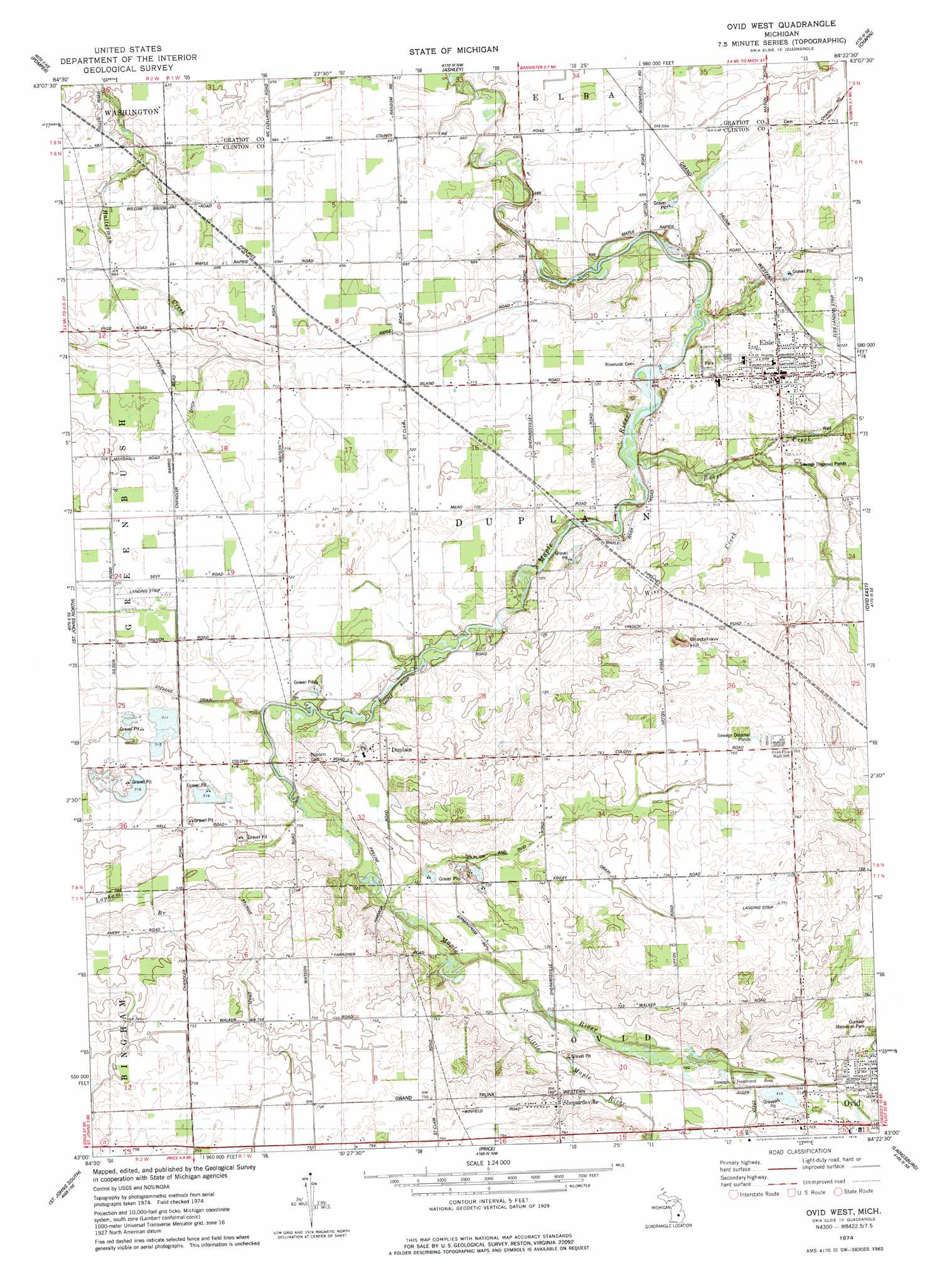
USGS Topo Quad 43084a4 - 1:24,000 scale
| Topo Map Name: | Ovid West |
| USGS Topo Quad ID: | 43084a4 |
| Print Size: | ca. 21 1/4" wide x 27" high |
| Southeast Coordinates: | 43° N latitude / 84.375° W longitude |
| Map Center Coordinates: | 43.0625° N latitude / 84.4375° W longitude |
| U.S. State: | MI |
| Filename: | o43084a4.jpg |
| Download Map JPG Image: | Ovid West topo map 1:24,000 scale |
| Map Type: | Topographic |
| Topo Series: | 7.5´ |
| Map Scale: | 1:24,000 |
| Source of Map Images: | United States Geological Survey (USGS) |
| Alternate Map Versions: |
Ovid West MI 1974, updated 1978 Download PDF Buy paper map Ovid West MI 2011 Download PDF Buy paper map Ovid West MI 2014 Download PDF Buy paper map Ovid West MI 2016 Download PDF Buy paper map |
1:24,000 Topo Quads surrounding Ovid West
Alma South |
Ithaca |
Rathbone |
Lakefield |
Saint Charles |
Perrinton |
Pompeii |
Ashley |
Chapin |
Chesaning West |
Maple Rapids |
Saint Johns North |
Ovid West |
Ovid East |
Owosso North |
Riley |
Saint Johns South |
Price |
Laingsburg |
Owosso South |
Wacousta |
Lansing North |
Bath |
Shaftsburg |
Perry |
> Back to 43084a1 at 1:100,000 scale
> Back to 43084a1 at 1:250,000 scale
> Back to U.S. Topo Maps home
Ovid West topo map: Gazetteer
Ovid West: Airports
Schiffer Acres Airport elevation 225m 738′Tripp Creek Airport elevation 218m 715′
Ovid West: Canals
Barrio Ditch elevation 217m 711′Duplain and Ovid Drain elevation 223m 731′
Stevens Drain elevation 215m 705′
Sturgis Drain elevation 226m 741′
Ovid West: Parks
Rochester Colony Historical Marker elevation 224m 734′Ovid West: Populated Places
Duplain elevation 224m 734′Elsie elevation 224m 734′
Shepardsville elevation 230m 754′
Ovid West: Post Offices
Duplain Post Office (historical) elevation 223m 731′Elsie Post Office elevation 223m 731′
Shepardsville Post Office (historical) elevation 230m 754′
Ovid West: Streams
Alder Creek Drain elevation 218m 715′Baker Creek elevation 209m 685′
Little Maple River elevation 216m 708′
Wise Creek elevation 212m 695′
Ovid West: Summits
Bradshaw Hill elevation 244m 800′Ovid West digital topo map on disk
Buy this Ovid West topo map showing relief, roads, GPS coordinates and other geographical features, as a high-resolution digital map file on DVD: