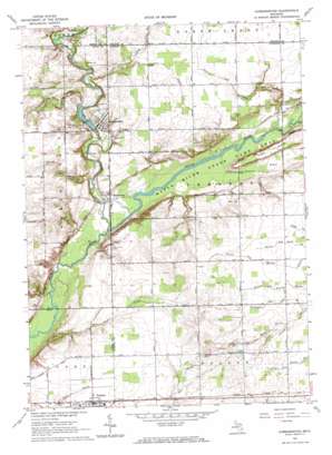
Hubbardston Topo Map Michigan
To zoom in, hover over the map of Hubbardston
USGS Topo Quad 43084a7 - 1:24,000 scale
| Topo Map Name: | Hubbardston |
| USGS Topo Quad ID: | 43084a7 |
| Print Size: | ca. 21 1/4" wide x 27" high |
| Southeast Coordinates: | 43° N latitude / 84.75° W longitude |
| Map Center Coordinates: | 43.0625° N latitude / 84.8125° W longitude |
| U.S. State: | MI |
| Filename: | o43084a7.jpg |
| Download Map JPG Image: | Hubbardston topo map 1:24,000 scale |
| Map Type: | Topographic |
| Topo Series: | 7.5´ |
| Map Scale: | 1:24,000 |
| Source of Map Images: | United States Geological Survey (USGS) |
| Alternate Map Versions: |
Hubbardston MI 1967, updated 1968 Download PDF Buy paper map Hubbardston MI 2011 Download PDF Buy paper map Hubbardston MI 2014 Download PDF Buy paper map Hubbardston MI 2016 Download PDF Buy paper map |
1:24,000 Topo Quads surrounding Hubbardston
> Back to 43084a1 at 1:100,000 scale
> Back to 43084a1 at 1:250,000 scale
> Back to U.S. Topo Maps home
Hubbardston topo map: Gazetteer
Hubbardston: Canals
Bower Drain elevation 216m 708′Connor Drain elevation 221m 725′
Connors and Sessions Drain elevation 223m 731′
Nichols Drain elevation 223m 731′
Reynolds and Sessions Drain elevation 197m 646′
Ruel Drain elevation 220m 721′
Sage and Hafner Drain elevation 226m 741′
Sharps Drain elevation 224m 734′
Stewart and Kinley Drain elevation 224m 734′
Waters and Nash Drain elevation 224m 734′
Williams and Cook Drain elevation 227m 744′
Hubbardston: Parks
Saint John the Baptist Cemetery Historical Marker elevation 220m 721′Saint John the Baptist Church Historical Marker elevation 220m 721′
Hubbardston: Populated Places
Hubbardston elevation 208m 682′Matherton elevation 199m 652′
Pewamo elevation 224m 734′
Hubbardston: Post Offices
Hubbardston Post Office elevation 205m 672′Matherton Post Office (historical) elevation 200m 656′
Pewamo Post Office elevation 224m 734′
Hubbardston: Streams
Fifield Creek elevation 207m 679′Fish Creek elevation 195m 639′
Stoughton Creek elevation 205m 672′
Hubbardston digital topo map on disk
Buy this Hubbardston topo map showing relief, roads, GPS coordinates and other geographical features, as a high-resolution digital map file on DVD:


