Chapin Topo Map Michigan
To zoom in, hover over the map of Chapin
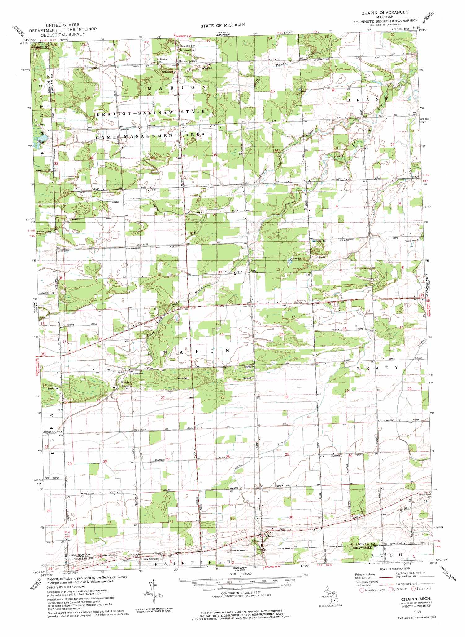
USGS Topo Quad 43084b3 - 1:24,000 scale
| Topo Map Name: | Chapin |
| USGS Topo Quad ID: | 43084b3 |
| Print Size: | ca. 21 1/4" wide x 27" high |
| Southeast Coordinates: | 43.125° N latitude / 84.25° W longitude |
| Map Center Coordinates: | 43.1875° N latitude / 84.3125° W longitude |
| U.S. State: | MI |
| Filename: | o43084b3.jpg |
| Download Map JPG Image: | Chapin topo map 1:24,000 scale |
| Map Type: | Topographic |
| Topo Series: | 7.5´ |
| Map Scale: | 1:24,000 |
| Source of Map Images: | United States Geological Survey (USGS) |
| Alternate Map Versions: |
Chapin MI 1974, updated 1978 Download PDF Buy paper map Chapin MI 2011 Download PDF Buy paper map Chapin MI 2014 Download PDF Buy paper map Chapin MI 2017 Download PDF Buy paper map |
1:24,000 Topo Quads surrounding Chapin
Saint Louis |
Breckenridge |
Merrill |
Hemlock |
Shields |
Ithaca |
Rathbone |
Lakefield |
Saint Charles |
Alicia |
Pompeii |
Ashley |
Chapin |
Chesaning West |
Chesaning East |
Saint Johns North |
Ovid West |
Ovid East |
Owosso North |
Easton |
Saint Johns South |
Price |
Laingsburg |
Owosso South |
Corunna |
> Back to 43084a1 at 1:100,000 scale
> Back to 43084a1 at 1:250,000 scale
> Back to U.S. Topo Maps home
Chapin topo map: Gazetteer
Chapin: Canals
Bibrietz Drain elevation 197m 646′Coon Drain elevation 206m 675′
Limbocker Drain elevation 196m 643′
North Branch Limbocker Drain elevation 196m 643′
Olney Drain elevation 202m 662′
Chapin: Parks
Gratiot - Saginaw State Game Management Area elevation 196m 643′Chapin: Populated Places
Chapin elevation 216m 708′Fenmore elevation 198m 649′
Marion Springs elevation 197m 646′
Olney Corners elevation 216m 708′
Racy elevation 195m 639′
Chapin: Post Offices
Chapin Post Office (historical) elevation 216m 708′Fenmore Post Office (historical) elevation 198m 649′
Marion Springs Post Office (historical) elevation 197m 646′
Racy Post Office (historical) elevation 195m 639′
Chapin: Streams
Griffus Creek elevation 188m 616′Lamb Creek elevation 185m 606′
Limbocker Creek elevation 186m 610′
Chapin digital topo map on disk
Buy this Chapin topo map showing relief, roads, GPS coordinates and other geographical features, as a high-resolution digital map file on DVD: