Rosebush Topo Map Michigan
To zoom in, hover over the map of Rosebush
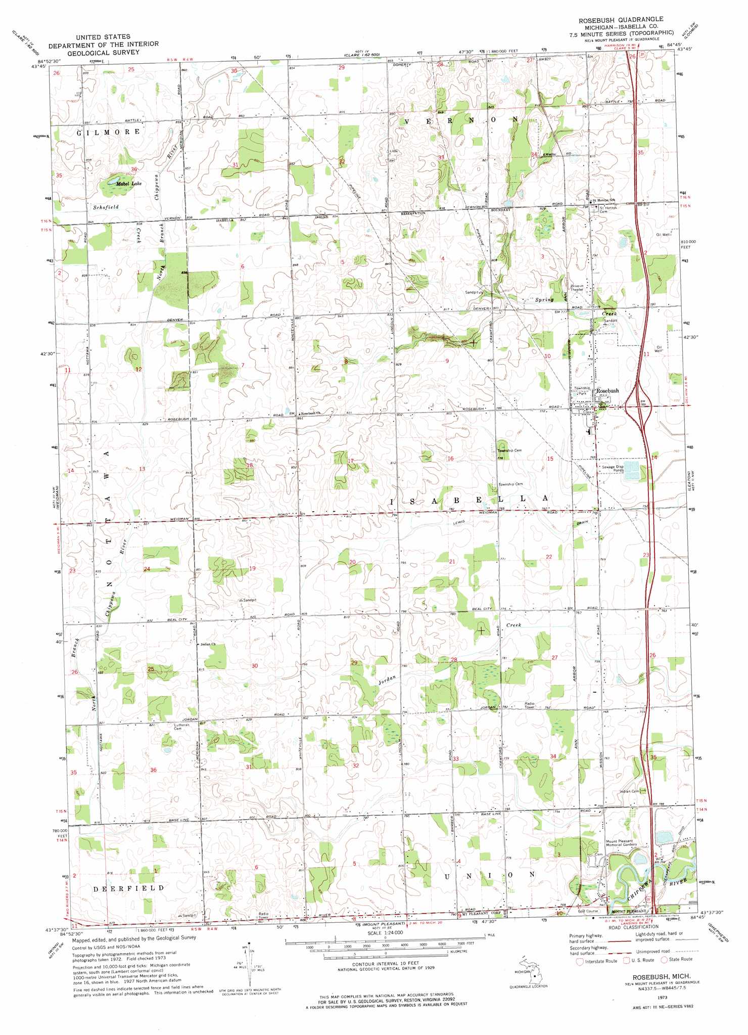
USGS Topo Quad 43084f7 - 1:24,000 scale
| Topo Map Name: | Rosebush |
| USGS Topo Quad ID: | 43084f7 |
| Print Size: | ca. 21 1/4" wide x 27" high |
| Southeast Coordinates: | 43.625° N latitude / 84.75° W longitude |
| Map Center Coordinates: | 43.6875° N latitude / 84.8125° W longitude |
| U.S. State: | MI |
| Filename: | o43084f7.jpg |
| Download Map JPG Image: | Rosebush topo map 1:24,000 scale |
| Map Type: | Topographic |
| Topo Series: | 7.5´ |
| Map Scale: | 1:24,000 |
| Source of Map Images: | United States Geological Survey (USGS) |
| Alternate Map Versions: |
Rosebush MI 1973, updated 1976 Download PDF Buy paper map Rosebush MI 2011 Download PDF Buy paper map Rosebush MI 2014 Download PDF Buy paper map Rosebush MI 2016 Download PDF Buy paper map |
1:24,000 Topo Quads surrounding Rosebush
Lake Ne |
Lake George |
Hatton |
Browns Corners |
Coleman Ne |
Lake |
Woods |
Clare |
Loomis |
Coleman |
Sherman City |
Weidman |
Rosebush |
Leaton |
Alamando |
Blanchard |
Winn |
Mount Pleasant |
Shepherd |
Pleasant Valley |
Edmore |
Vestaburg |
Riverdale |
Alma North |
Saint Louis |
> Back to 43084e1 at 1:100,000 scale
> Back to 43084a1 at 1:250,000 scale
> Back to U.S. Topo Maps home
Rosebush topo map: Gazetteer
Rosebush: Canals
Lewis Drain elevation 228m 748′Rosebush: Crossings
Interchange 149 elevation 237m 777′Rosebush: Lakes
Mabel Lake elevation 256m 839′Rosebush: Parks
Isabella Township Park elevation 237m 777′Rosebush: Populated Places
Country Place Park elevation 231m 757′Oakview Mobile Home Estates elevation 242m 793′
Rosebush elevation 238m 780′
Westwinds Mobile Home Park elevation 238m 780′
Rosebush: Post Offices
Longwood Post Office (historical) elevation 227m 744′Rosebush Post Office elevation 238m 780′
Whiteville Post Office (historical) elevation 244m 800′
Rosebush: Streams
Schofield Creek elevation 255m 836′Rosebush digital topo map on disk
Buy this Rosebush topo map showing relief, roads, GPS coordinates and other geographical features, as a high-resolution digital map file on DVD: