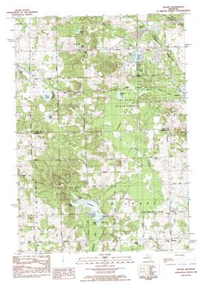
Woods Topo Map Michigan
To zoom in, hover over the map of Woods
USGS Topo Quad 43084g8 - 1:25,000 scale
| Topo Map Name: | Woods |
| USGS Topo Quad ID: | 43084g8 |
| Print Size: | ca. 21 1/4" wide x 27" high |
| Southeast Coordinates: | 43.75° N latitude / 84.875° W longitude |
| Map Center Coordinates: | 43.8125° N latitude / 84.9375° W longitude |
| U.S. State: | MI |
| Filename: | l43084g8.jpg |
| Download Map JPG Image: | Woods topo map 1:25,000 scale |
| Map Type: | Topographic |
| Topo Series: | 7.5´ |
| Map Scale: | 1:25,000 |
| Source of Map Images: | United States Geological Survey (USGS) |
| Alternate Map Versions: |
Woods MI 1983, updated 1984 Download PDF Buy paper map |
1:24,000 Topo Quads surrounding Woods
> Back to 43084e1 at 1:100,000 scale
> Back to 43084a1 at 1:250,000 scale
> Back to U.S. Topo Maps home
Woods topo map: Gazetteer
Woods: Lakes
Bass Lake elevation 279m 915′Bluff Lake elevation 322m 1056′
Deadman Lake elevation 290m 951′
Dishpan Lake elevation 297m 974′
Dollar Lake elevation 339m 1112′
Grass Lake elevation 316m 1036′
Littlefield Lake elevation 278m 912′
Lost Lake elevation 282m 925′
Mill Pond elevation 275m 902′
Minnow Lake elevation 287m 941′
Outlet Lake elevation 279m 915′
Russell Lake elevation 339m 1112′
Sucker Lake elevation 278m 912′
Surrey Lake elevation 291m 954′
Tower Lake elevation 278m 912′
We-E Lake elevation 341m 1118′
Woods: Parks
Coldwater Township Park elevation 306m 1003′Woods: Populated Places
Woods elevation 286m 938′Woods: Streams
Elm Creek elevation 282m 925′Overton Creek elevation 275m 902′
Sucker Creek elevation 279m 915′
Woods: Swamps
Deadman Swamp elevation 288m 944′Woods digital topo map on disk
Buy this Woods topo map showing relief, roads, GPS coordinates and other geographical features, as a high-resolution digital map file on DVD:


