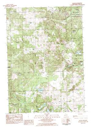
Hatton Topo Map Michigan
To zoom in, hover over the map of Hatton
USGS Topo Quad 43084h7 - 1:25,000 scale
| Topo Map Name: | Hatton |
| USGS Topo Quad ID: | 43084h7 |
| Print Size: | ca. 21 1/4" wide x 27" high |
| Southeast Coordinates: | 43.875° N latitude / 84.75° W longitude |
| Map Center Coordinates: | 43.9375° N latitude / 84.8125° W longitude |
| U.S. State: | MI |
| Filename: | l43084h7.jpg |
| Download Map JPG Image: | Hatton topo map 1:25,000 scale |
| Map Type: | Topographic |
| Topo Series: | 7.5´ |
| Map Scale: | 1:25,000 |
| Source of Map Images: | United States Geological Survey (USGS) |
| Alternate Map Versions: |
Hatton MI 1983, updated 1984 Download PDF Buy paper map |
1:24,000 Topo Quads surrounding Hatton
> Back to 43084e1 at 1:100,000 scale
> Back to 43084a1 at 1:250,000 scale
> Back to U.S. Topo Maps home
Hatton topo map: Gazetteer
Hatton: Crossings
Interchange 162 elevation 279m 915′Interchange 168 elevation 320m 1049′
Interchange 170 elevation 326m 1069′
Hatton: Lakes
Beebe Lake elevation 294m 964′East Trout Lake elevation 282m 925′
Gut Lake elevation 284m 931′
Handy Lake elevation 355m 1164′
Lake Enola elevation 279m 915′
Loon Lake elevation 290m 951′
Pfannes Lake elevation 361m 1184′
West Trout Lake elevation 279m 915′
Hatton: Parks
Gerrish Railroad Roadside Park elevation 279m 915′Logging Railroads Historical Marker elevation 281m 921′
Hatton: Populated Places
Hatton elevation 304m 997′Hatton: Post Offices
Hatton Post Office (historical) elevation 304m 997′Hatton: Streams
Loon Lake Creek elevation 283m 928′Hatton: Swamps
Bear Swamp elevation 296m 971′Hatton digital topo map on disk
Buy this Hatton topo map showing relief, roads, GPS coordinates and other geographical features, as a high-resolution digital map file on DVD:


