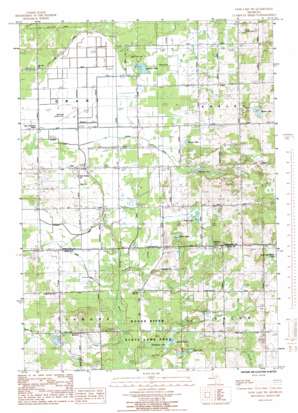
Sand Lake Sw Topo Map Michigan
To zoom in, hover over the map of Sand Lake Sw
USGS Topo Quad 43085c6 - 1:24,000 scale
| Topo Map Name: | Sand Lake Sw |
| USGS Topo Quad ID: | 43085c6 |
| Print Size: | ca. 21 1/4" wide x 27" high |
| Southeast Coordinates: | 43.25° N latitude / 85.625° W longitude |
| Map Center Coordinates: | 43.3125° N latitude / 85.6875° W longitude |
| U.S. State: | MI |
| Filename: | o43085c6.jpg |
| Download Map JPG Image: | Sand Lake Sw topo map 1:24,000 scale |
| Map Type: | Topographic |
| Topo Series: | 7.5´ |
| Map Scale: | 1:24,000 |
| Source of Map Images: | United States Geological Survey (USGS) |
| Alternate Map Versions: |
Sand Lake SW MI 1985, updated 1985 Download PDF Buy paper map Sand Lake SW MI 2011 Download PDF Buy paper map Sand Lake SW MI 2014 Download PDF Buy paper map Sand Lake SW MI 2017 Download PDF Buy paper map |
1:24,000 Topo Quads surrounding Sand Lake Sw
> Back to 43085a1 at 1:100,000 scale
> Back to 43084a1 at 1:250,000 scale
> Back to U.S. Topo Maps home
Sand Lake Sw topo map: Gazetteer
Sand Lake Sw: Airports
Bellamy Landing Strip elevation 265m 869′Bolthouse Landing Strip elevation 241m 790′
Sand Lake Sw: Canals
Costen Drain elevation 242m 793′Geers Drain elevation 240m 787′
Hickory Creek elevation 241m 790′
Hilbrand Drain elevation 240m 787′
Plaiser Drain elevation 240m 787′
Veenboer Drain elevation 240m 787′
Sand Lake Sw: Lakes
Baldwin Lake elevation 259m 849′Butler Lake elevation 283m 928′
Chrishaven Lake elevation 237m 777′
Clear Lake elevation 239m 784′
Frey Lake elevation 248m 813′
Harwell Lake elevation 247m 810′
Moore Lake elevation 245m 803′
Ransom Lake elevation 241m 790′
South Lake elevation 250m 820′
Spring Lake elevation 236m 774′
Sand Lake Sw: Populated Places
Sun elevation 252m 826′Sand Lake Sw: Post Offices
Perrins Post Office (historical) elevation 248m 813′Plumville Post Office (historical) elevation 252m 826′
Sun Post Office (historical) elevation 251m 823′
Sand Lake Sw: Streams
Ransom Creek elevation 241m 790′Walter Creek elevation 235m 770′
Sand Lake Sw digital topo map on disk
Buy this Sand Lake Sw topo map showing relief, roads, GPS coordinates and other geographical features, as a high-resolution digital map file on DVD:


