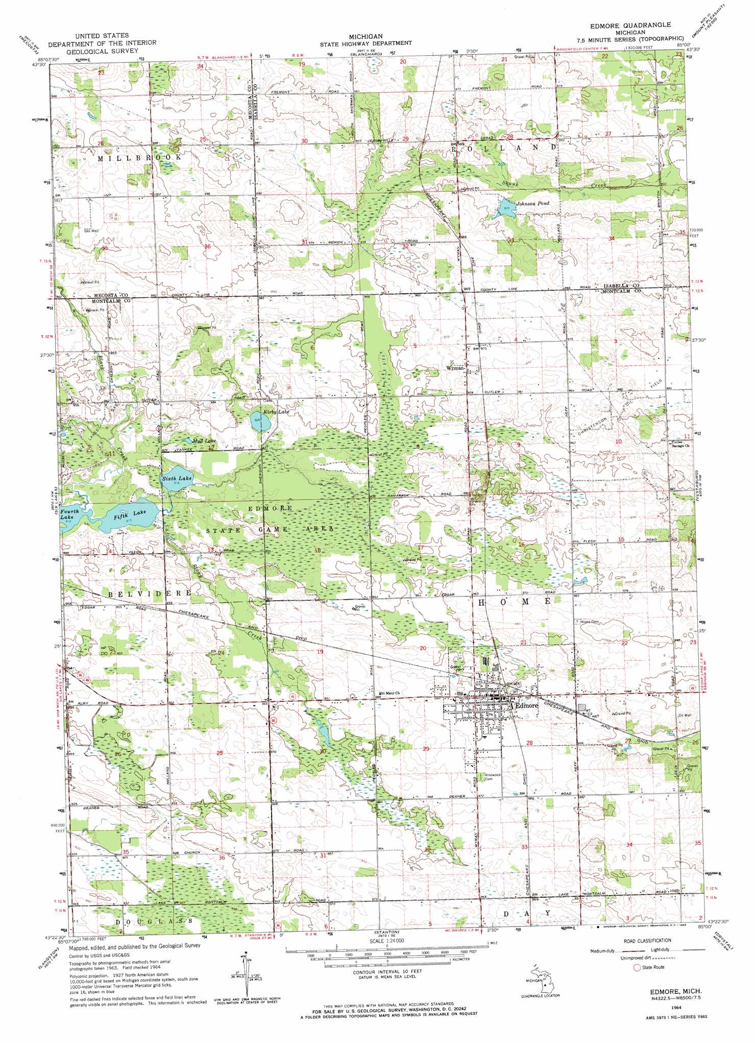
Edmore Topo Map Michigan
To zoom in, hover over the map of Edmore
USGS Topo Quad 43085d1 - 1:24,000 scale
| Topo Map Name: | Edmore |
| USGS Topo Quad ID: | 43085d1 |
| Print Size: | ca. 21 1/4" wide x 27" high |
| Southeast Coordinates: | 43.375° N latitude / 85° W longitude |
| Map Center Coordinates: | 43.4375° N latitude / 85.0625° W longitude |
| U.S. State: | MI |
| Filename: | o43085d1.jpg |
| Download Map JPG Image: | Edmore topo map 1:24,000 scale |
| Map Type: | Topographic |
| Topo Series: | 7.5´ |
| Map Scale: | 1:24,000 |
| Source of Map Images: | United States Geological Survey (USGS) |
| Alternate Map Versions: |
Edmore MI 1964, updated 1965 Download PDF Buy paper map Edmore MI 2011 Download PDF Buy paper map Edmore MI 2014 Download PDF Buy paper map Edmore MI 2017 Download PDF Buy paper map |
1:24,000 Topo Quads surrounding Edmore
Chippewa Lake South |
Mecosta Nw |
Sherman City |
Weidman |
Rosebush |
Altona |
Mecosta |
Blanchard |
Winn |
Mount Pleasant |
Lakeview |
Six Lakes |
Edmore |
Vestaburg |
Riverdale |
Trufant |
Langston |
Stanton |
Crystal |
Sumner |
Greenville West |
Greenville East |
Sheridan |
Butternut |
Carson City |
> Back to 43085a1 at 1:100,000 scale
> Back to 43084a1 at 1:250,000 scale
> Back to U.S. Topo Maps home
Edmore topo map: Gazetteer
Edmore: Lakes
Fifth Lake elevation 279m 915′Fourth Lake elevation 279m 915′
Johnson Pond elevation 282m 925′
Kirby Lake elevation 282m 925′
Mud Lake elevation 283m 928′
Sixth Lake elevation 279m 915′
Edmore: Oilfields
Christenson Oil Field elevation 299m 980′Six Lakes Gas Field elevation 286m 938′
Edmore: Populated Places
Edmore elevation 295m 967′Edmore Mobile Home Park elevation 297m 974′
Wyman elevation 301m 987′
Edmore: Post Offices
Edmore Post Office elevation 292m 958′Wyman Post Office (historical) elevation 301m 987′
Edmore: Streams
Black Creek elevation 279m 915′Stony Creek elevation 280m 918′
Edmore digital topo map on disk
Buy this Edmore topo map showing relief, roads, GPS coordinates and other geographical features, as a high-resolution digital map file on DVD: