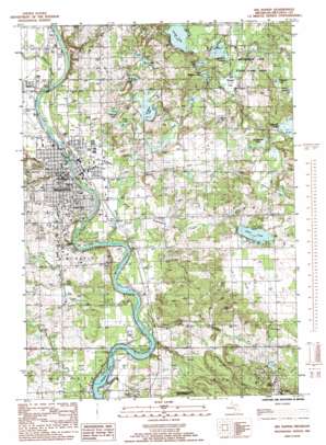
Big Rapids Topo Map Michigan
To zoom in, hover over the map of Big Rapids
USGS Topo Quad 43085f4 - 1:24,000 scale
| Topo Map Name: | Big Rapids |
| USGS Topo Quad ID: | 43085f4 |
| Print Size: | ca. 21 1/4" wide x 27" high |
| Southeast Coordinates: | 43.625° N latitude / 85.375° W longitude |
| Map Center Coordinates: | 43.6875° N latitude / 85.4375° W longitude |
| U.S. State: | MI |
| Filename: | o43085f4.jpg |
| Download Map JPG Image: | Big Rapids topo map 1:24,000 scale |
| Map Type: | Topographic |
| Topo Series: | 7.5´ |
| Map Scale: | 1:24,000 |
| Source of Map Images: | United States Geological Survey (USGS) |
| Alternate Map Versions: |
Big Rapids MI 1985, updated 1985 Download PDF Buy paper map Big Rapids MI 2011 Download PDF Buy paper map Big Rapids MI 2014 Download PDF Buy paper map Big Rapids MI 2017 Download PDF Buy paper map |
1:24,000 Topo Quads surrounding Big Rapids
> Back to 43085e1 at 1:100,000 scale
> Back to 43084a1 at 1:250,000 scale
> Back to U.S. Topo Maps home
Big Rapids topo map: Gazetteer
Big Rapids: Airports
Mecosta County General Hospital Heliport elevation 277m 908′Big Rapids: Lakes
Alma Lake elevation 302m 990′Ashegun Lake elevation 325m 1066′
Bergess Lake elevation 289m 948′
Clear Lake elevation 324m 1062′
Gooseneck Pond elevation 301m 987′
Hunt Lake elevation 290m 951′
Little Bergess Lake elevation 298m 977′
Nehmer Lake elevation 296m 971′
Rose Lake elevation 290m 951′
Round Lake elevation 305m 1000′
Townline Lake elevation 281m 921′
Youngs Lake elevation 303m 994′
Big Rapids: Parks
Centennial Park elevation 276m 905′Fairman Community Pool elevation 276m 905′
Ferris Institute Historical Marker (historical) elevation 291m 954′
Ferris State College Historical Marker elevation 291m 954′
First United Methodist Church Historical Marker elevation 285m 935′
Fred Meijer White Pine Trail State Park elevation 279m 915′
Hanchett Park elevation 273m 895′
Hemlock Park elevation 272m 892′
Holland Park elevation 278m 912′
Industrial Park Ballfield elevation 282m 925′
Library Park elevation 291m 954′
Linden Street Park elevation 281m 921′
Mineral Well Historical Marker elevation 306m 1003′
Mitchell Creek Park elevation 276m 905′
Northend Riverside Park elevation 281m 921′
Old Mecosta County Jail Historical Marker elevation -1m -4′
Old Mecosta County Jail Historical Marker elevation 285m 935′
Osceola Pavillion elevation 276m 905′
Pocket Park elevation 281m 921′
River Street Park elevation 274m 898′
Saint Andrew's Episcopal Church Historical Marker elevation 278m 912′
Supervisors Park elevation 273m 895′
Swede Hill Park elevation 274m 898′
Top Taggart Field elevation 300m 984′
Vogel Field elevation 280m 918′
West Intramural Fields elevation 301m 987′
Big Rapids: Populated Places
Big Rapids elevation 284m 931′Big Rapids Mobile Home Court elevation 283m 928′
Circle Drive Mobile Home Park elevation 274m 898′
College Park Mobile Village elevation 282m 925′
Forest Hills Mobile Home Park elevation 309m 1013′
Big Rapids: Post Offices
Big Rapids Post Office elevation 283m 928′Byers Post Office (historical) elevation 275m 902′
Marshfield Post Office (historical) elevation 337m 1105′
Big Rapids: Streams
Byers Creek elevation 261m 856′Dalziel Creek elevation 276m 905′
Higginson Creek elevation 279m 915′
Mitchell Creek elevation 268m 879′
Ryan Creek elevation 265m 869′
Winters Creek elevation 262m 859′
Big Rapids digital topo map on disk
Buy this Big Rapids topo map showing relief, roads, GPS coordinates and other geographical features, as a high-resolution digital map file on DVD:


