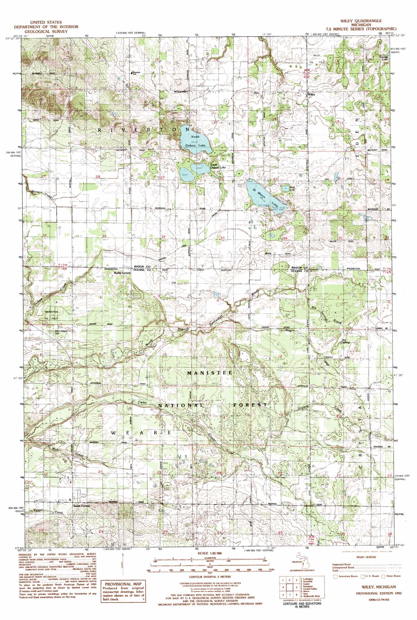
Wiley Topo Map Michigan
To zoom in, hover over the map of Wiley
USGS Topo Quad 43086g3 - 1:25,000 scale
| Topo Map Name: | Wiley |
| USGS Topo Quad ID: | 43086g3 |
| Print Size: | ca. 21 1/4" wide x 27" high |
| Southeast Coordinates: | 43.75° N latitude / 86.25° W longitude |
| Map Center Coordinates: | 43.8125° N latitude / 86.3125° W longitude |
| U.S. State: | MI |
| Filename: | l43086g3.jpg |
| Download Map JPG Image: | Wiley topo map 1:25,000 scale |
| Map Type: | Topographic |
| Topo Series: | 7.5´ |
| Map Scale: | 1:25,000 |
| Source of Map Images: | United States Geological Survey (USGS) |
| Alternate Map Versions: | |
| FStopo: | US Forest Service topo Wiley is available: Download FStopo PDF Download FStopo TIF |
1:24,000 Topo Quads surrounding Wiley
Hamlin Lake |
Kings Corners |
Freesoil Sw |
Freesoil Se |
|
Ludington Nw |
Ludington Ne |
Custer Nw |
Custer Ne |
|
Pentwater |
Wiley |
Custer Sw |
Custer Se |
|
Little Point Sable |
Mears |
Hart Ne |
Walkerville West |
Walkerville East |
Bigsbie Lake |
Town Corners |
Shelby |
Ferry |
Hesperia |
> Back to 43086e1 at 1:100,000 scale
> Back to 43086a1 at 1:250,000 scale
> Back to U.S. Topo Maps home
Wiley topo map: Gazetteer
Wiley: Canals
Oxbow Lake Drain elevation 203m 666′Wiley: Lakes
Mud Lake elevation 211m 692′North Oxbow Lake elevation 204m 669′
Saint Marys Lake elevation 204m 669′
South Oxbow Lake elevation 203m 666′
Wiley: Oilfields
Wiley Oil Field elevation 207m 679′Wiley: Populated Places
Wiley elevation 209m 685′Wiley: Post Offices
Smiths Corners Post Office (historical) elevation 203m 666′Spring Creek Post Office (historical) elevation 188m 616′
Squireville Post Office (historical) elevation 204m 669′
Wiley Post Office (historical) elevation -1m -4′
Wiley: Springs
Big Springs elevation 203m 666′Wiley: Streams
Allen Drain elevation 192m 629′Big Springs Creek elevation 195m 639′
Crystal Creek elevation 195m 639′
Wiley digital topo map on disk
Buy this Wiley topo map showing relief, roads, GPS coordinates and other geographical features, as a high-resolution digital map file on DVD: