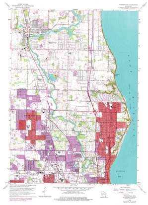
Thiensville Topo Map Wisconsin
To zoom in, hover over the map of Thiensville
USGS Topo Quad 43087b8 - 1:24,000 scale
| Topo Map Name: | Thiensville |
| USGS Topo Quad ID: | 43087b8 |
| Print Size: | ca. 21 1/4" wide x 27" high |
| Southeast Coordinates: | 43.125° N latitude / 87.875° W longitude |
| Map Center Coordinates: | 43.1875° N latitude / 87.9375° W longitude |
| U.S. State: | WI |
| Filename: | o43087b8.jpg |
| Download Map JPG Image: | Thiensville topo map 1:24,000 scale |
| Map Type: | Topographic |
| Topo Series: | 7.5´ |
| Map Scale: | 1:24,000 |
| Source of Map Images: | United States Geological Survey (USGS) |
| Alternate Map Versions: |
Thiensville WI 1958, updated 1960 Download PDF Buy paper map Thiensville WI 1958, updated 1973 Download PDF Buy paper map Thiensville WI 1958, updated 1977 Download PDF Buy paper map Thiensville WI 1958, updated 1977 Download PDF Buy paper map Thiensville WI 2010 Download PDF Buy paper map Thiensville WI 2013 Download PDF Buy paper map Thiensville WI 2016 Download PDF Buy paper map |
1:24,000 Topo Quads surrounding Thiensville
> Back to 43087a1 at 1:100,000 scale
> Back to 43086a1 at 1:250,000 scale
> Back to U.S. Topo Maps home
Thiensville topo map: Gazetteer
Thiensville: Airports
WITI-TV Studio Building Heliport elevation 200m 656′Thiensville: Bays
Donges Bay elevation 177m 580′Whitefish Bay elevation 177m 580′
Thiensville: Capes
Fox Point elevation 198m 649′Thiensville: Crossings
Interchange 80 elevation 216m 708′Interchange 82 elevation 210m 688′
Interchange 83 elevation 204m 669′
Interchange 85 elevation 204m 669′
Thiensville: Dams
Northridge Lakes G 3180 Dam elevation 222m 728′Thiensville 2WP535 Dam elevation 200m 656′
Thiensville: Lakes
Brantwood Lake elevation 198m 649′Lac Du Cours elevation 197m 646′
Thiensville: Parks
A C Hanson Park elevation 207m 679′Algonquin Park elevation 213m 698′
Berryland Playground elevation 211m 692′
Brown Deer Park elevation 208m 682′
Clovernook Playground elevation 223m 731′
Doctors Park elevation 199m 652′
Ellsworth Park elevation 204m 669′
Fairy Chasm State Natural Area elevation 190m 623′
Fairy Chasm Youth Sports Facility elevation 202m 662′
Grasslyn Nature Preserve elevation 216m 708′
Katherine Kearney Carpenter Park elevation 207m 679′
Kletzsch Park elevation 193m 633′
Lilly Lane Nature Preserve elevation 200m 656′
Mequon Community Park elevation 203m 666′
River Barn Park elevation 199m 652′
River Forest Nature Preserve elevation 201m 659′
Riverview Park elevation 201m 659′
Schlitz Audubon Center elevation 207m 679′
Scout Park elevation 200m 656′
Settlers Park elevation 198m 649′
Shoreland Nature Preserve elevation 201m 659′
Stormouth City Park elevation 212m 695′
Thiensville Village Park elevation 202m 662′
Uihlein Soccer Park elevation 226m 741′
Village Grove Park elevation 200m 656′
Village Park elevation 198m 649′
Virmond Park elevation 217m 711′
Whitefish Bay Park elevation 204m 669′
Willow Bay Nature Preserve elevation 201m 659′
Wyrick Park elevation 214m 702′
Thiensville: Populated Places
Bayside elevation 205m 672′Brown Deer elevation 211m 692′
Fox Point elevation 210m 688′
Glendale elevation 198m 649′
Mequon elevation 204m 669′
River Hills elevation 216m 708′
Thiensville elevation 206m 675′
Thiensville: Post Offices
North Milwaukee Station Milwaukee Post Office elevation 203m 666′Sequoia Station Milwaukee Post Office elevation 206m 675′
Thiensville: Reservoirs
Northridge Lake elevation 206m 675′Northridge Lakes 1 and 2 elevation 222m 728′
Thiensville Millpond 594 elevation 200m 656′
Thiensville: Streams
Indian Creek elevation 195m 639′Pigeon Creek elevation 198m 649′
Thiensville: Woods
Highland Woods elevation 215m 705′Thiensville digital topo map on disk
Buy this Thiensville topo map showing relief, roads, GPS coordinates and other geographical features, as a high-resolution digital map file on DVD:


