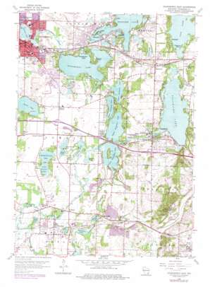
Oconomowoc East Topo Map Wisconsin
To zoom in, hover over the map of Oconomowoc East
USGS Topo Quad 43088a4 - 1:24,000 scale
| Topo Map Name: | Oconomowoc East |
| USGS Topo Quad ID: | 43088a4 |
| Print Size: | ca. 21 1/4" wide x 27" high |
| Southeast Coordinates: | 43° N latitude / 88.375° W longitude |
| Map Center Coordinates: | 43.0625° N latitude / 88.4375° W longitude |
| U.S. State: | WI |
| Filename: | o43088a4.jpg |
| Download Map JPG Image: | Oconomowoc East topo map 1:24,000 scale |
| Map Type: | Topographic |
| Topo Series: | 7.5´ |
| Map Scale: | 1:24,000 |
| Source of Map Images: | United States Geological Survey (USGS) |
| Alternate Map Versions: |
Oconomowoc East WI 1959, updated 1961 Download PDF Buy paper map Oconomowoc East WI 1959, updated 1969 Download PDF Buy paper map Oconomowoc East WI 1959, updated 1973 Download PDF Buy paper map Oconomowoc East WI 1959, updated 1977 Download PDF Buy paper map Oconomowoc East WI 1959, updated 1977 Download PDF Buy paper map Oconomowoc East WI 2010 Download PDF Buy paper map Oconomowoc East WI 2013 Download PDF Buy paper map Oconomowoc East WI 2015 Download PDF Buy paper map |
1:24,000 Topo Quads surrounding Oconomowoc East
> Back to 43088a1 at 1:100,000 scale
> Back to 43088a1 at 1:250,000 scale
> Back to U.S. Topo Maps home
Oconomowoc East topo map: Gazetteer
Oconomowoc East: Airports
Bark River Airport elevation 266m 872′Pabst Field elevation 270m 885′
Oconomowoc East: Capes
Hewitt Point elevation 265m 869′Oconomowoc East: Crossings
Interchange 176 elevation 271m 889′Interchange 178 elevation 274m 898′
Interchange 179 elevation 282m 925′
Interchange 182 elevation 272m 892′
Interchange 282 elevation 269m 882′
Interchange 283 elevation 272m 892′
Interchange 285 elevation 290m 951′
Oconomowoc East: Dams
Delafield Fish Hatchery Dam elevation 271m 889′Lower Lake Nemahbin WP439 Dam elevation 266m 872′
Oconomowoc Lake 1899C288 Dam elevation 264m 866′
Okauchee Lake 2WP1438 Dam elevation 266m 872′
Peacock Dam elevation 262m 859′
Upper Nashotah Dam elevation 270m 885′
Waterville 2WP1421 Dam elevation 270m 885′
Oconomowoc East: Islands
Treasure Island elevation 281m 921′Oconomowoc East: Lakes
Bowron Lake elevation 264m 866′Crooked Lake elevation 264m 866′
Duck Lake elevation 263m 862′
Dutchman Lake elevation 264m 866′
Egg Lake elevation 265m 869′
Forest Lake elevation 267m 875′
Garvin Lake elevation 267m 875′
Grass Lake elevation 267m 875′
Henrietta Lake elevation 267m 875′
Lac La Belle elevation 260m 853′
Lower Genesee Lake elevation 263m 862′
Lower Nashotah Lake elevation 265m 869′
Lower Nemahbin Lake elevation 264m 866′
Middle Genesee Lake elevation 263m 862′
Pine Lake elevation 274m 898′
Silver Lake elevation 263m 862′
Spring Lake elevation 264m 866′
Upper Genesee Lake elevation 264m 866′
Upper Nashotah Lake elevation 265m 869′
Upper Nemahbin Lake elevation 264m 866′
Utica Lake elevation 259m 849′
Waterville Lake elevation 270m 885′
Oconomowoc East: Parks
Cory Municipal Park elevation 264m 866′Cushing Memorial State Park elevation 270m 885′
Dickten Park elevation 286m 938′
Firemans Memorial Park elevation 304m 997′
Firemen's Park elevation 286m 938′
Fowler Lake Park elevation 262m 859′
Heritage Heights Park elevation 269m 882′
Memorial Park elevation 262m 859′
Nashotah Park elevation 280m 918′
Okauchee Lions Community Park elevation 272m 892′
Riverside Park elevation 264m 866′
Westover Park elevation 264m 866′
Whitman Hills Park elevation 265m 869′
Oconomowoc East: Populated Places
Chenequa elevation 279m 915′Delafield elevation 275m 902′
Dousman elevation 263m 862′
Nashotah elevation 289m 948′
Oconomowoc elevation 263m 862′
Oconomowoc Lake elevation 274m 898′
Okauchee elevation 275m 902′
Okauchee Lake elevation 268m 879′
Summit Center elevation 268m 879′
Summit Corners elevation 268m 879′
Utica elevation 263m 862′
Wales elevation 305m 1000′
Waterville elevation 272m 892′
Oconomowoc East: Post Offices
Delafield Post Office elevation 271m 889′Dousman Post Office elevation 262m 859′
Nashotah Post Office elevation 292m 958′
Oconomowoc Post Office elevation 263m 862′
Oconomowoc East: Reservoirs
Fowler Lake elevation 262m 859′Lake Fowler 88 elevation 262m 859′
Lake Nagawicka 46 elevation 271m 889′
Nagawicka Lake elevation 271m 889′
Oconomowoc Lake elevation 264m 866′
Oconomowoc Lake 87 elevation 264m 866′
Okauchee Lake elevation 266m 872′
Okauchee Lake 85 elevation 269m 882′
Upper Nashotah Lake 3 elevation 270m 885′
Upper Oconomowoc Lake elevation 268m 879′
Waterville Millpond elevation 270m 885′
Oconomowoc East: Streams
Scuppernong Creek elevation 259m 849′Wales Creek elevation 283m 928′
Oconomowoc East: Summits
Lapham Hill elevation 374m 1227′Oconomowoc East: Trails
Ice Age National Scenic Trail elevation 287m 941′Oconomowoc East digital topo map on disk
Buy this Oconomowoc East topo map showing relief, roads, GPS coordinates and other geographical features, as a high-resolution digital map file on DVD:


