Jefferson Topo Map Wisconsin
To zoom in, hover over the map of Jefferson
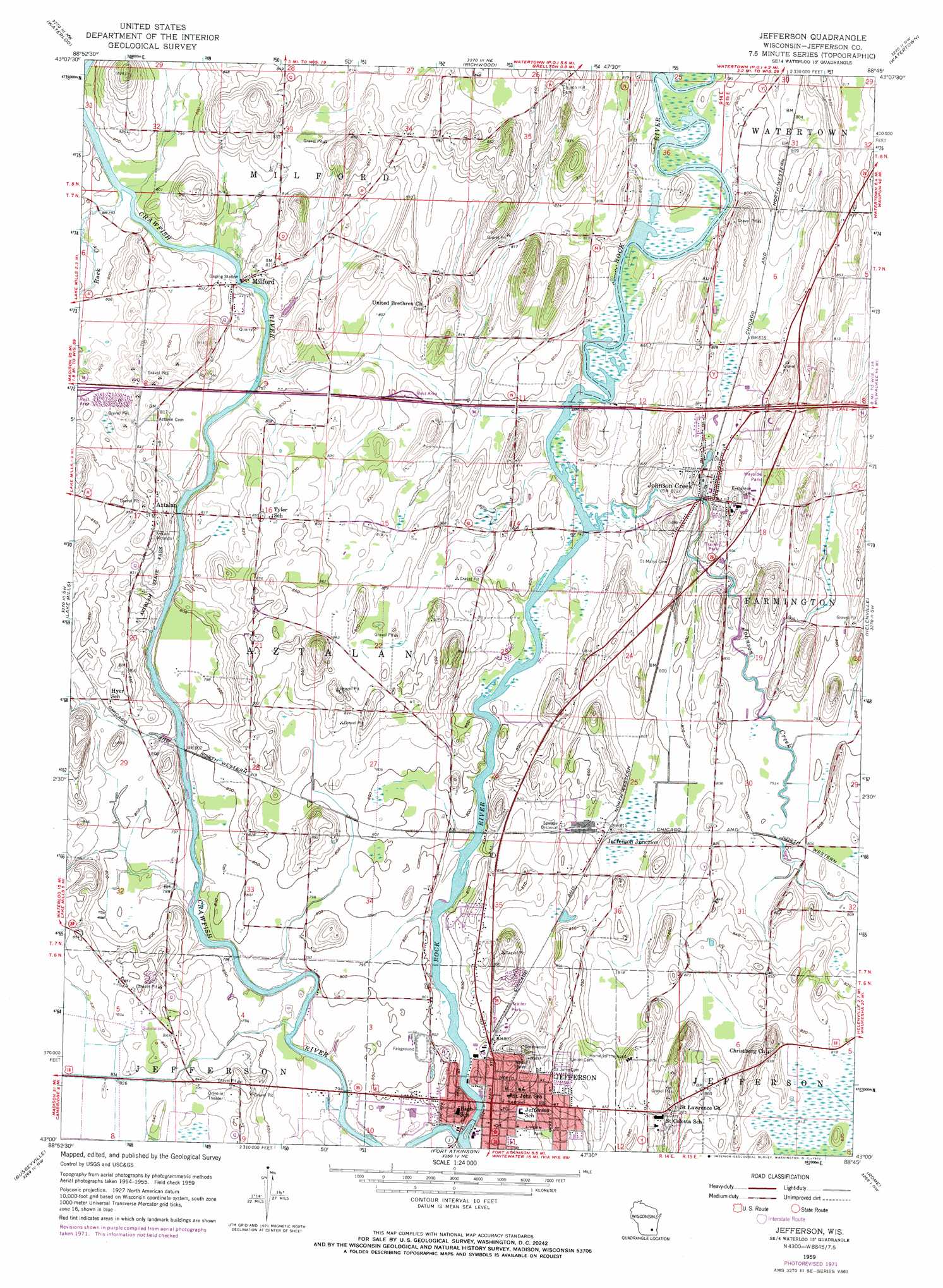
USGS Topo Quad 43088a7 - 1:24,000 scale
| Topo Map Name: | Jefferson |
| USGS Topo Quad ID: | 43088a7 |
| Print Size: | ca. 21 1/4" wide x 27" high |
| Southeast Coordinates: | 43° N latitude / 88.75° W longitude |
| Map Center Coordinates: | 43.0625° N latitude / 88.8125° W longitude |
| U.S. State: | WI |
| Filename: | o43088a7.jpg |
| Download Map JPG Image: | Jefferson topo map 1:24,000 scale |
| Map Type: | Topographic |
| Topo Series: | 7.5´ |
| Map Scale: | 1:24,000 |
| Source of Map Images: | United States Geological Survey (USGS) |
| Alternate Map Versions: |
Jefferson WI 1959, updated 1961 Download PDF Buy paper map Jefferson WI 1959, updated 1972 Download PDF Buy paper map Jefferson WI 2010 Download PDF Buy paper map Jefferson WI 2013 Download PDF Buy paper map Jefferson WI 2015 Download PDF Buy paper map |
1:24,000 Topo Quads surrounding Jefferson
Columbus |
Astigo |
Reeseville |
Clyman |
Hustisford |
Marshall |
Waterloo |
Richwood |
Watertown |
Ixonia |
Deerfield |
Lake Mills |
Jefferson |
Helenville |
Oconomowoc West |
Rockdale |
Busseyville |
Fort Atkinson |
Rome |
Palmyra |
Edgerton |
Milton |
Lima Center |
Whitewater |
Little Prairie |
> Back to 43088a1 at 1:100,000 scale
> Back to 43088a1 at 1:250,000 scale
> Back to U.S. Topo Maps home
Jefferson topo map: Gazetteer
Jefferson: Dams
Jefferson 2WP916 Dam elevation 239m 784′Jefferson: Parks
Aztalan State Park elevation 255m 836′Jefferson County Fairgrounds elevation 245m 803′
Oak Ridge Park elevation 269m 882′
River Front Park elevation 239m 784′
Jefferson: Populated Places
Aztalan elevation 259m 849′Jefferson elevation 244m 800′
Jefferson Junction elevation 248m 813′
Johnson Creek elevation 253m 830′
Milford elevation 244m 800′
Rock River Mobile Home Park elevation 239m 784′
Village Terrace Mobile Home Park elevation 254m 833′
Jefferson: Post Offices
Jefferson Post Office elevation 250m 820′Jefferson: Reservoirs
1074 Reservoir elevation 239m 784′Jefferson: Streams
Crawfish River elevation 238m 780′Johnson Creek elevation 240m 787′
Rock Creek elevation 241m 790′
Jefferson digital topo map on disk
Buy this Jefferson topo map showing relief, roads, GPS coordinates and other geographical features, as a high-resolution digital map file on DVD: