Stonebank Topo Map Wisconsin
To zoom in, hover over the map of Stonebank
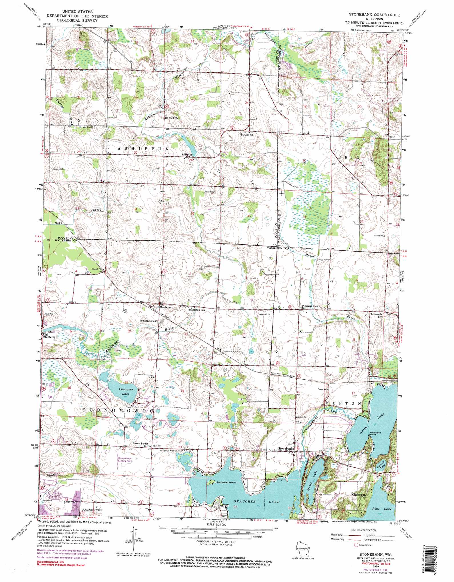
USGS Topo Quad 43088b4 - 1:24,000 scale
| Topo Map Name: | Stonebank |
| USGS Topo Quad ID: | 43088b4 |
| Print Size: | ca. 21 1/4" wide x 27" high |
| Southeast Coordinates: | 43.125° N latitude / 88.375° W longitude |
| Map Center Coordinates: | 43.1875° N latitude / 88.4375° W longitude |
| U.S. State: | WI |
| Filename: | o43088b4.jpg |
| Download Map JPG Image: | Stonebank topo map 1:24,000 scale |
| Map Type: | Topographic |
| Topo Series: | 7.5´ |
| Map Scale: | 1:24,000 |
| Source of Map Images: | United States Geological Survey (USGS) |
| Alternate Map Versions: |
Stonebank WI 1959, updated 1961 Download PDF Buy paper map Stonebank WI 1959, updated 1972 Download PDF Buy paper map Stonebank WI 1959, updated 1973 Download PDF Buy paper map Stonebank WI 1959, updated 1990 Download PDF Buy paper map Stonebank WI 2010 Download PDF Buy paper map Stonebank WI 2013 Download PDF Buy paper map Stonebank WI 2015 Download PDF Buy paper map |
1:24,000 Topo Quads surrounding Stonebank
Horicon |
Mayville South |
Nenno |
Allenton |
West Bend |
Clyman |
Hustisford |
Hartford West |
Hartford East |
Jackson |
Watertown |
Ixonia |
Stonebank |
Merton |
Sussex |
Helenville |
Oconomowoc West |
Oconomowoc East |
Hartland |
Waukesha |
Rome |
Palmyra |
Eagle |
Genesee |
Muskego |
> Back to 43088a1 at 1:100,000 scale
> Back to 43088a1 at 1:250,000 scale
> Back to U.S. Topo Maps home
Stonebank topo map: Gazetteer
Stonebank: Airports
Oconomowoc Airport elevation 270m 885′Stonebank: Capes
Wildwood Point elevation 273m 895′Stonebank: Dams
Alderly Mill 1866c-71 Dam elevation 285m 935′Monterey Dam elevation 268m 879′
Stonebank: Islands
McDowell Island elevation 266m 872′Stonebank: Lakes
Cornell Lake elevation 272m 892′Moose Lake elevation 266m 872′
North Lake elevation 273m 895′
North Lake elevation 272m 892′
Tamarack Lake elevation 267m 875′
Stonebank: Populated Places
Alderley elevation 290m 951′Mapleton elevation 272m 892′
Monterey elevation 268m 879′
Stonebank elevation 275m 902′
Stonebank: Reservoirs
Alderly Millpond 24 elevation 285m 935′Ashippun Lake elevation 268m 879′
Monterey Millpond 34 elevation 268m 879′
Stonebank: Streams
Mason Creek elevation 274m 898′Stonebank digital topo map on disk
Buy this Stonebank topo map showing relief, roads, GPS coordinates and other geographical features, as a high-resolution digital map file on DVD: