Markesan Topo Map Wisconsin
To zoom in, hover over the map of Markesan
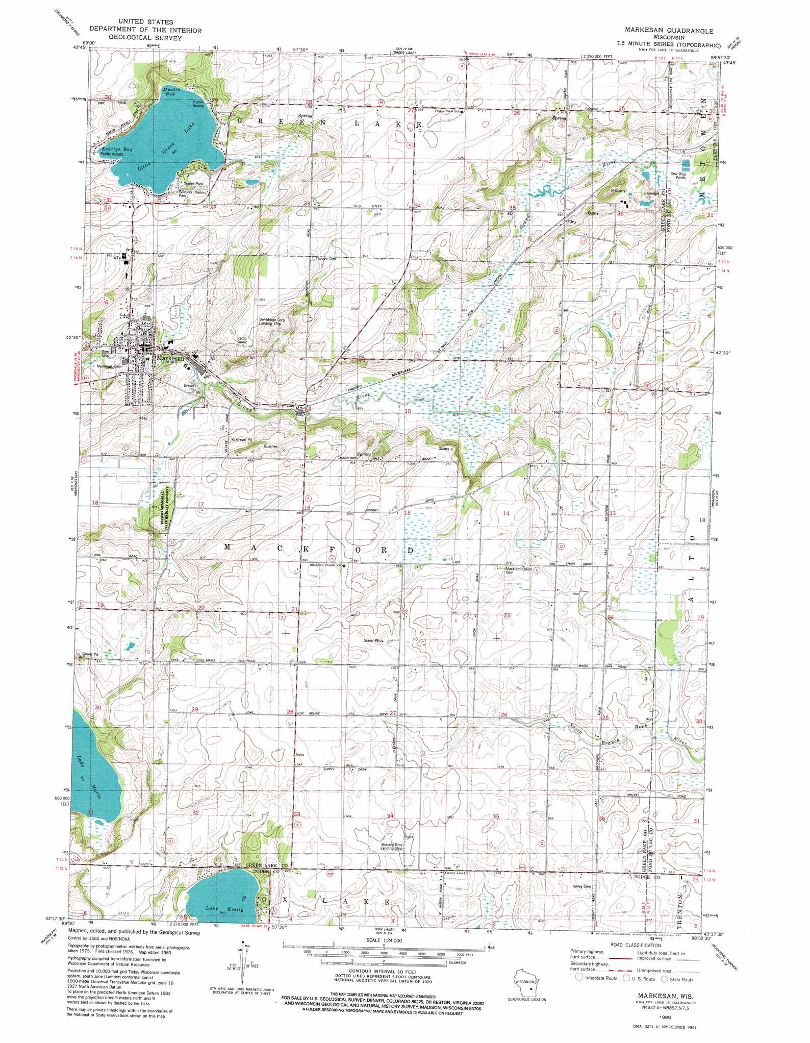
USGS Topo Quad 43088f8 - 1:24,000 scale
| Topo Map Name: | Markesan |
| USGS Topo Quad ID: | 43088f8 |
| Print Size: | ca. 21 1/4" wide x 27" high |
| Southeast Coordinates: | 43.625° N latitude / 88.875° W longitude |
| Map Center Coordinates: | 43.6875° N latitude / 88.9375° W longitude |
| U.S. State: | WI |
| Filename: | o43088f8.jpg |
| Download Map JPG Image: | Markesan topo map 1:24,000 scale |
| Map Type: | Topographic |
| Topo Series: | 7.5´ |
| Map Scale: | 1:24,000 |
| Source of Map Images: | United States Geological Survey (USGS) |
| Alternate Map Versions: |
Markesan WI 1980, updated 1981 Download PDF Buy paper map Markesan WI 2010 Download PDF Buy paper map Markesan WI 2013 Download PDF Buy paper map Markesan WI 2015 Download PDF Buy paper map |
1:24,000 Topo Quads surrounding Markesan
Neshkoro |
Fairburn |
Berlin |
Rush Lake |
Pickett |
Princeton West |
Princeton East |
Green Lake |
Ripon |
Rosendale |
Marquette |
Manchester |
Markesan |
Brandon |
Waupun North |
Sand Spring Creek |
Randolph |
Fox Lake |
Buckhorn Corner |
Waupun South |
Rio |
Fall River |
Lost Lake |
Beaver Dam |
Horicon |
> Back to 43088e1 at 1:100,000 scale
> Back to 43088a1 at 1:250,000 scale
> Back to U.S. Topo Maps home
Markesan topo map: Gazetteer
Markesan: Airports
Bosveld Brothers Landing Strip elevation 305m 1000′Del Monte Corporation Landing Strip elevation 307m 1007′
Nowatzski Field elevation 286m 938′
Markesan: Bays
Keartys Bay elevation 281m 921′Muskie Bay elevation 281m 921′
Markesan: Lakes
Lake Emily elevation 287m 941′Little Green Lake elevation 281m 921′
Markesan: Parks
Rogers Memorial State Habitat Preserve elevation 274m 898′Soldiers-Sailors Park elevation 288m 944′
Markesan: Populated Places
Markesan elevation 260m 853′Utley elevation 271m 889′
Markesan digital topo map on disk
Buy this Markesan topo map showing relief, roads, GPS coordinates and other geographical features, as a high-resolution digital map file on DVD: