Marytown Topo Map Wisconsin
To zoom in, hover over the map of Marytown
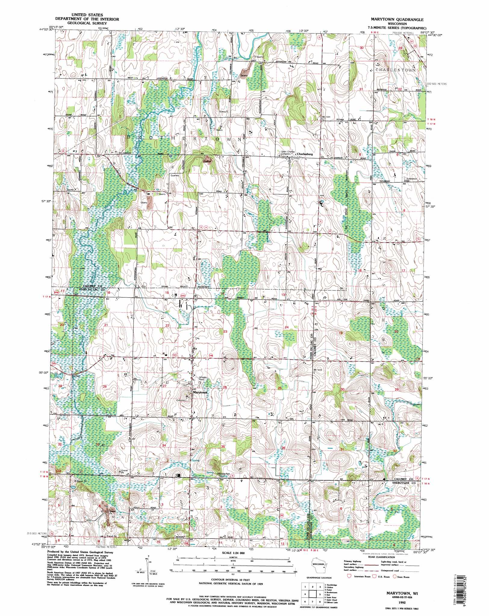
USGS Topo Quad 43088h2 - 1:24,000 scale
| Topo Map Name: | Marytown |
| USGS Topo Quad ID: | 43088h2 |
| Print Size: | ca. 21 1/4" wide x 27" high |
| Southeast Coordinates: | 43.875° N latitude / 88.125° W longitude |
| Map Center Coordinates: | 43.9375° N latitude / 88.1875° W longitude |
| U.S. State: | WI |
| Filename: | o43088h2.jpg |
| Download Map JPG Image: | Marytown topo map 1:24,000 scale |
| Map Type: | Topographic |
| Topo Series: | 7.5´ |
| Map Scale: | 1:24,000 |
| Source of Map Images: | United States Geological Survey (USGS) |
| Alternate Map Versions: |
Marytown WI 1974, updated 1977 Download PDF Buy paper map Marytown WI 1992, updated 1996 Download PDF Buy paper map Marytown WI 2010 Download PDF Buy paper map Marytown WI 2013 Download PDF Buy paper map Marytown WI 2015 Download PDF Buy paper map |
1:24,000 Topo Quads surrounding Marytown
Neenah |
Sherwood |
Hilbert |
Brillion |
Reedsville |
Indian Point |
Stockbridge |
Chilton |
Potter |
Valders |
Fahrney Point |
Brothertown |
Marytown |
Kiel |
School Hill |
Fond Du Lac |
Saint Peter |
Saint Cloud |
Elkhart Lake |
Franklin |
Byron |
Eden |
Dundee |
Cascade |
Plymouth South |
> Back to 43088e1 at 1:100,000 scale
> Back to 43088a1 at 1:250,000 scale
> Back to U.S. Topo Maps home
Marytown topo map: Gazetteer
Marytown: Populated Places
Charlesburg elevation 301m 987′Marytown elevation 294m 964′
Marytown digital topo map on disk
Buy this Marytown topo map showing relief, roads, GPS coordinates and other geographical features, as a high-resolution digital map file on DVD: