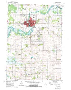
Berlin Topo Map Wisconsin
To zoom in, hover over the map of Berlin
USGS Topo Quad 43088h8 - 1:24,000 scale
| Topo Map Name: | Berlin |
| USGS Topo Quad ID: | 43088h8 |
| Print Size: | ca. 21 1/4" wide x 27" high |
| Southeast Coordinates: | 43.875° N latitude / 88.875° W longitude |
| Map Center Coordinates: | 43.9375° N latitude / 88.9375° W longitude |
| U.S. State: | WI |
| Filename: | o43088h8.jpg |
| Download Map JPG Image: | Berlin topo map 1:24,000 scale |
| Map Type: | Topographic |
| Topo Series: | 7.5´ |
| Map Scale: | 1:24,000 |
| Source of Map Images: | United States Geological Survey (USGS) |
| Alternate Map Versions: |
Berlin WI 1980, updated 1981 Download PDF Buy paper map Berlin WI 2010 Download PDF Buy paper map Berlin WI 2013 Download PDF Buy paper map Berlin WI 2015 Download PDF Buy paper map |
1:24,000 Topo Quads surrounding Berlin
> Back to 43088e1 at 1:100,000 scale
> Back to 43088a1 at 1:250,000 scale
> Back to U.S. Topo Maps home
Berlin topo map: Gazetteer
Berlin: Airports
Berlin Field elevation 235m 770′Broken Prop Airport elevation 231m 757′
Myers Field elevation 274m 898′
Berlin: Dams
Berlin Lock Number One elevation 231m 757′Berlin: Parks
Berlin Fen State Natural Area elevation 234m 767′East Side Park elevation 250m 820′
Market Square elevation 236m 774′
River Side Park elevation 234m 767′
Berlin: Populated Places
Berlin elevation 246m 807′Berlin: Post Offices
Berlin Post Office elevation 238m 780′Berlin: Streams
Barnes Creek elevation 231m 757′Town Drain elevation 231m 757′
Berlin digital topo map on disk
Buy this Berlin topo map showing relief, roads, GPS coordinates and other geographical features, as a high-resolution digital map file on DVD:


