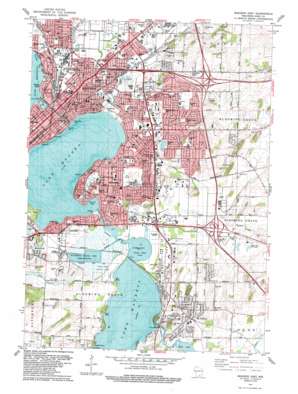
Madison East Topo Map Wisconsin
To zoom in, hover over the map of Madison East
USGS Topo Quad 43089a3 - 1:24,000 scale
| Topo Map Name: | Madison East |
| USGS Topo Quad ID: | 43089a3 |
| Print Size: | ca. 21 1/4" wide x 27" high |
| Southeast Coordinates: | 43° N latitude / 89.25° W longitude |
| Map Center Coordinates: | 43.0625° N latitude / 89.3125° W longitude |
| U.S. State: | WI |
| Filename: | o43089a3.jpg |
| Download Map JPG Image: | Madison East topo map 1:24,000 scale |
| Map Type: | Topographic |
| Topo Series: | 7.5´ |
| Map Scale: | 1:24,000 |
| Source of Map Images: | United States Geological Survey (USGS) |
| Alternate Map Versions: |
Madison East WI 1959, updated 1970 Download PDF Buy paper map Madison East WI 1959, updated 1975 Download PDF Buy paper map Madison East WI 1983, updated 1984 Download PDF Buy paper map Madison East WI 2010 Download PDF Buy paper map Madison East WI 2013 Download PDF Buy paper map Madison East WI 2016 Download PDF Buy paper map |
1:24,000 Topo Quads surrounding Madison East
> Back to 43089a1 at 1:100,000 scale
> Back to 43088a1 at 1:250,000 scale
> Back to U.S. Topo Maps home
Madison East topo map: Gazetteer
Madison East: Bays
Brams Bay elevation 257m 843′Dengel Bay elevation 257m 843′
East Bay elevation 257m 843′
McConnel Bay elevation 257m 843′
Squaw Bay elevation 257m 843′
Turvilles Bay elevation 257m 843′
Madison East: Capes
Brams Point elevation 257m 843′Turvilles Point elevation 259m 849′
Winnequaw Point elevation 258m 846′
Madison East: Crossings
Black Bridge Crossing elevation 258m 846′Monona Crossing elevation 258m 846′
Madison East: Dams
Lake Waubesa 2WP290 Dam elevation 258m 846′Mendota Locks 2WP1286 Dam elevation 258m 846′
Madison East: Islands
Hog Island elevation 258m 846′Madison East: Lakes
Lake Monona elevation 257m 843′Lake Waubesa elevation 257m 843′
Upper Mud Lake elevation 257m 843′
Madison East: Parks
Acewood Park elevation 277m 908′Babcock Park elevation 260m 853′
Breese Stevens Field elevation 261m 856′
Brentwood Park elevation 272m 892′
Bridge Road Park elevation 271m 889′
Brigham Park elevation 262m 859′
Burrows Park elevation 259m 849′
Clarke Park elevation 257m 843′
Demetral Field elevation 260m 853′
Eastmorland Park elevation 259m 849′
Eken Park elevation 262m 859′
Elmside Circle Park elevation 270m 885′
Elvehjem Park elevation 291m 954′
Esther Beach Park elevation 263m 862′
Frost Woods Park elevation 265m 869′
Goodland Park elevation 259m 849′
Hartmeyer Park elevation 259m 849′
Heritage Heights Park elevation 280m 918′
Hiestand Park elevation 289m 948′
Indian Mound Park elevation 283m 928′
Kennedy Park elevation 295m 967′
Kingston Onyx Park elevation 280m 918′
Lake Edge Park elevation 264m 866′
Lake Farm County Park elevation 259m 849′
Lansing Park elevation 259m 849′
Lewis Park elevation 261m 856′
Marsh Woods Park elevation 259m 849′
Mayfair Park elevation 269m 882′
Maywood Park elevation 258m 846′
McGinnis Park elevation 279m 915′
Morrison Park elevation 259m 849′
Oak Street Park elevation 262m 859′
Olbrich Park elevation 259m 849′
Oneida Park elevation 259m 849′
Orton Park elevation 267m 875′
Paunack Park elevation 258m 846′
Portland Park elevation 269m 882′
Sycamore Park elevation 290m 951′
Tenney Park elevation 259m 849′
Washington Manor Park elevation 260m 853′
Waunona Park elevation 265m 869′
Winnequah Park elevation 261m 856′
Worthington Park elevation 261m 856′
Yahara Place Park elevation 259m 849′
Madison East: Populated Places
Elmside elevation 271m 889′Ethelwyn Park elevation 261m 856′
Highland Manor elevation 276m 905′
Lake Waubesa elevation 262m 859′
McFarland elevation 265m 869′
Monona elevation 268m 879′
Tonyawatha elevation 265m 869′
Madison East: Reservoirs
Lake Mendota 254 elevation 258m 846′Lake Waubesa elevation 258m 846′
Madison East: Streams
Nine Springs Creek elevation 258m 846′Starkweather Creek elevation 257m 843′
Madison East: Woods
Truvilles Woods elevation 267m 875′Madison East digital topo map on disk
Buy this Madison East topo map showing relief, roads, GPS coordinates and other geographical features, as a high-resolution digital map file on DVD:


