Fairburn Topo Map Wisconsin
To zoom in, hover over the map of Fairburn
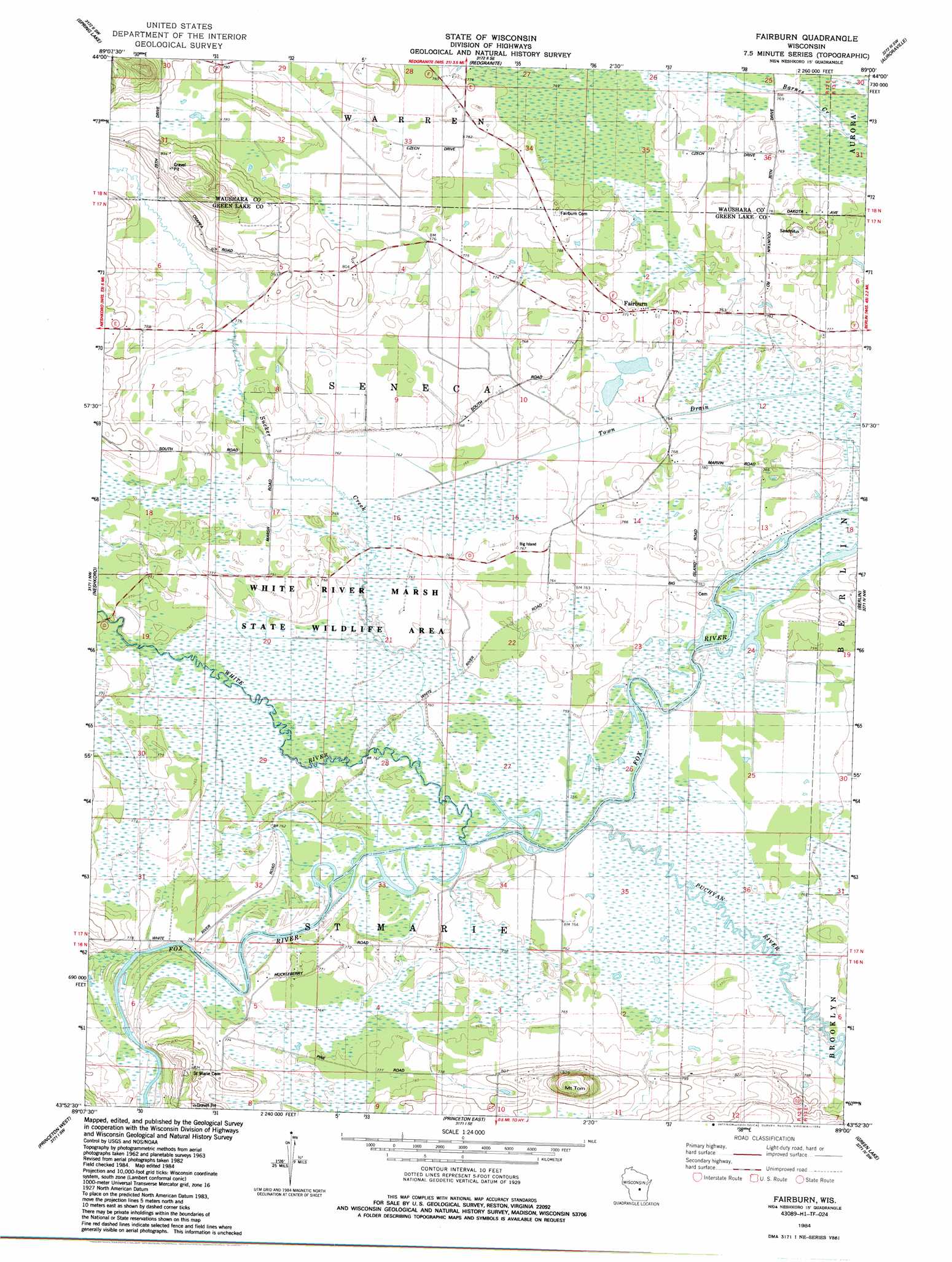
USGS Topo Quad 43089h1 - 1:24,000 scale
| Topo Map Name: | Fairburn |
| USGS Topo Quad ID: | 43089h1 |
| Print Size: | ca. 21 1/4" wide x 27" high |
| Southeast Coordinates: | 43.875° N latitude / 89° W longitude |
| Map Center Coordinates: | 43.9375° N latitude / 89.0625° W longitude |
| U.S. State: | WI |
| Filename: | o43089h1.jpg |
| Download Map JPG Image: | Fairburn topo map 1:24,000 scale |
| Map Type: | Topographic |
| Topo Series: | 7.5´ |
| Map Scale: | 1:24,000 |
| Source of Map Images: | United States Geological Survey (USGS) |
| Alternate Map Versions: |
Fairburn WI 1984, updated 1984 Download PDF Buy paper map Fairburn WI 2010 Download PDF Buy paper map Fairburn WI 2013 Download PDF Buy paper map Fairburn WI 2016 Download PDF Buy paper map |
1:24,000 Topo Quads surrounding Fairburn
Wautoma Ne |
Wild Rose |
Saxeville |
Poy Sippi |
Lake Poygan |
Wautoma |
Spring Lake |
Redgranite |
Auroraville |
Eureka |
Germania |
Neshkoro |
Fairburn |
Berlin |
Rush Lake |
Montello |
Princeton West |
Princeton East |
Green Lake |
Ripon |
Observatory Hill |
Marquette |
Manchester |
Markesan |
Brandon |
> Back to 43089e1 at 1:100,000 scale
> Back to 43088a1 at 1:250,000 scale
> Back to U.S. Topo Maps home
Fairburn topo map: Gazetteer
Fairburn: Dams
White River Lock (historical) elevation 232m 761′Fairburn: Parks
Princeton Prairie State Natural Area elevation 231m 757′Puchyan Prairie State Natural Area elevation 234m 767′
White River Marsh State Wildlife Area elevation 235m 770′
White River Sedge Meadow State Natural Area elevation 232m 761′
Fairburn: Populated Places
Fairburn elevation 238m 780′Fairburn: Streams
Black Creek elevation 232m 761′Puchyan River elevation 231m 757′
Sucker Creek elevation 231m 757′
White River elevation 231m 757′
Fairburn: Summits
Mount Tom elevation 281m 921′Fairburn digital topo map on disk
Buy this Fairburn topo map showing relief, roads, GPS coordinates and other geographical features, as a high-resolution digital map file on DVD: