Wauzeka East Topo Map Wisconsin
To zoom in, hover over the map of Wauzeka East
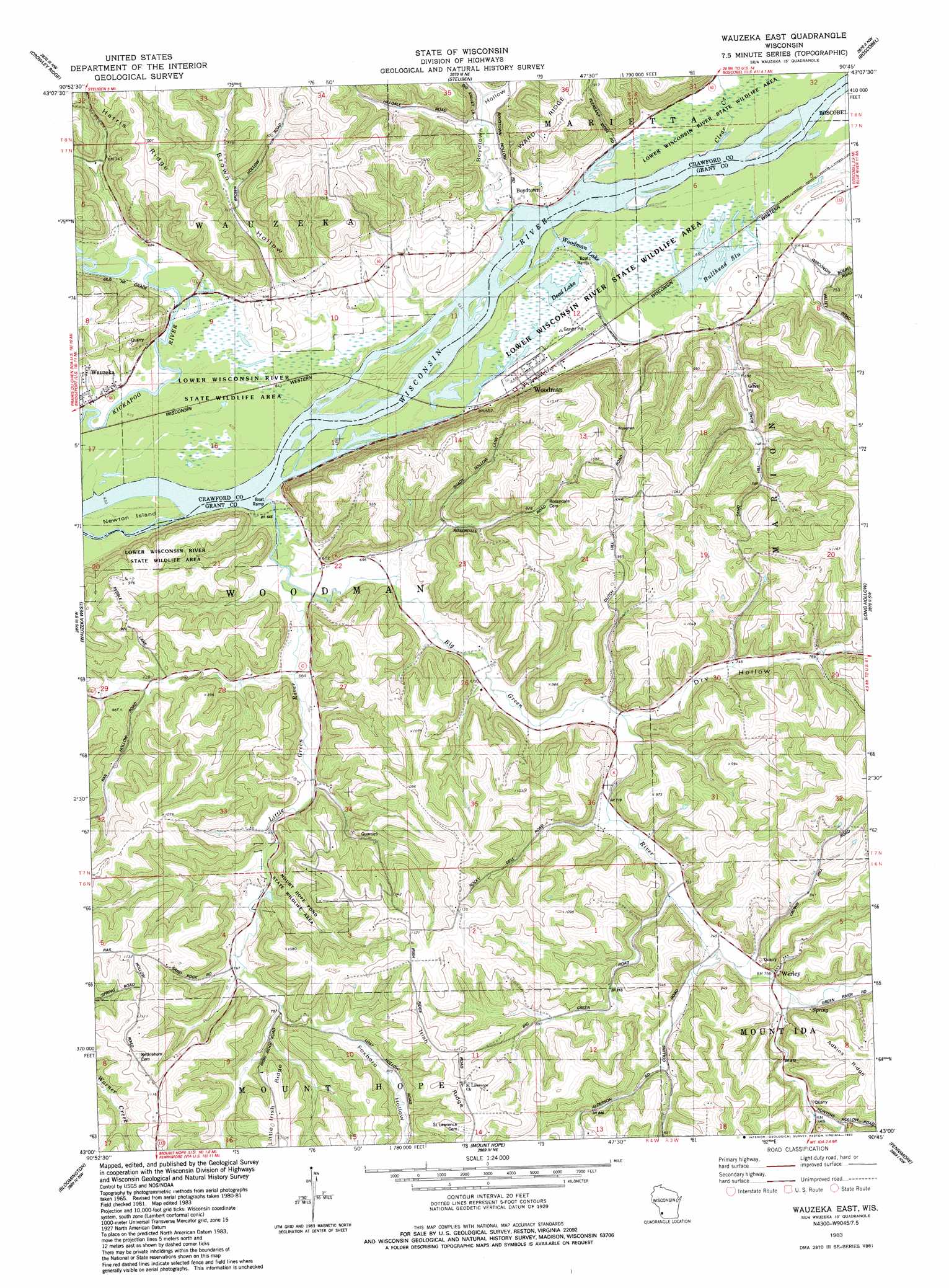
USGS Topo Quad 43090a7 - 1:24,000 scale
| Topo Map Name: | Wauzeka East |
| USGS Topo Quad ID: | 43090a7 |
| Print Size: | ca. 21 1/4" wide x 27" high |
| Southeast Coordinates: | 43° N latitude / 90.75° W longitude |
| Map Center Coordinates: | 43.0625° N latitude / 90.8125° W longitude |
| U.S. State: | WI |
| Filename: | o43090a7.jpg |
| Download Map JPG Image: | Wauzeka East topo map 1:24,000 scale |
| Map Type: | Topographic |
| Topo Series: | 7.5´ |
| Map Scale: | 1:24,000 |
| Source of Map Images: | United States Geological Survey (USGS) |
| Alternate Map Versions: |
Wauzeka East WI 1983, updated 1983 Download PDF Buy paper map Wauzeka East WI 2010 Download PDF Buy paper map Wauzeka East WI 2013 Download PDF Buy paper map Wauzeka East WI 2016 Download PDF Buy paper map |
1:24,000 Topo Quads surrounding Wauzeka East
Ferryville |
Mount Sterling |
Gays Mills |
Mount Zion |
Boaz |
Eastman |
Crowley Ridge |
Steuben |
Boscobel |
Blue River |
Bridgeport |
Wauzeka West |
Wauzeka East |
Long Hollow |
Castle Rock |
Bagley |
Bloomington |
Mount Hope |
Fennimore |
Stitzer |
Guttenberg |
Beetown |
Hurricane |
Lancaster |
Ellenboro |
> Back to 43090a1 at 1:100,000 scale
> Back to 43090a1 at 1:250,000 scale
> Back to U.S. Topo Maps home
Wauzeka East topo map: Gazetteer
Wauzeka East: Guts
Bullhead Slu elevation 196m 643′Wauzeka East: Islands
Newton Island elevation 193m 633′Wauzeka East: Lakes
Dead Lake elevation 193m 633′Woodman Lake elevation 193m 633′
Wauzeka East: Parks
Mount Hope Pond State Wildlife Area elevation 249m 816′Wauzeka Bottoms State Natural Area elevation 194m 636′
Woodman Lake Sand Prairie and Dead Lake State Natural Area elevation 195m 639′
Wauzeka East: Populated Places
Boydtown elevation 198m 649′Werley elevation 235m 770′
Woodman elevation 200m 656′
Wauzeka East: Streams
Big Green River elevation 192m 629′Clear Creek elevation 193m 633′
Little Green River elevation 195m 639′
Wauzeka East: Valleys
Boydtown Hollow elevation 197m 646′Brown Hollow elevation 195m 639′
Dry Hollow elevation 210m 688′
Foxboro Hollow elevation 237m 777′
Wauzeka East digital topo map on disk
Buy this Wauzeka East topo map showing relief, roads, GPS coordinates and other geographical features, as a high-resolution digital map file on DVD: