Wauzeka West Topo Map Wisconsin
To zoom in, hover over the map of Wauzeka West
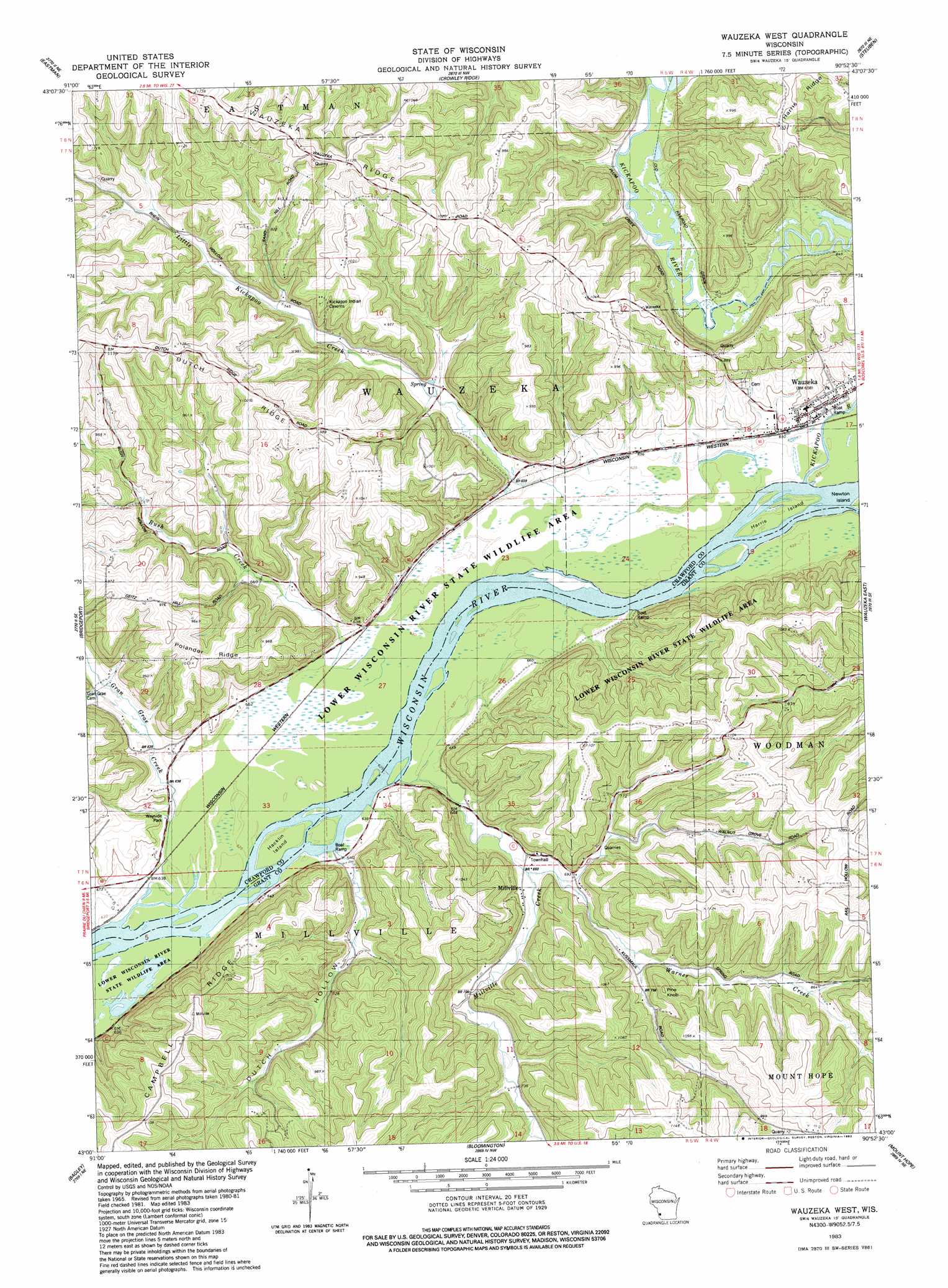
USGS Topo Quad 43090a8 - 1:24,000 scale
| Topo Map Name: | Wauzeka West |
| USGS Topo Quad ID: | 43090a8 |
| Print Size: | ca. 21 1/4" wide x 27" high |
| Southeast Coordinates: | 43° N latitude / 90.875° W longitude |
| Map Center Coordinates: | 43.0625° N latitude / 90.9375° W longitude |
| U.S. State: | WI |
| Filename: | o43090a8.jpg |
| Download Map JPG Image: | Wauzeka West topo map 1:24,000 scale |
| Map Type: | Topographic |
| Topo Series: | 7.5´ |
| Map Scale: | 1:24,000 |
| Source of Map Images: | United States Geological Survey (USGS) |
| Alternate Map Versions: |
Wauzeka West WI 1983, updated 1983 Download PDF Buy paper map Wauzeka West WI 2010 Download PDF Buy paper map Wauzeka West WI 2013 Download PDF Buy paper map Wauzeka West WI 2016 Download PDF Buy paper map |
1:24,000 Topo Quads surrounding Wauzeka West
Lansing |
Ferryville |
Mount Sterling |
Gays Mills |
Mount Zion |
Harpers Ferry |
Eastman |
Crowley Ridge |
Steuben |
Boscobel |
Prairie Du Chien |
Bridgeport |
Wauzeka West |
Wauzeka East |
Long Hollow |
Clayton |
Bagley |
Bloomington |
Mount Hope |
Fennimore |
Garnavillo |
Guttenberg |
Beetown |
Hurricane |
Lancaster |
> Back to 43090a1 at 1:100,000 scale
> Back to 43090a1 at 1:250,000 scale
> Back to U.S. Topo Maps home
Wauzeka West topo map: Gazetteer
Wauzeka West: Guts
Reickman Slough elevation 193m 633′Shulz Crossing Slough elevation 192m 629′
Wauzeka West: Islands
Hacklin Island elevation 190m 623′Harris Island elevation 190m 623′
Wauzeka West: Parks
Adiantum Woods State Natural Area elevation 279m 915′Wauzeka West: Populated Places
Millville elevation 204m 669′Wauzeka elevation 201m 659′
Wauzeka West: Ridges
Dutch Ridge elevation 337m 1105′Polander Ridge elevation 306m 1003′
Wauzeka Ridge elevation 346m 1135′
Wauzeka West: Streams
Bush Creek elevation 191m 626′Gran Grae Creek elevation 189m 620′
Kickapoo River elevation 190m 623′
Little Kickapoo Creek elevation 192m 629′
Millville Creek elevation 191m 626′
Plum Creek elevation 196m 643′
Warner Creek elevation 198m 649′
Wauzeka West: Summits
Pine Knob elevation 302m 990′Wauzeka West: Valleys
Dutch Hollow elevation 195m 639′Wauzeka West digital topo map on disk
Buy this Wauzeka West topo map showing relief, roads, GPS coordinates and other geographical features, as a high-resolution digital map file on DVD: