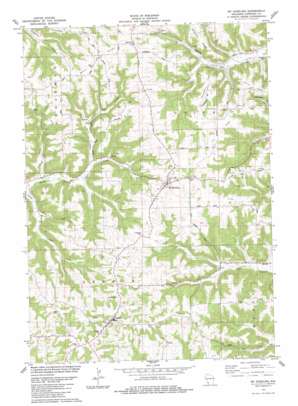
Mount Sterling Topo Map Wisconsin
To zoom in, hover over the map of Mount Sterling
USGS Topo Quad 43090c8 - 1:24,000 scale
| Topo Map Name: | Mount Sterling |
| USGS Topo Quad ID: | 43090c8 |
| Print Size: | ca. 21 1/4" wide x 27" high |
| Southeast Coordinates: | 43.25° N latitude / 90.875° W longitude |
| Map Center Coordinates: | 43.3125° N latitude / 90.9375° W longitude |
| U.S. State: | WI |
| Filename: | o43090c8.jpg |
| Download Map JPG Image: | Mount Sterling topo map 1:24,000 scale |
| Map Type: | Topographic |
| Topo Series: | 7.5´ |
| Map Scale: | 1:24,000 |
| Source of Map Images: | United States Geological Survey (USGS) |
| Alternate Map Versions: |
Mt. Sterling WI 1983, updated 1983 Download PDF Buy paper map Mount Sterling WI 2010 Download PDF Buy paper map Mount Sterling WI 2013 Download PDF Buy paper map Mount Sterling WI 2016 Download PDF Buy paper map |
1:24,000 Topo Quads surrounding Mount Sterling
> Back to 43090a1 at 1:100,000 scale
> Back to 43090a1 at 1:250,000 scale
> Back to U.S. Topo Maps home
Mount Sterling topo map: Gazetteer
Mount Sterling: Dams
Blackhawk-Kickapoo Project G8735.2 Dam elevation 253m 830′Mount Sterling: Populated Places
Fairview elevation 369m 1210′Mount Sterling elevation 361m 1184′
Seneca elevation 382m 1253′
Mount Sterling: Reservoirs
2 Reservoir elevation 253m 830′Mount Sterling: Ridges
Boma Ridge elevation 356m 1167′Gays Mills Ridge elevation 349m 1145′
Gunderson Ridge elevation 340m 1115′
Helgerson Ridge elevation 344m 1128′
Howe Ridge elevation 355m 1164′
Lilly Ridge elevation 354m 1161′
Mickelson Ridge elevation 340m 1115′
O'Neil Ridge elevation 348m 1141′
Sime Ridge elevation 335m 1099′
Mount Sterling: Streams
Upper Copper Creek elevation 225m 738′Mount Sterling: Valleys
Joy Hollow elevation 207m 679′Mount Sterling digital topo map on disk
Buy this Mount Sterling topo map showing relief, roads, GPS coordinates and other geographical features, as a high-resolution digital map file on DVD:


