La Farge Topo Map Wisconsin
To zoom in, hover over the map of La Farge
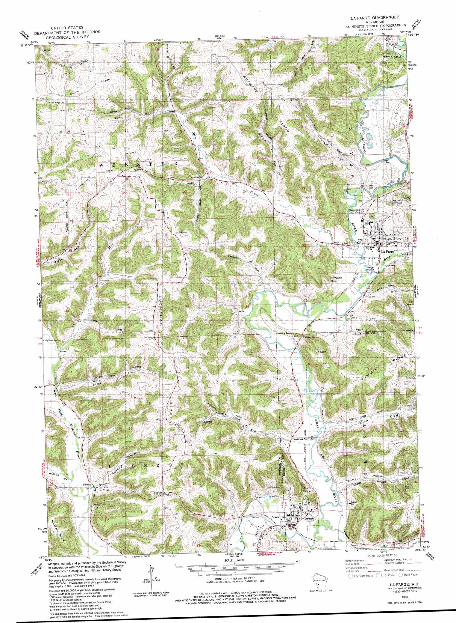
USGS Topo Quad 43090e6 - 1:24,000 scale
| Topo Map Name: | La Farge |
| USGS Topo Quad ID: | 43090e6 |
| Print Size: | ca. 21 1/4" wide x 27" high |
| Southeast Coordinates: | 43.5° N latitude / 90.625° W longitude |
| Map Center Coordinates: | 43.5625° N latitude / 90.6875° W longitude |
| U.S. State: | WI |
| Filename: | o43090e6.jpg |
| Download Map JPG Image: | La Farge topo map 1:24,000 scale |
| Map Type: | Topographic |
| Topo Series: | 7.5´ |
| Map Scale: | 1:24,000 |
| Source of Map Images: | United States Geological Survey (USGS) |
| Alternate Map Versions: |
La Farge WI 1983, updated 1984 Download PDF Buy paper map La Farge WI 2010 Download PDF Buy paper map La Farge WI 2013 Download PDF Buy paper map La Farge WI 2016 Download PDF Buy paper map |
1:24,000 Topo Quads surrounding La Farge
Middle Ridge |
Melvina |
Saint Marys |
Wilton |
Kendall West |
Esofea |
Westby |
Dell |
Ontario |
Trippville |
Viroqua |
Avalanche |
La Farge |
West Lima |
Yuba |
Rising Sun |
Readstown |
Sugar Grove |
Sabin |
Gillingham |
Mount Sterling |
Gays Mills |
Mount Zion |
Boaz |
Richland Center |
> Back to 43090e1 at 1:100,000 scale
> Back to 43090a1 at 1:250,000 scale
> Back to U.S. Topo Maps home
La Farge topo map: Gazetteer
La Farge: Dams
La Farge 1840C48 Dam elevation 241m 790′La Farge: Pillars
Fort Wales Rock elevation 264m 866′La Farge: Populated Places
La Farge elevation 243m 797′Liberty elevation 235m 770′
Tunnelville elevation 244m 800′
Viola elevation 233m 764′
La Farge: Reservoirs
272 Reservoir elevation 241m 790′La Farge: Ridges
Buchanan Ridge elevation 373m 1223′Buckeye Ridge elevation 392m 1286′
Fairview Ridge elevation 384m 1259′
Salem Ridge elevation 383m 1256′
La Farge: Streams
Bear Creek elevation 262m 859′Birds Creek elevation 237m 777′
Bishop Branch elevation 234m 767′
Camp Creek elevation 229m 751′
Elk Run elevation 242m 793′
Goose Creek elevation 235m 770′
Otter Creek elevation 241m 790′
Plum Run elevation 243m 797′
Weister Creek elevation 247m 810′
La Farge: Summits
Indianhead elevation 334m 1095′Mount Nebo elevation 341m 1118′
Sheldon Mount elevation 344m 1128′
La Farge: Valleys
Chadwick Hollow elevation 237m 777′Dry Hollow elevation 267m 875′
Greene Hollow elevation 269m 882′
Norris Hollow elevation 241m 790′
Scott Hollow elevation 238m 780′
Welker Hollow elevation 238m 780′
La Farge digital topo map on disk
Buy this La Farge topo map showing relief, roads, GPS coordinates and other geographical features, as a high-resolution digital map file on DVD: