Trippville Topo Map Wisconsin
To zoom in, hover over the map of Trippville
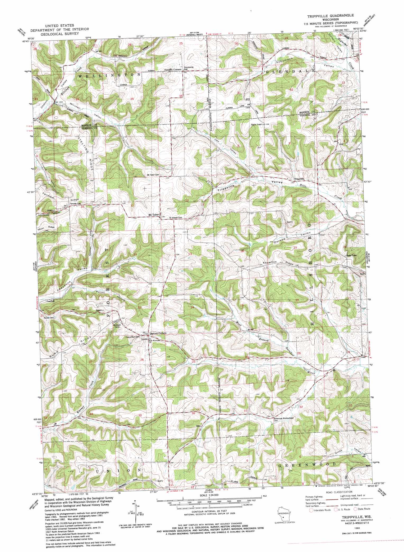
USGS Topo Quad 43090f4 - 1:24,000 scale
| Topo Map Name: | Trippville |
| USGS Topo Quad ID: | 43090f4 |
| Print Size: | ca. 21 1/4" wide x 27" high |
| Southeast Coordinates: | 43.625° N latitude / 90.375° W longitude |
| Map Center Coordinates: | 43.6875° N latitude / 90.4375° W longitude |
| U.S. State: | WI |
| Filename: | o43090f4.jpg |
| Download Map JPG Image: | Trippville topo map 1:24,000 scale |
| Map Type: | Topographic |
| Topo Series: | 7.5´ |
| Map Scale: | 1:24,000 |
| Source of Map Images: | United States Geological Survey (USGS) |
| Alternate Map Versions: |
Trippville WI 1983, updated 1984 Download PDF Buy paper map Trippville WI 2010 Download PDF Buy paper map Trippville WI 2013 Download PDF Buy paper map Trippville WI 2016 Download PDF Buy paper map |
1:24,000 Topo Quads surrounding Trippville
City Rock |
Tomah |
Oakdale |
Camp Douglas |
New Lisbon North |
Saint Marys |
Wilton |
Kendall West |
Kendall East |
New Lisbon South |
Dell |
Ontario |
Trippville |
Hillsboro |
Wonewoc |
La Farge |
West Lima |
Yuba |
Valton |
La Valle |
Sugar Grove |
Sabin |
Gillingham |
Rockeridge |
Lime Ridge |
> Back to 43090e1 at 1:100,000 scale
> Back to 43090a1 at 1:250,000 scale
> Back to U.S. Topo Maps home
Trippville topo map: Gazetteer
Trippville: Populated Places
Dilly elevation 347m 1138′Mount Tabor elevation 419m 1374′
Trippville elevation 325m 1066′
Trippville: Ridges
Knowlton Ridge elevation 404m 1325′Stelting Ridge elevation 419m 1374′
Trippville: Streams
Dilly Creek elevation 303m 994′Trippville: Valleys
Barton Hollow elevation 307m 1007′Cox Valley elevation 341m 1118′
Durkee Valley elevation 325m 1066′
Newman Valley elevation 318m 1043′
Schumann Valley elevation 326m 1069′
Trippville Valley elevation 318m 1043′
Walters Valley elevation 320m 1049′
Trippville digital topo map on disk
Buy this Trippville topo map showing relief, roads, GPS coordinates and other geographical features, as a high-resolution digital map file on DVD: