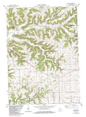
Esofea Topo Map Wisconsin
To zoom in, hover over the map of Esofea
USGS Topo Quad 43090f8 - 1:24,000 scale
| Topo Map Name: | Esofea |
| USGS Topo Quad ID: | 43090f8 |
| Print Size: | ca. 21 1/4" wide x 27" high |
| Southeast Coordinates: | 43.625° N latitude / 90.875° W longitude |
| Map Center Coordinates: | 43.6875° N latitude / 90.9375° W longitude |
| U.S. State: | WI |
| Filename: | o43090f8.jpg |
| Download Map JPG Image: | Esofea topo map 1:24,000 scale |
| Map Type: | Topographic |
| Topo Series: | 7.5´ |
| Map Scale: | 1:24,000 |
| Source of Map Images: | United States Geological Survey (USGS) |
| Alternate Map Versions: |
Esofea WI 1983, updated 1983 Download PDF Buy paper map Esofea WI 1983, updated 1985 Download PDF Buy paper map Esofea WI 2010 Download PDF Buy paper map Esofea WI 2013 Download PDF Buy paper map Esofea WI 2016 Download PDF Buy paper map |
1:24,000 Topo Quads surrounding Esofea
> Back to 43090e1 at 1:100,000 scale
> Back to 43090a1 at 1:250,000 scale
> Back to U.S. Topo Maps home
Esofea topo map: Gazetteer
Esofea: Dams
Coon Creek 53 D6025 Dam elevation 321m 1053′Esofea: Parks
Coon Creek Cliffs State Natural Area elevation 274m 898′Esofea County Park elevation 304m 997′
Von Ruden Memorial Park elevation 395m 1295′
Esofea: Populated Places
Esofea elevation 298m 977′Esofea: Ridges
Bohemian Ridge elevation 388m 1272′Lindvig Ridge elevation 396m 1299′
Lovaas Ridge elevation 399m 1309′
North Ridge elevation 392m 1286′
South Ridge elevation 378m 1240′
Spring Ridge elevation 386m 1266′
West Portland Ridge elevation 385m 1263′
Esofea: Streams
German Coulee elevation 242m 793′Rullands Coulee Creek elevation 256m 839′
Timber Coulee Creek elevation 234m 767′
Esofea: Valleys
Berge Coulee elevation 269m 882′Bohemian Valley elevation 231m 757′
Poplar Coulee elevation 231m 757′
Rulland Coulee elevation 269m 882′
Rundahl Coulee elevation 238m 780′
Spring Coulee elevation 225m 738′
Timber Coulee elevation 234m 767′
Esofea digital topo map on disk
Buy this Esofea topo map showing relief, roads, GPS coordinates and other geographical features, as a high-resolution digital map file on DVD:


