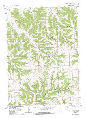
Middle Ridge Topo Map Wisconsin
To zoom in, hover over the map of Middle Ridge
USGS Topo Quad 43090g8 - 1:24,000 scale
| Topo Map Name: | Middle Ridge |
| USGS Topo Quad ID: | 43090g8 |
| Print Size: | ca. 21 1/4" wide x 27" high |
| Southeast Coordinates: | 43.75° N latitude / 90.875° W longitude |
| Map Center Coordinates: | 43.8125° N latitude / 90.9375° W longitude |
| U.S. State: | WI |
| Filename: | o43090g8.jpg |
| Download Map JPG Image: | Middle Ridge topo map 1:24,000 scale |
| Map Type: | Topographic |
| Topo Series: | 7.5´ |
| Map Scale: | 1:24,000 |
| Source of Map Images: | United States Geological Survey (USGS) |
| Alternate Map Versions: |
Middle Ridge WI 1983, updated 1984 Download PDF Buy paper map Middle Ridge WI 2010 Download PDF Buy paper map Middle Ridge WI 2013 Download PDF Buy paper map Middle Ridge WI 2016 Download PDF Buy paper map |
1:24,000 Topo Quads surrounding Middle Ridge
> Back to 43090e1 at 1:100,000 scale
> Back to 43090a1 at 1:250,000 scale
> Back to U.S. Topo Maps home
Middle Ridge topo map: Gazetteer
Middle Ridge: Dams
Coon Creek 29 D-6025 Dam elevation 357m 1171′Coon Creek 31 D-6025 Dam elevation 371m 1217′
Coon Creek 33 D-6025 Dam elevation 346m 1135′
Coon Creek 35 D-6025 Dam elevation 275m 902′
Middle Ridge: Populated Places
Middle Ridge elevation 386m 1266′Middle Ridge: Reservoirs
1 Reservoir elevation 371m 1217′1.22 Reservoir elevation 275m 902′
1.93 Reservoir elevation 346m 1135′
3 Reservoir elevation 357m 1171′
Middle Ridge: Ridges
Fish Creek Ridge elevation 395m 1295′Middle Ridge: Summits
Bunker Hill elevation 394m 1292′Middle Ridge: Valleys
Bedessem Coulee elevation 274m 898′Darling Coulee elevation 242m 793′
Fisbach Coulee elevation 274m 898′
Hundt Coulee elevation 296m 971′
Korn Coulee elevation 296m 971′
Pinkish Coulee elevation 257m 843′
Russian Coulee elevation 231m 757′
Sedevie Coulee elevation 268m 879′
Middle Ridge digital topo map on disk
Buy this Middle Ridge topo map showing relief, roads, GPS coordinates and other geographical features, as a high-resolution digital map file on DVD:


