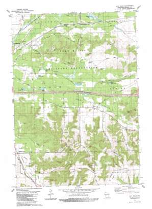
City Rock Topo Map Wisconsin
To zoom in, hover over the map of City Rock
USGS Topo Quad 43090h6 - 1:24,000 scale
| Topo Map Name: | City Rock |
| USGS Topo Quad ID: | 43090h6 |
| Print Size: | ca. 21 1/4" wide x 27" high |
| Southeast Coordinates: | 43.875° N latitude / 90.625° W longitude |
| Map Center Coordinates: | 43.9375° N latitude / 90.6875° W longitude |
| U.S. State: | WI |
| Filename: | o43090h6.jpg |
| Download Map JPG Image: | City Rock topo map 1:24,000 scale |
| Map Type: | Topographic |
| Topo Series: | 7.5´ |
| Map Scale: | 1:24,000 |
| Source of Map Images: | United States Geological Survey (USGS) |
| Alternate Map Versions: |
Tomah NW WI 1976, updated 1978 Download PDF Buy paper map City Rock WI 1983, updated 1984 Download PDF Buy paper map City Rock WI 2010 Download PDF Buy paper map City Rock WI 2013 Download PDF Buy paper map City Rock WI 2016 Download PDF Buy paper map |
1:24,000 Topo Quads surrounding City Rock
> Back to 43090e1 at 1:100,000 scale
> Back to 43090a1 at 1:250,000 scale
> Back to U.S. Topo Maps home
City Rock topo map: Gazetteer
City Rock: Airports
Sparta-Fort McCoy Airport elevation 252m 826′Young Tactical Landing Site Airport elevation 278m 912′
City Rock: Cliffs
Bald Bluff elevation 328m 1076′City Rock: Dams
Stillwell Dam elevation 287m 941′City Rock: Gaps
Lafayette Pass elevation 314m 1030′Lower Pass elevation 286m 938′
Raymore Pass elevation 345m 1131′
Upper Pass elevation 289m 948′
City Rock: Lakes
Big Sandy Lake elevation 265m 869′Sandy Lake elevation 258m 846′
West Sandy Lake elevation 256m 839′
City Rock: Parks
Fort McCoy Barrens State Natural Area elevation 277m 908′La Crosse River State Fishery Area elevation 250m 820′
City Rock: Pillars
Cave Rock elevation 399m 1309′Chicken Rock elevation 346m 1135′
Chimney Rock elevation 388m 1272′
City Rock elevation 402m 1318′
Face Rock elevation 400m 1312′
Jeff Davis Rock elevation 396m 1299′
City Rock: Populated Places
Farmers Valley elevation 257m 843′Scotts Junction elevation 287m 941′
City Rock: Reservoirs
East Silver Lake elevation 282m 925′West Silver Lake elevation 253m 830′
City Rock: Streams
Bailey Creek elevation 249m 816′City Rock: Summits
Coles Peak elevation 362m 1187′Erdman Hill elevation 416m 1364′
Hill H elevation 314m 1030′
Perry Peak elevation 309m 1013′
Quarry Hill elevation 334m 1095′
Selfridge Knoll elevation 311m 1020′
Stevens Knoll elevation 296m 971′
Sugarbush Hill elevation 427m 1400′
Thorp Hill elevation 310m 1017′
City Rock: Valleys
Coles Valley elevation 265m 869′City Rock digital topo map on disk
Buy this City Rock topo map showing relief, roads, GPS coordinates and other geographical features, as a high-resolution digital map file on DVD:


