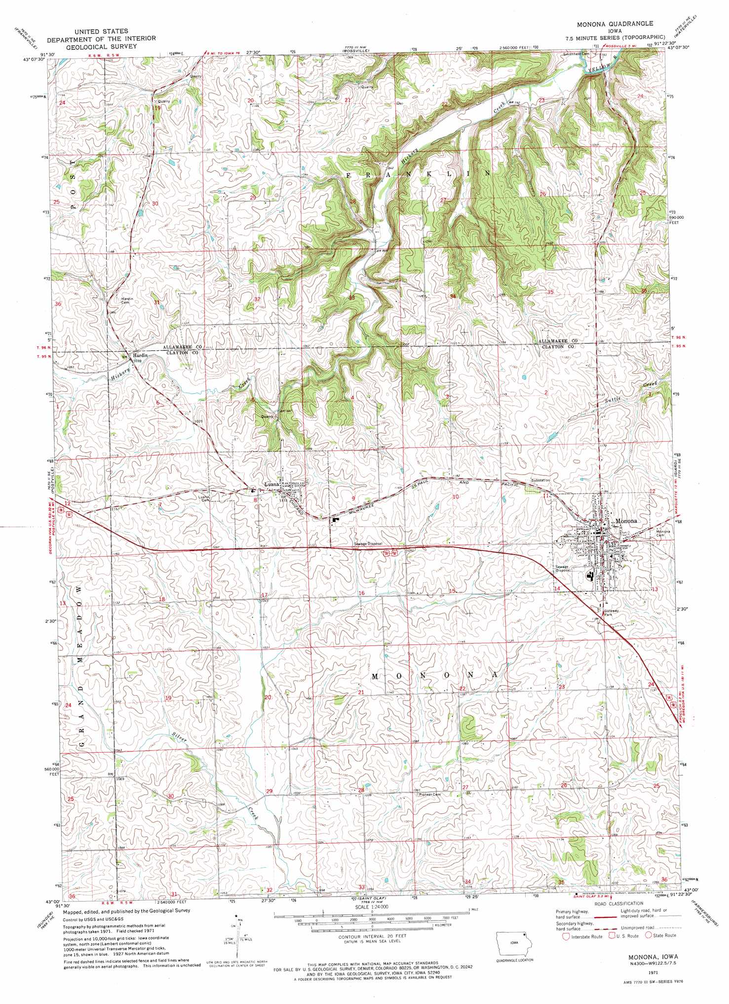
Monona Topo Map Iowa
To zoom in, hover over the map of Monona
USGS Topo Quad 43091a4 - 1:24,000 scale
| Topo Map Name: | Monona |
| USGS Topo Quad ID: | 43091a4 |
| Print Size: | ca. 21 1/4" wide x 27" high |
| Southeast Coordinates: | 43° N latitude / 91.375° W longitude |
| Map Center Coordinates: | 43.0625° N latitude / 91.4375° W longitude |
| U.S. State: | IA |
| Filename: | o43091a4.jpg |
| Download Map JPG Image: | Monona topo map 1:24,000 scale |
| Map Type: | Topographic |
| Topo Series: | 7.5´ |
| Map Scale: | 1:24,000 |
| Source of Map Images: | United States Geological Survey (USGS) |
| Alternate Map Versions: |
Monona IA 1971, updated 1973 Download PDF Buy paper map Monona IA 2010 Download PDF Buy paper map Monona IA 2013 Download PDF Buy paper map Monona IA 2015 Download PDF Buy paper map |
1:24,000 Topo Quads surrounding Monona
Freeport |
Hanover |
Waukon |
Church |
Lansing |
Postville Nw |
Frankville |
Rossville |
Waterville |
Harpers Ferry |
Castalia |
Postville |
Monona |
Giard |
Prairie Du Chien |
Elgin |
Gunder |
Saint Olaf |
Farmersburg |
Clayton |
Wadena |
Volga |
Elkader |
Littleport |
Garnavillo |
> Back to 43091a1 at 1:100,000 scale
> Back to 43090a1 at 1:250,000 scale
> Back to U.S. Topo Maps home
Monona topo map: Gazetteer
Monona: Bridges
Monona Township Culbert elevation 332m 1089′Monona: Parks
Gateway Park elevation 365m 1197′Luana Softball Diamond elevation 345m 1131′
Monona City Park elevation 372m 1220′
Monona: Populated Places
Hardin elevation 317m 1040′Luana elevation 345m 1131′
Monona elevation 370m 1213′
Monona: Post Offices
Luana Post Office elevation 345m 1131′Monona Post Office elevation 370m 1213′
Monona: Streams
Hickory Creek elevation 232m 761′Monona digital topo map on disk
Buy this Monona topo map showing relief, roads, GPS coordinates and other geographical features, as a high-resolution digital map file on DVD: