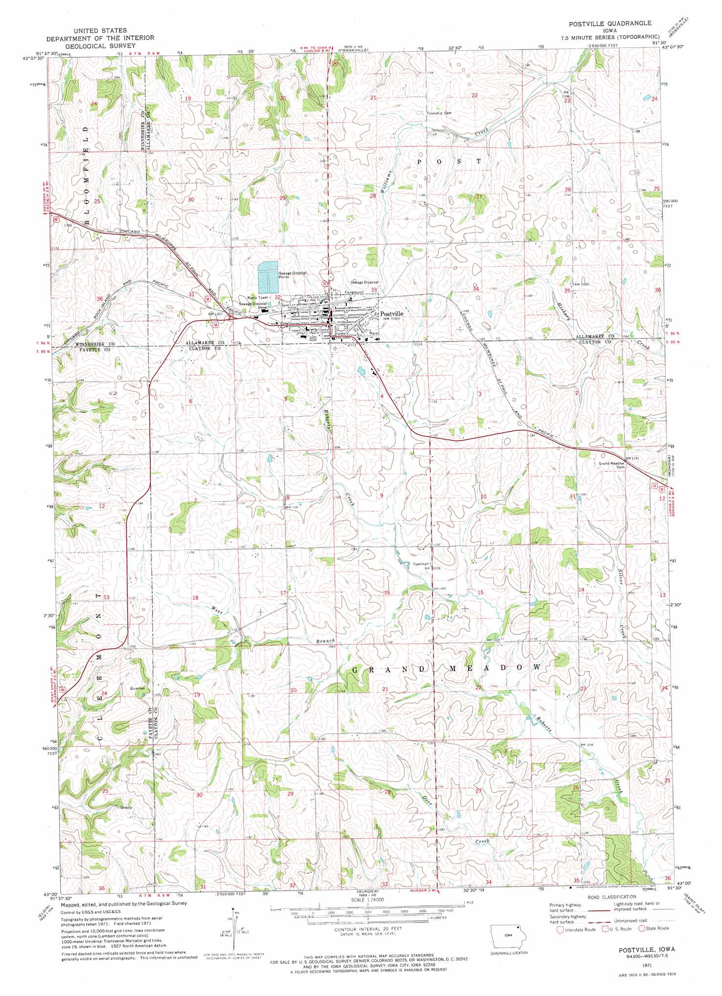
Postville Topo Map Iowa
To zoom in, hover over the map of Postville
USGS Topo Quad 43091a5 - 1:24,000 scale
| Topo Map Name: | Postville |
| USGS Topo Quad ID: | 43091a5 |
| Print Size: | ca. 21 1/4" wide x 27" high |
| Southeast Coordinates: | 43° N latitude / 91.5° W longitude |
| Map Center Coordinates: | 43.0625° N latitude / 91.5625° W longitude |
| U.S. State: | IA |
| Filename: | o43091a5.jpg |
| Download Map JPG Image: | Postville topo map 1:24,000 scale |
| Map Type: | Topographic |
| Topo Series: | 7.5´ |
| Map Scale: | 1:24,000 |
| Source of Map Images: | United States Geological Survey (USGS) |
| Alternate Map Versions: |
Postville IA 1971, updated 1973 Download PDF Buy paper map Postville IA 2010 Download PDF Buy paper map Postville IA 2013 Download PDF Buy paper map Postville IA 2015 Download PDF Buy paper map |
1:24,000 Topo Quads surrounding Postville
Decorah |
Freeport |
Hanover |
Waukon |
Church |
Calmar |
Postville Nw |
Frankville |
Rossville |
Waterville |
Festina |
Castalia |
Postville |
Monona |
Giard |
West Union |
Elgin |
Gunder |
Saint Olaf |
Farmersburg |
Fayette |
Wadena |
Volga |
Elkader |
Littleport |
> Back to 43091a1 at 1:100,000 scale
> Back to 43090a1 at 1:250,000 scale
> Back to U.S. Topo Maps home
Postville topo map: Gazetteer
Postville: Airports
Dale Delight Airport elevation 358m 1174′Postville: Parks
Clinton Meyer Park elevation 366m 1200′Lull's Park elevation 351m 1151′
Roberts Park elevation 362m 1187′
Postville: Populated Places
Postville elevation 360m 1181′Ridley elevation 356m 1167′
Postville: Post Offices
Grand Meadow Post Office (historical) elevation 358m 1174′Henderson Prairie Post Office (historical) elevation 359m 1177′
Postville Post Office elevation 360m 1181′
Winneshiek Post Office (historical) elevation 360m 1181′
Postville: Streams
West Branch Roberts Creek elevation 322m 1056′Postville digital topo map on disk
Buy this Postville topo map showing relief, roads, GPS coordinates and other geographical features, as a high-resolution digital map file on DVD: