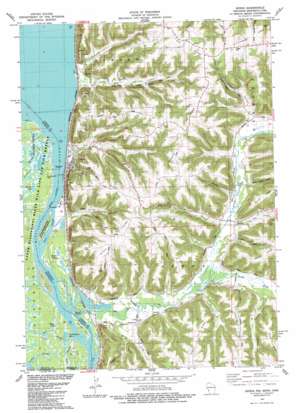
Genoa Topo Map Wisconsin
To zoom in, hover over the map of Genoa
USGS Topo Quad 43091e2 - 1:24,000 scale
| Topo Map Name: | Genoa |
| USGS Topo Quad ID: | 43091e2 |
| Print Size: | ca. 21 1/4" wide x 27" high |
| Southeast Coordinates: | 43.5° N latitude / 91.125° W longitude |
| Map Center Coordinates: | 43.5625° N latitude / 91.1875° W longitude |
| U.S. States: | WI, IA, MN |
| Filename: | o43091e2.jpg |
| Download Map JPG Image: | Genoa topo map 1:24,000 scale |
| Map Type: | Topographic |
| Topo Series: | 7.5´ |
| Map Scale: | 1:24,000 |
| Source of Map Images: | United States Geological Survey (USGS) |
| Alternate Map Versions: |
Genoa WI 1983, updated 1983 Download PDF Buy paper map Genoa WI 2010 Download PDF Buy paper map Genoa WI 2013 Download PDF Buy paper map Genoa WI 2015 Download PDF Buy paper map |
1:24,000 Topo Quads surrounding Genoa
> Back to 43091e1 at 1:100,000 scale
> Back to 43090a1 at 1:250,000 scale
> Back to U.S. Topo Maps home
Genoa topo map: Gazetteer
Genoa: Capes
Heck Point elevation 211m 692′Genoa: Channels
Lost Channel elevation 189m 620′Genoa: Dams
Genoa Fish Hatchery Pond 3 Dam elevation 189m 620′Genoa Fish Hatchery Pond One Dam elevation 189m 620′
Lock and Dam Number 8 elevation 193m 633′
Lock and Dam Number 8 elevation 190m 623′
Lock and Dam Number Eight elevation 190m 623′
Genoa: Guts
Thief Slough elevation 190m 623′Genoa: Islands
Gillette Island elevation 191m 626′Island Number One Hundred Thirtyfive elevation 190m 623′
Twin Island elevation 190m 623′
Genoa: Lakes
Commodore Lake elevation 189m 620′Elgar Lake elevation 190m 623′
Goose Lake elevation 189m 620′
Waller Lakes elevation 190m 623′
Zabolio Lake elevation 190m 623′
Genoa: Parks
Romance Prairie State Natural Area elevation 240m 787′Genoa: Populated Places
Genoa elevation 199m 652′Romance elevation 203m 666′
Genoa: Reservoirs
Pond One 0 elevation 189m 620′Pond Three 0 elevation 189m 620′
Pool Eight 64700 elevation 190m 623′
Genoa: Ridges
Genoa Ridge elevation 356m 1167′Hickory Ridge elevation 357m 1171′
Johnson Ridge elevation 337m 1105′
Mound Ridge elevation 362m 1187′
Victory Ridge elevation 333m 1092′
Genoa: Streams
Bad Axe River elevation 189m 620′Cox Creek elevation 198m 649′
Indian Slough elevation 190m 623′
North Fork Bad Axe River elevation 191m 626′
Riley Creek elevation 190m 623′
South Fork Bad Axe River elevation 191m 626′
Genoa: Valleys
Deadman Hollow elevation 215m 705′Italian Hollow elevation 195m 639′
Spring Coulee elevation 193m 633′
Thompson Hollow elevation 199m 652′
Genoa digital topo map on disk
Buy this Genoa topo map showing relief, roads, GPS coordinates and other geographical features, as a high-resolution digital map file on DVD:


