Spring Grove Topo Map Minnesota
To zoom in, hover over the map of Spring Grove
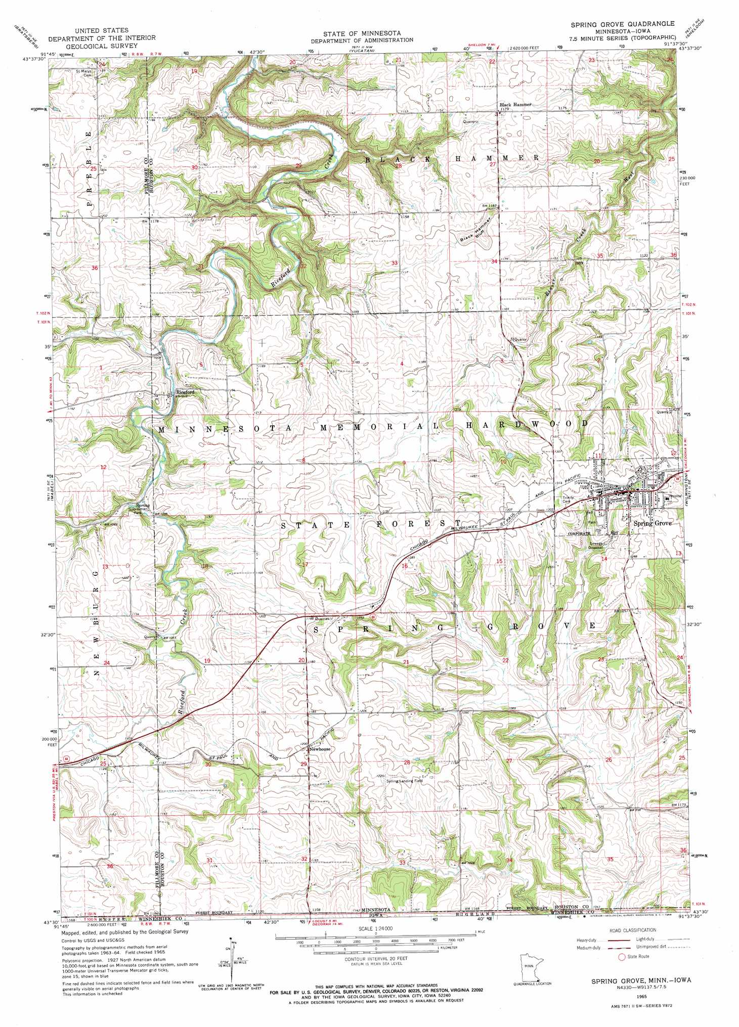
USGS Topo Quad 43091e6 - 1:24,000 scale
| Topo Map Name: | Spring Grove |
| USGS Topo Quad ID: | 43091e6 |
| Print Size: | ca. 21 1/4" wide x 27" high |
| Southeast Coordinates: | 43.5° N latitude / 91.625° W longitude |
| Map Center Coordinates: | 43.5625° N latitude / 91.6875° W longitude |
| U.S. States: | MN, IA |
| Filename: | o43091e6.jpg |
| Download Map JPG Image: | Spring Grove topo map 1:24,000 scale |
| Map Type: | Topographic |
| Topo Series: | 7.5´ |
| Map Scale: | 1:24,000 |
| Source of Map Images: | United States Geological Survey (USGS) |
| Alternate Map Versions: |
Spring Grove MN 1965, updated 1966 Download PDF Buy paper map Spring Grove MN 2010 Download PDF Buy paper map Spring Grove MN 2013 Download PDF Buy paper map Spring Grove MN 2016 Download PDF Buy paper map |
1:24,000 Topo Quads surrounding Spring Grove
Arendahl |
Rushford West |
Rushford East |
Houston |
Mound Prairie |
Lanesboro |
Bratsberg |
Yucatan |
Sheldon |
Caledonia |
Canton |
Mabel |
Spring Grove |
Wilmington |
Eitzen |
Bluffton |
Burr Oak |
Highlandville |
Dorchester |
Waukon Nw |
Ridgeway |
Decorah |
Freeport |
Hanover |
Waukon |
> Back to 43091e1 at 1:100,000 scale
> Back to 43090a1 at 1:250,000 scale
> Back to U.S. Topo Maps home
Spring Grove topo map: Gazetteer
Spring Grove: Airports
Deters Farms Airport elevation 376m 1233′Sylling Landing Field elevation 373m 1223′
Spring Grove: Parks
Sportsman Park elevation 317m 1040′Spring Grove City Park elevation 403m 1322′
Spring Grove City Park elevation 385m 1263′
Spring Grove: Populated Places
Black Hammer elevation 357m 1171′Mid Town Mobile Home Park elevation 403m 1322′
Newhouse elevation 366m 1200′
Onstad Trailer Park elevation 403m 1322′
Riceford elevation 309m 1013′
Spring Grove elevation 403m 1322′
Spring Grove: Post Offices
Black Hammer Post Office (historical) elevation 357m 1171′Newhouse Post Office (historical) elevation 366m 1200′
Riceford Post Office (historical) elevation 309m 1013′
Spring Grove Post Office elevation 397m 1302′
Spring Grove: Summits
Black Hammer Bluff elevation 386m 1266′Spring Grove digital topo map on disk
Buy this Spring Grove topo map showing relief, roads, GPS coordinates and other geographical features, as a high-resolution digital map file on DVD: